A week long off trail backpacking trip in Sequoia-Kings Canyon National Park fighting thunderstorms and chasing golden trout.
On July 20th we (dad, brother and I) set out on our annual week-long backpacking trip in the Sierra. This year we had an aggressive itinerary to hit 5 lakes that could all hold trophy golden trout. The unique part of this trip was the one-way itinerary. Usually we do some sort of out and back or lollipop loop. This time around we planned a car-shuttle for our one-way route.
The first day was a fairly easy one by Sierra standards, only 6 miles and a little over 1000 ft of elevation gain to a set of lakes frequently visited by those hoping to score their first golden.

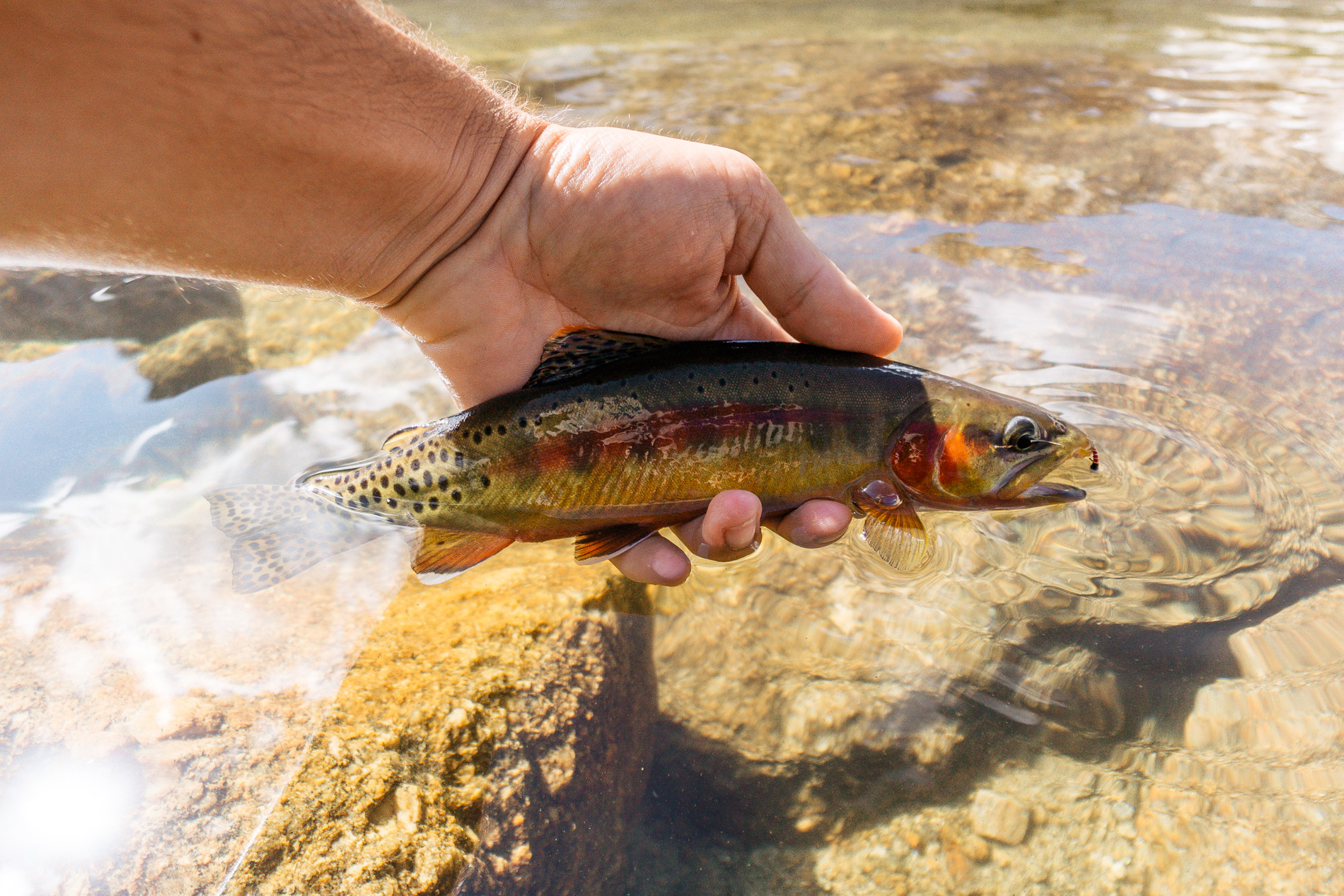
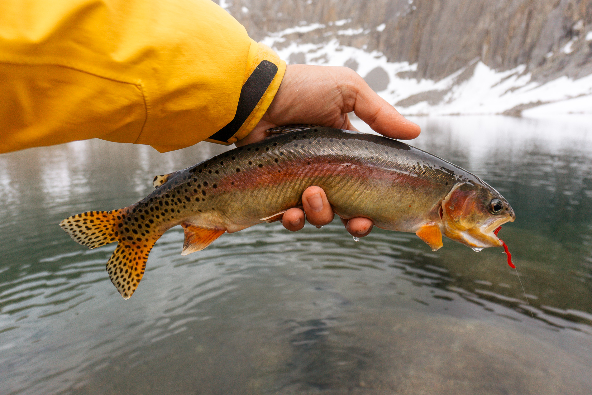
We set up camp and walked up to the highest lakes within the basin to score our first goldens of the trip. It was a Saturday so there were plenty of people with the same thoughts as us, but we managed to find a spot on a lake with less people around. My brother landed the first golden of the trip.
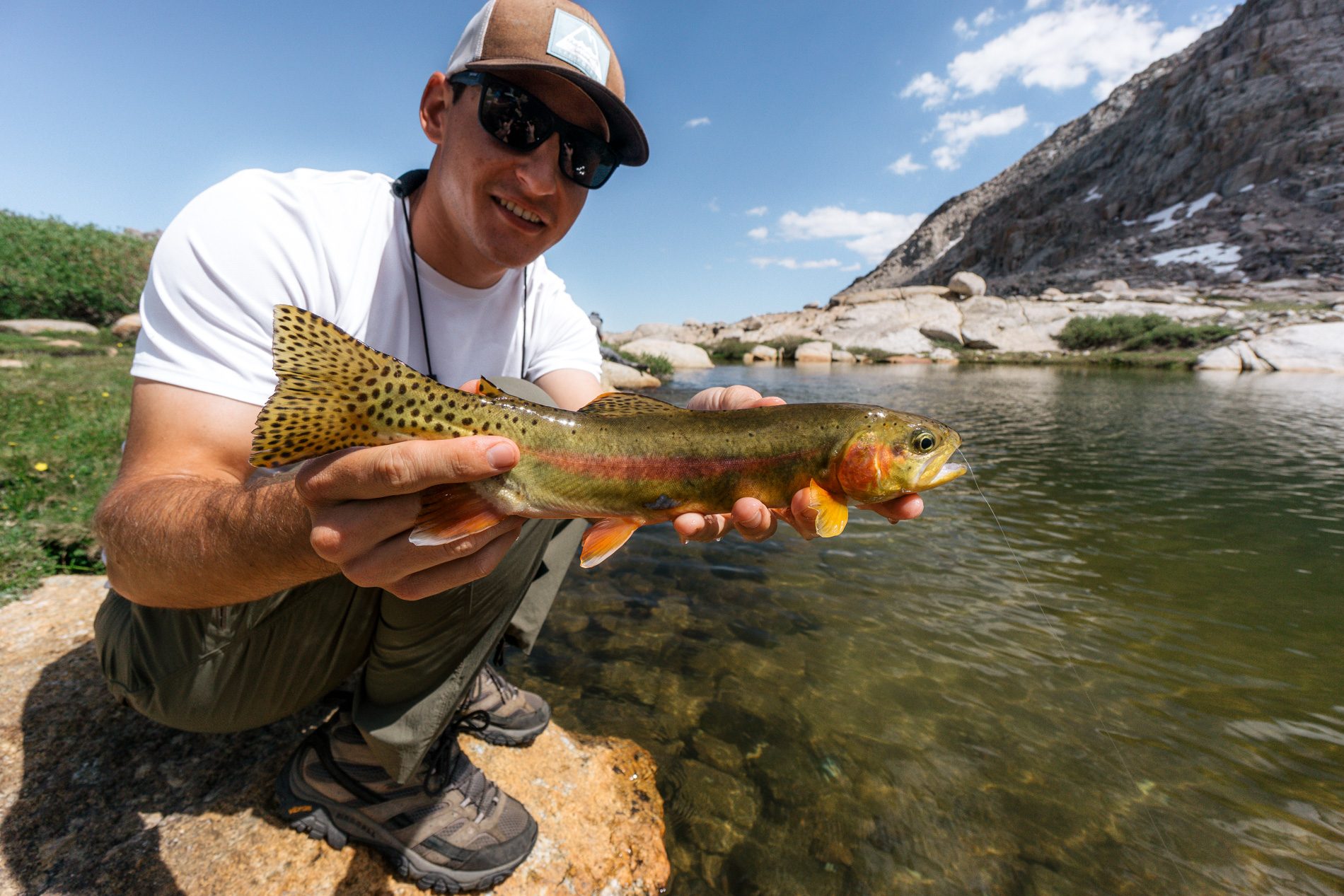
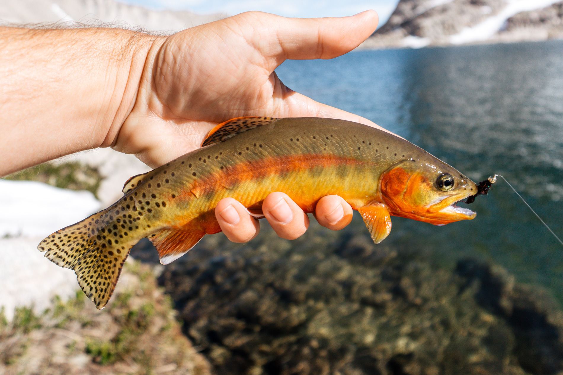
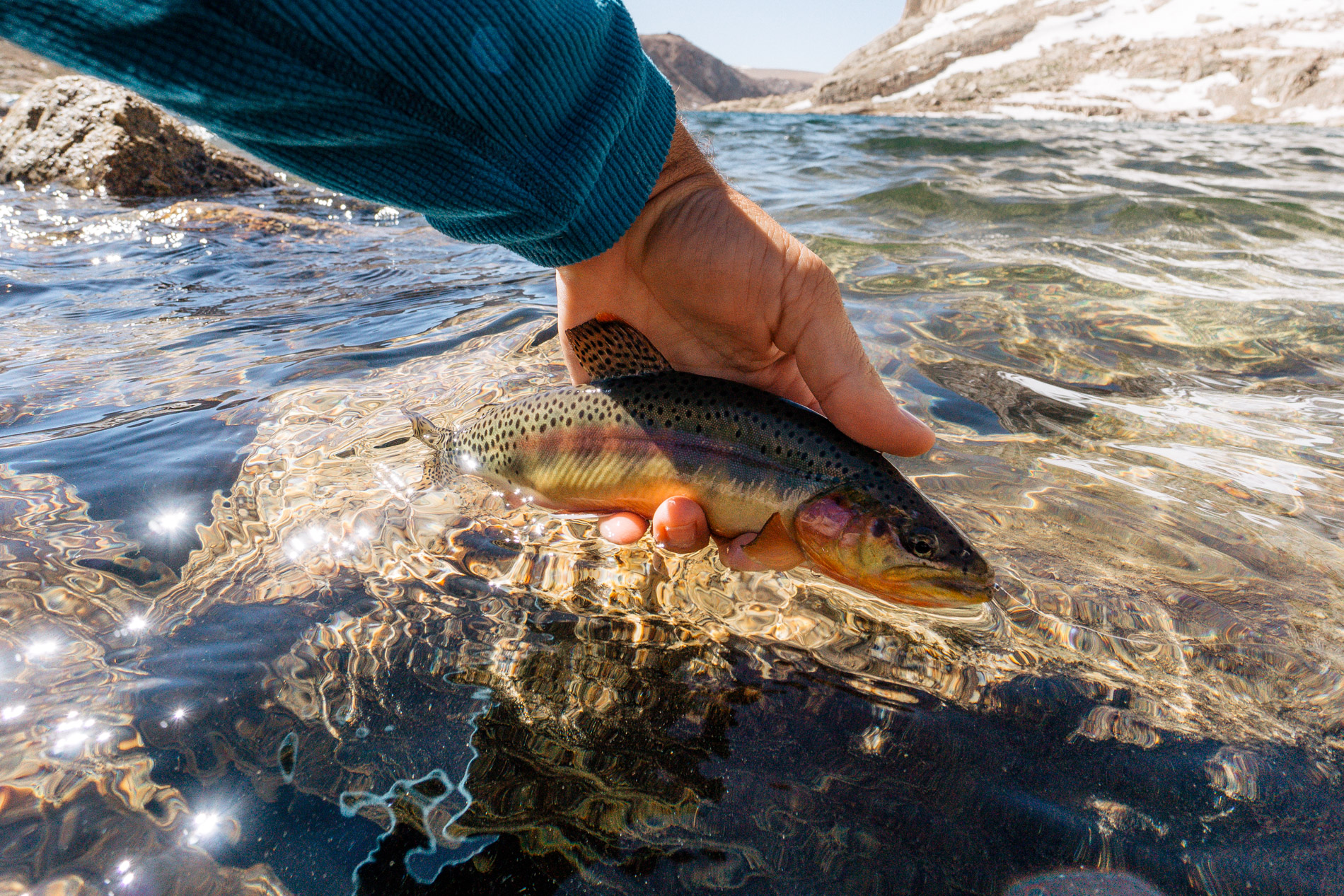
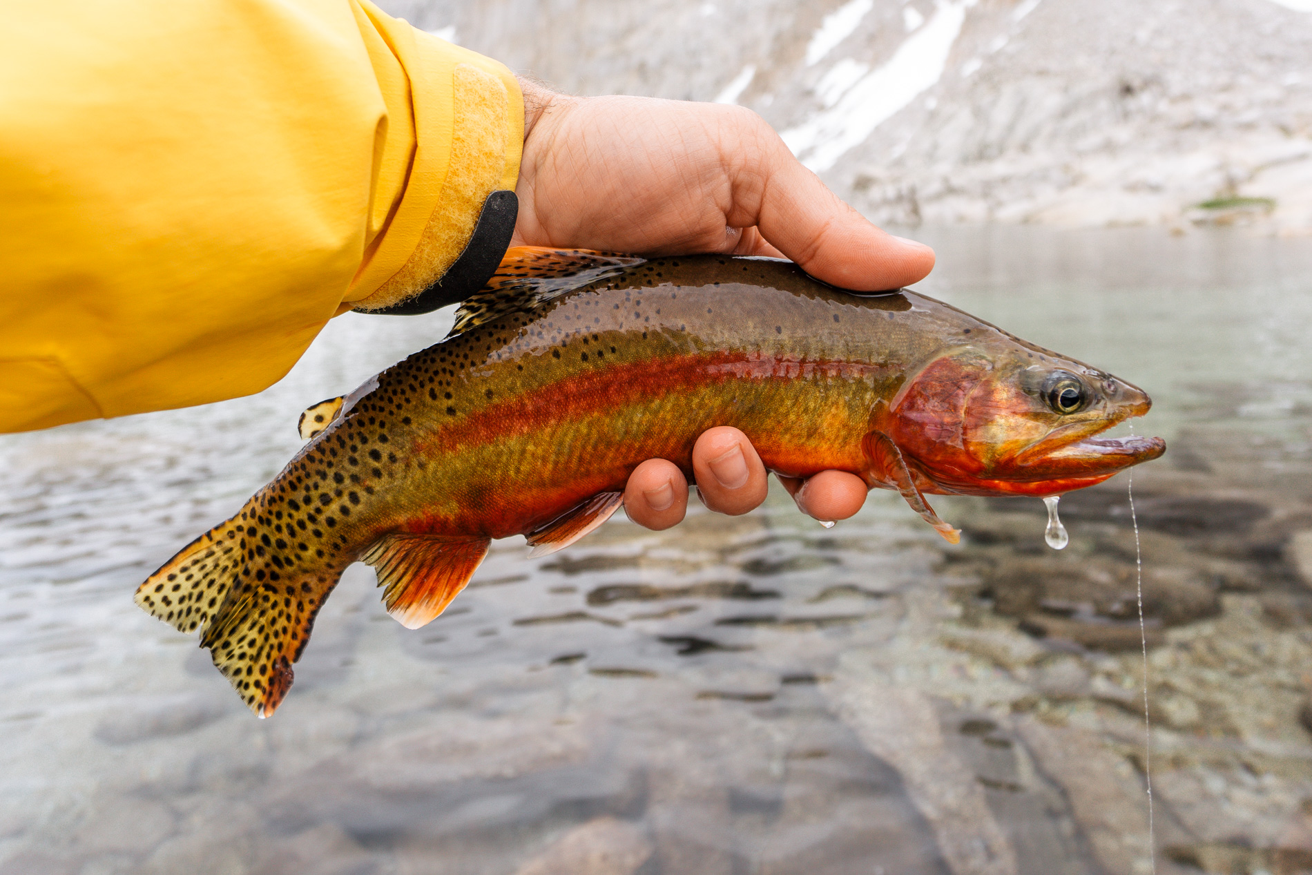
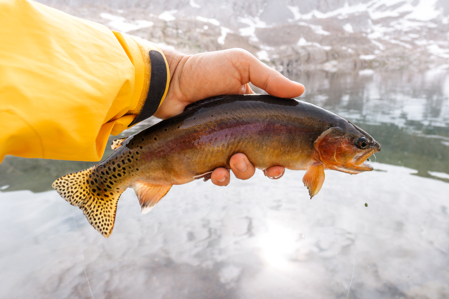
I’m fairly new to fly fishing (<5 years full time) and I had been doing quite a bit of research on how to fish chironomid patterns in lakes. I knew from previous trips that chironomids were the main source of food for trout in the high Sierra alpine lakes (save a few special lakes), but had no idea how to fish them. What I discovered was that dangling some midge patterns under an indicator is actually a really popular way to fish lakes, so I bought a few different patterns to try and the fish above is actually the first fish my brother caught on this new (to us) method.
We learned quickly that the floating line must be kept tight at all times and even the slightest nudge in the indicator means a fish likely sucked in that fake chironomid at the end of your line. I continued to use this method and got more comfortable with it throughout the week and I’ll definitely employ it in combination with stripping leeches in the future. The standout fly was the Sno-Cone Zebra Midge… something about that white bead the fish couldn’t resist.
The afternoon turned to evening and we returned to our campsite to eat some dinner.

My brother’s knee had been bothering him for the last week after we did a training hike up Humphrey’s Peak in Arizona and it started to flare up again. He was worried about getting further from the trailhead on a bum knee and rightly so. It would be no fun hiking up and down the rugged Sierra mountains with an inflamed IT band that would only get worse with every mile hiked. He decided that evening to turn back, leaving only myself and my dad to finish the trip. It was a tough pill to swallow, but it was the right call. I’m sure he was more disappointed than I.
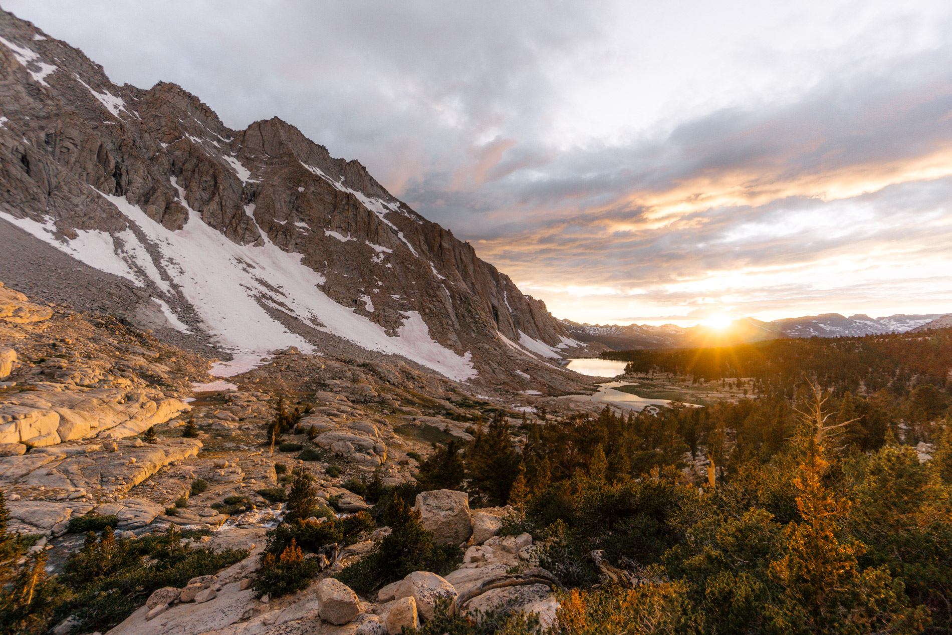
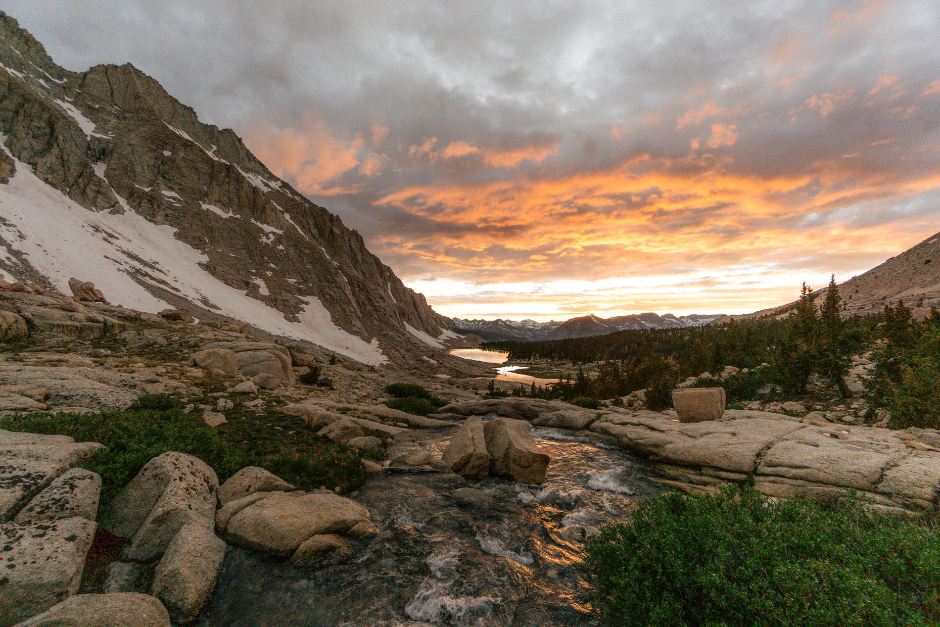
Sunset that night was a typical blue sky Sierra sunset, but was a little tough to shoot because the sun fell behind the local 14,000 ft peak fairly early.
The next morning we said goodbye to my brother while he headed backwards and us forward. We had a big day ahead of us – the second most miles hiked and largest cumulative elevation gain in a single day of the trip. We walked 8 miles and gained at least 2500 ft that day. It took us 6 hiking hours to reach our destination because of the combination of on and off trail travel. I had a random thought during this hike – no matter how difficult the hike was, we would never have to repeat it because of our one way itinerary. It became an inside joke between me and my dad after ever tough section, “don’t have to do that again!”
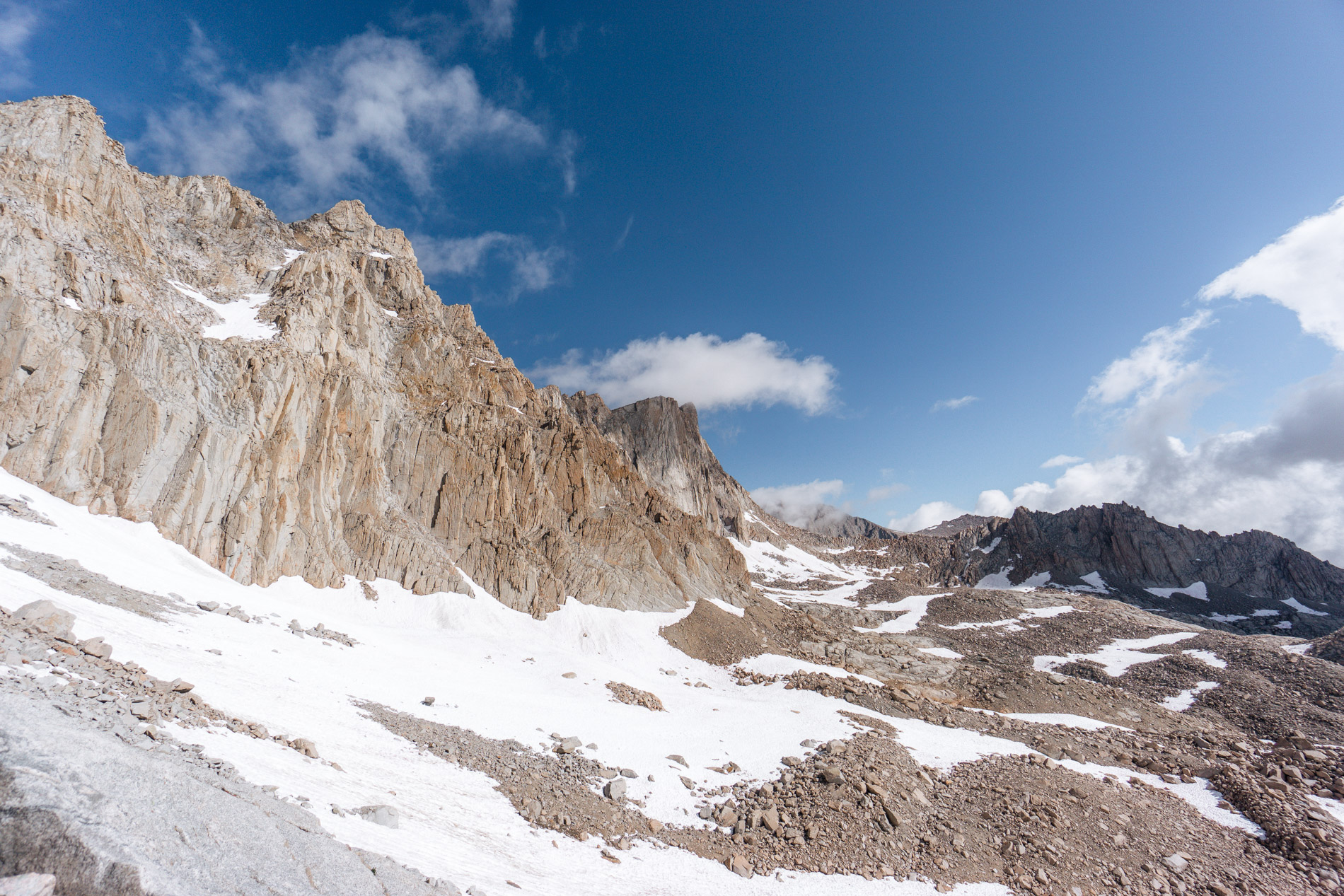
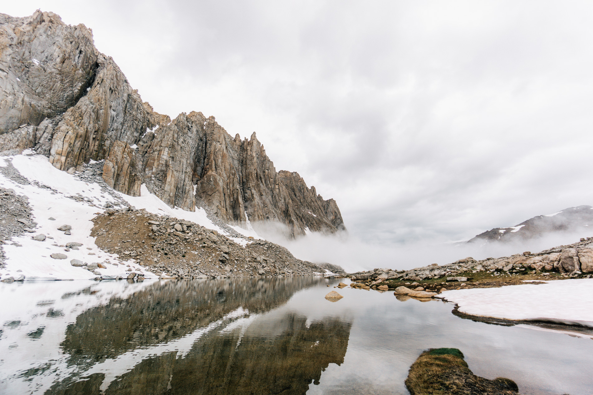
The first hurdle was a 12000 ft pass. The trail was well graded and easy to follow all the way to the last 100 yards, where there was a giant snow cornice blocking the way to the top of the pass. Luckily previous hikers had piled up cairns guiding people to an alternative talus scrambling route that avoided the cornice but not the snow entirely. Ultimately the view from the top was pretty cool.
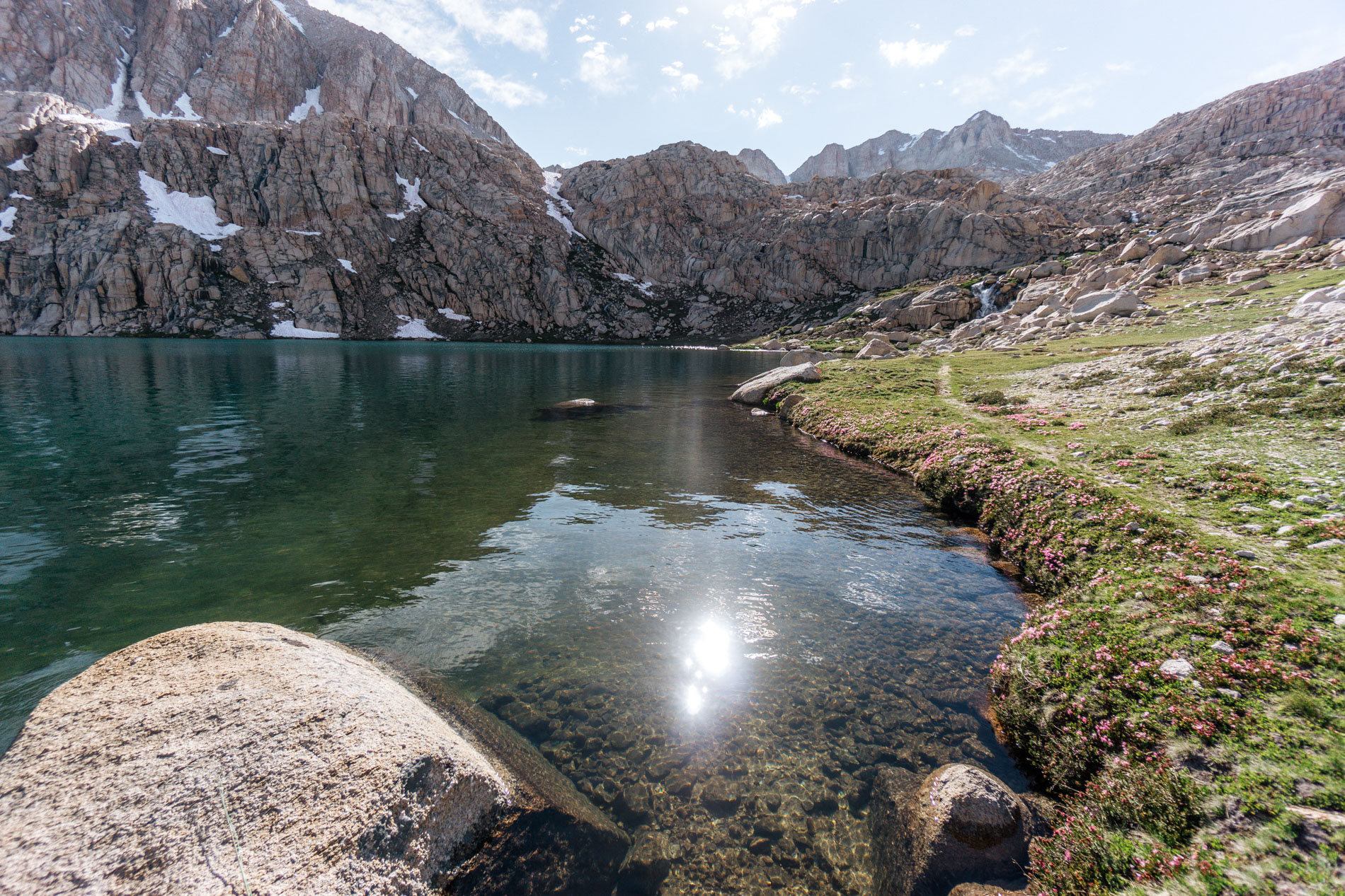
We jumped on a popular use trail that summits a local mountain for a few miles before turning left and continuing towards a large off trail high elevation basin. We dropped down a steep hill covered in sand and talus on a surprisingly nice use trail to a lake surrounded by Foxtail Pines. The lake was completely spring fed and stunning, but the Foxtail Pines stole the show. They were so cool.
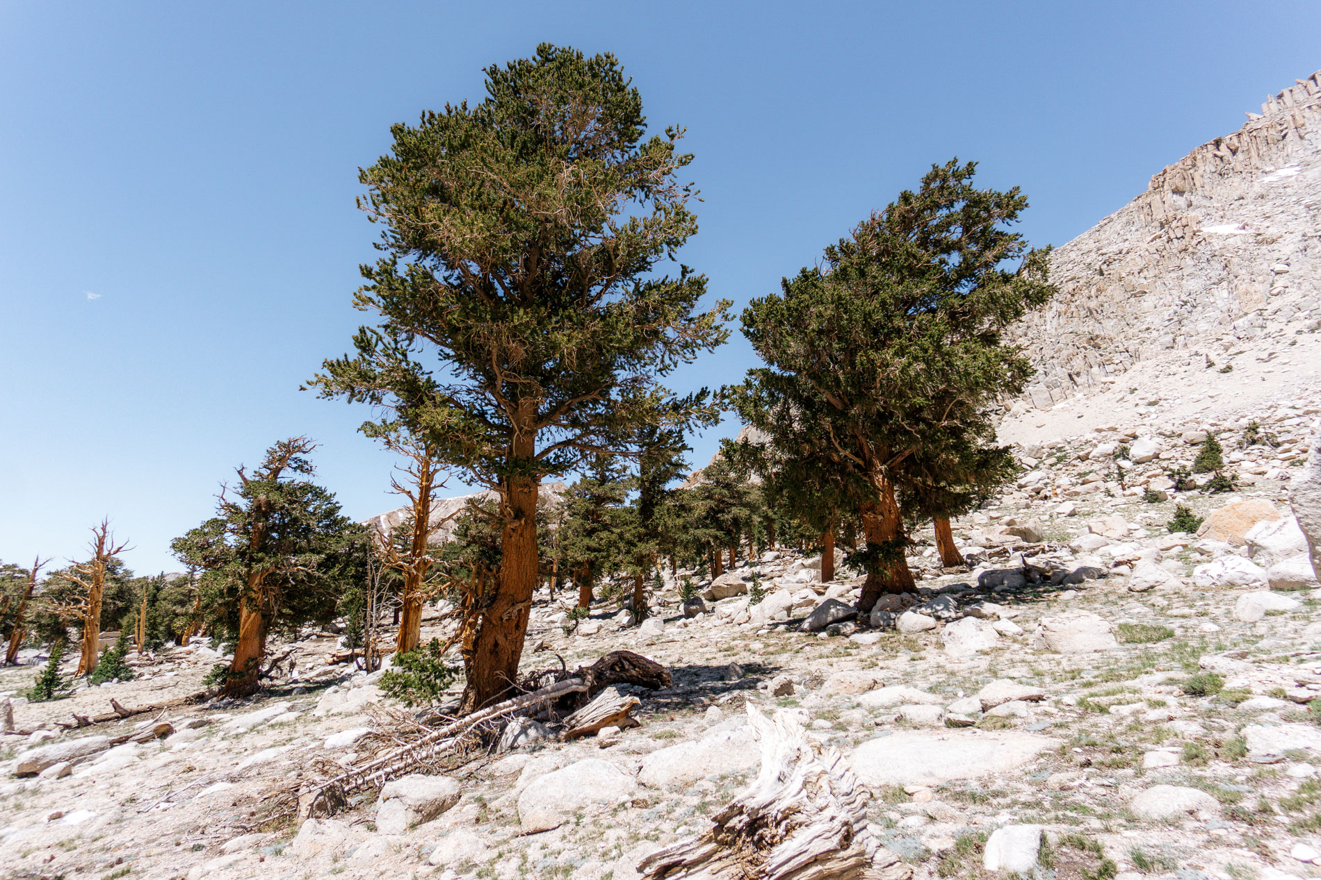
They’re an extremely rare pine tree that grows only in California in the Sierra and Klamath mountains. The larger trees have fat trunks and short limbs filled with pine needles. Some have even been dated at over 2000 years old. They have a penchant for becoming those fascinating “ghost trees” that are dead but still upright throughout the Sierra. I was instantly fascinated.
We ate lunch by the lake for an hour drinking the spring fed water and replenishing our energy. The rest of the hike would be completely off trail, with one crux. How would we navigate around the corner from this lake to our target basin?
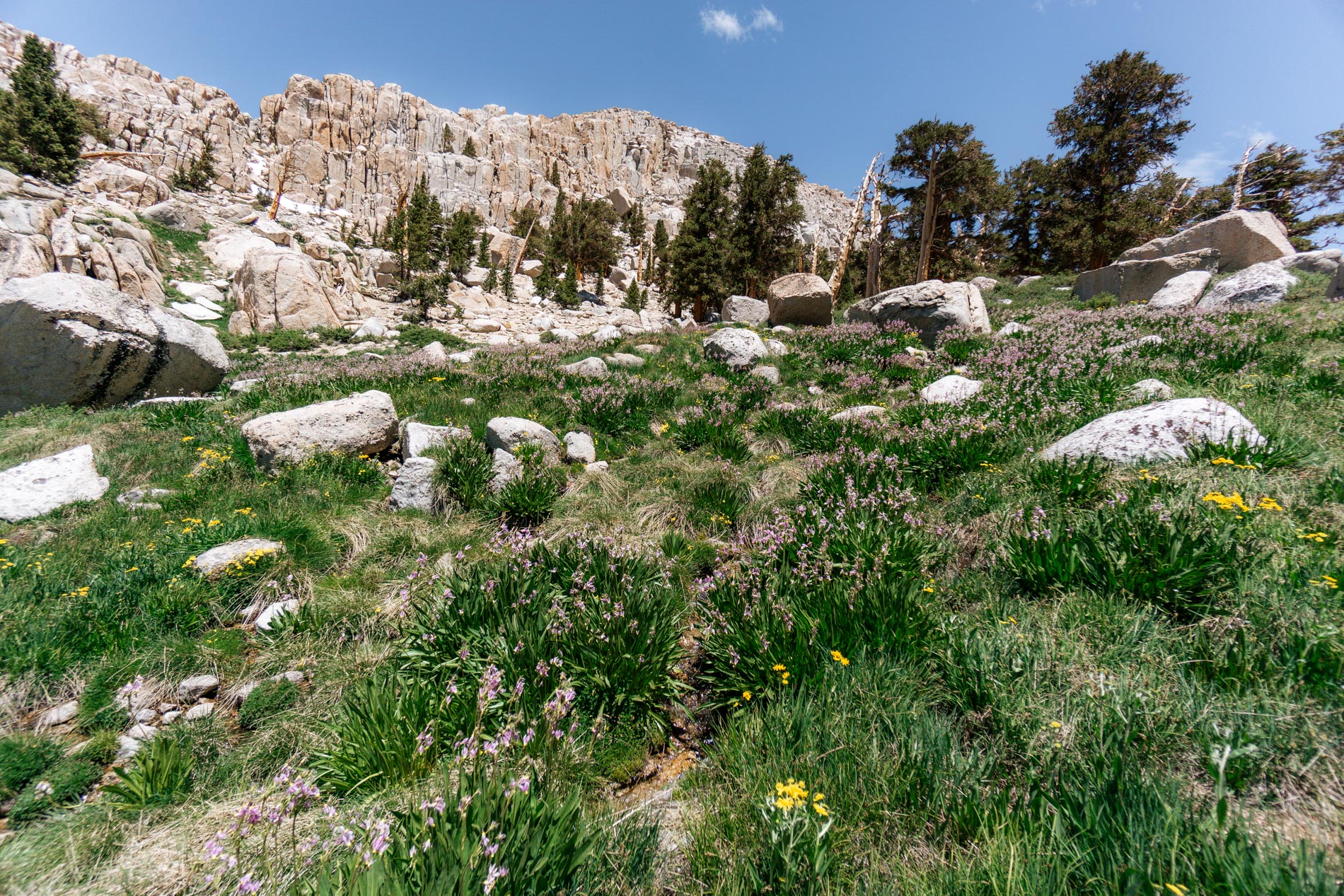
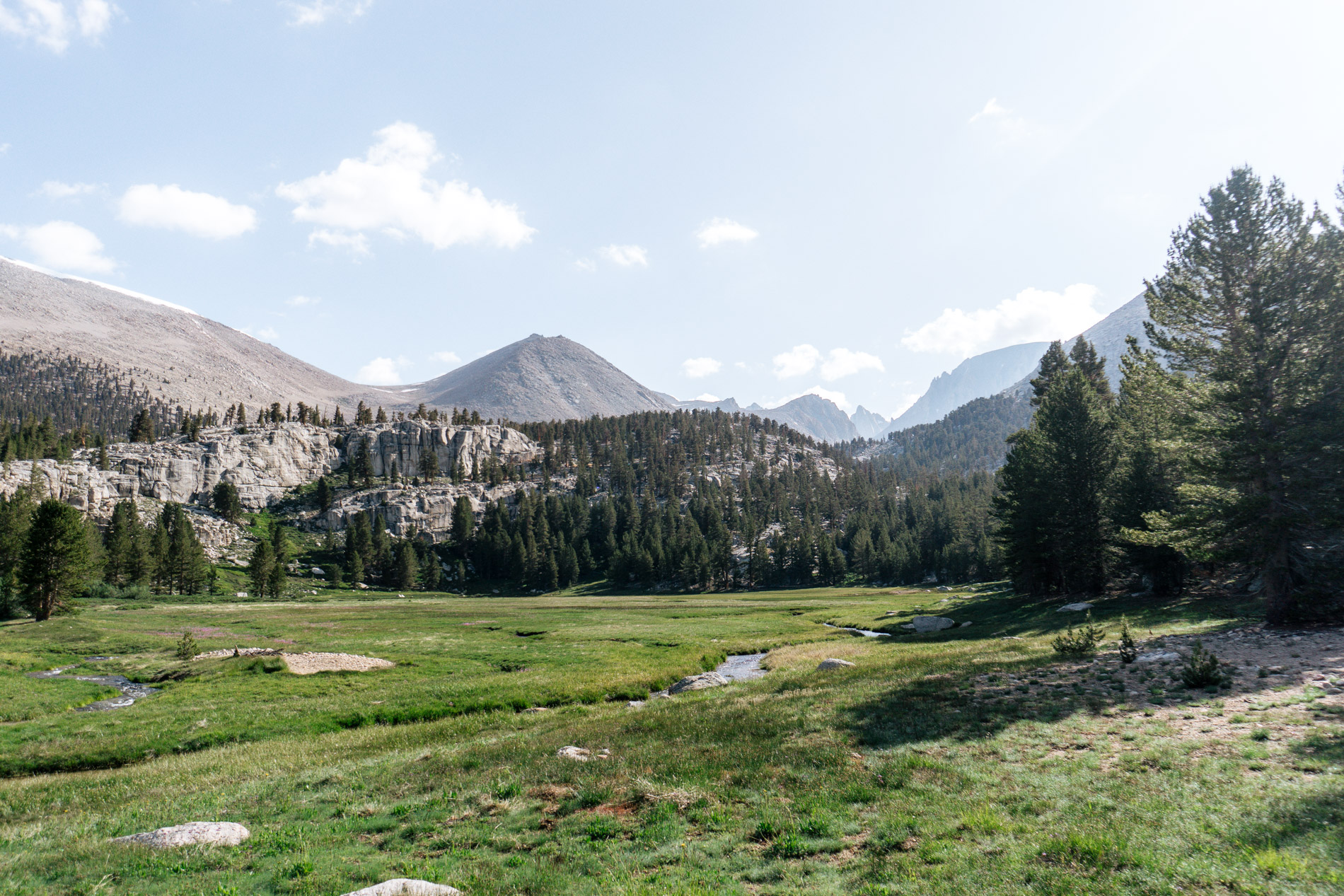
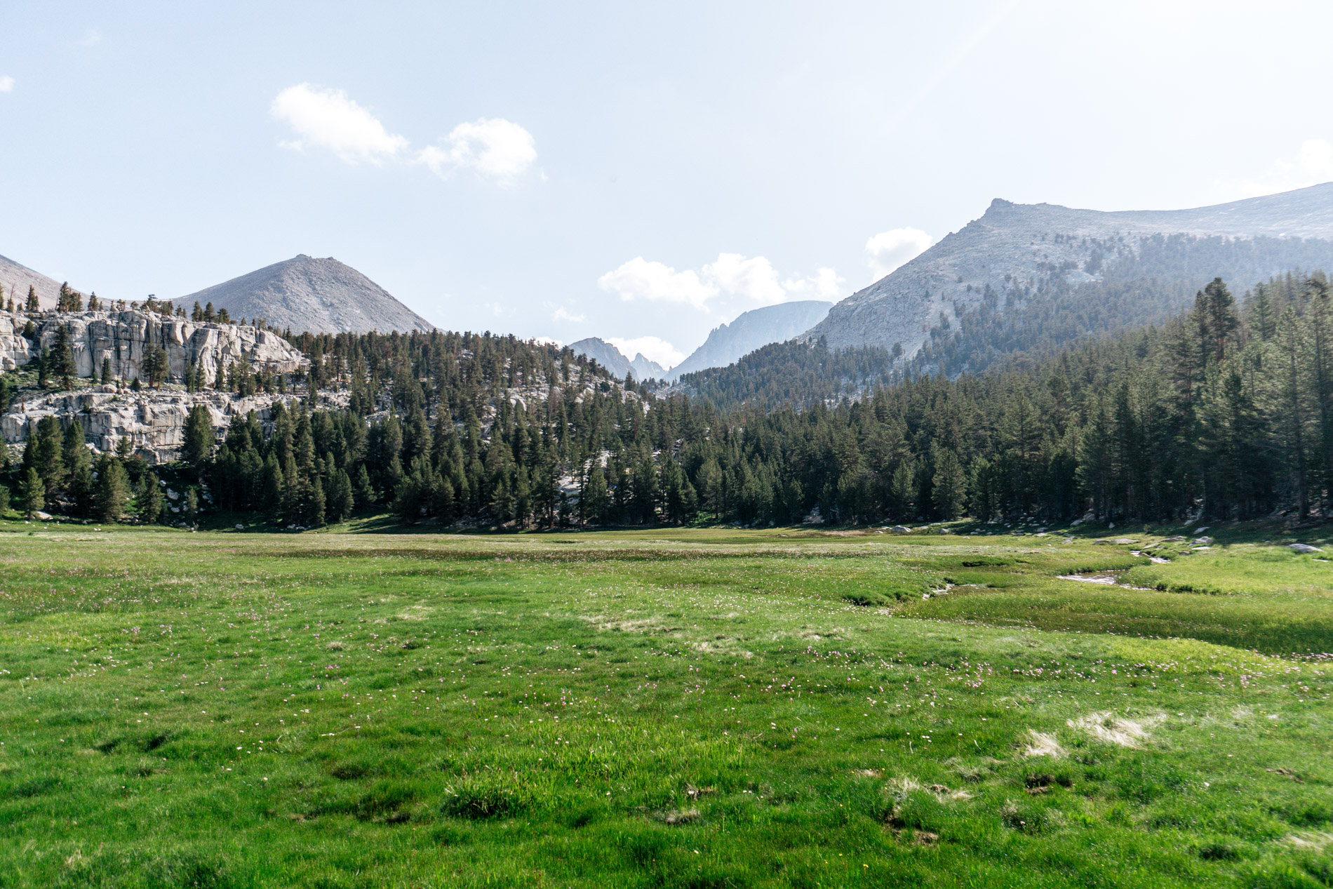
In the end, it was pretty straight forward and we didn’t get into any trouble. We even walked through this gorgeous meadow filled with shooting stars – a common sight for the rest of the trip.
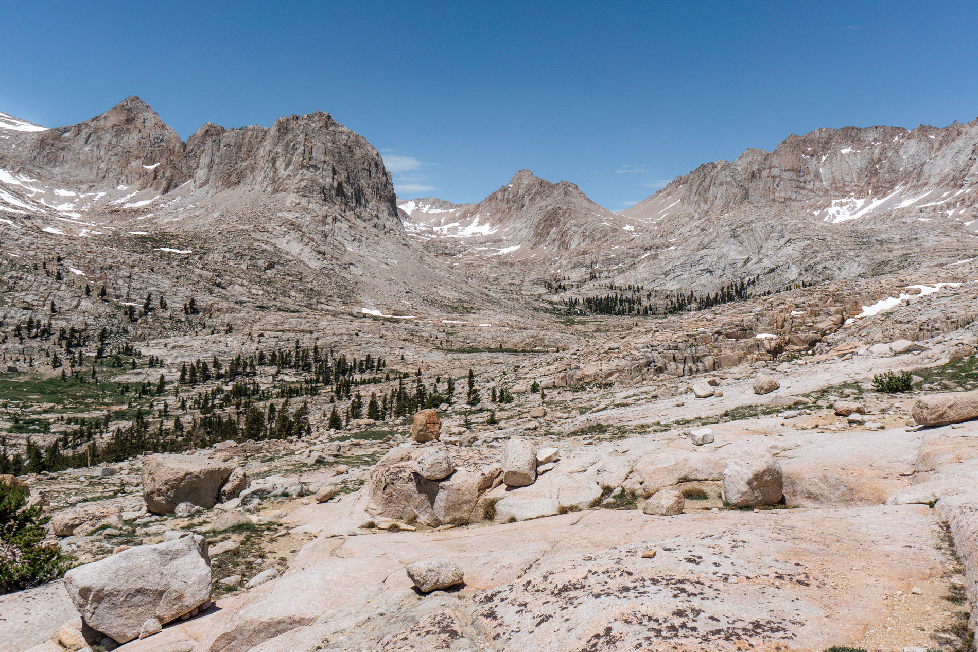
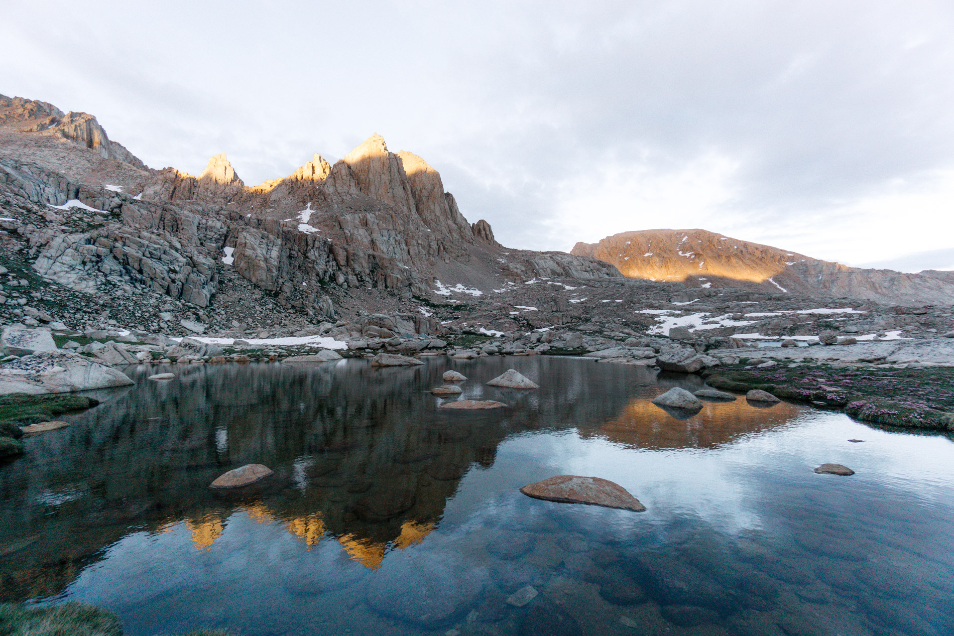
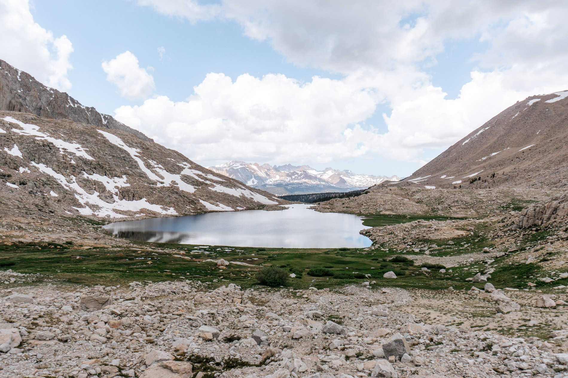
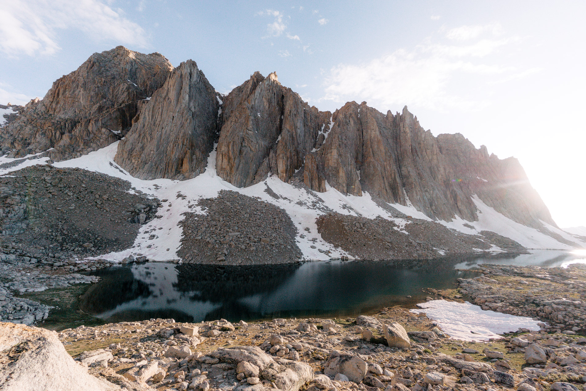
Once we turned the corner the basin opened up in front of us.
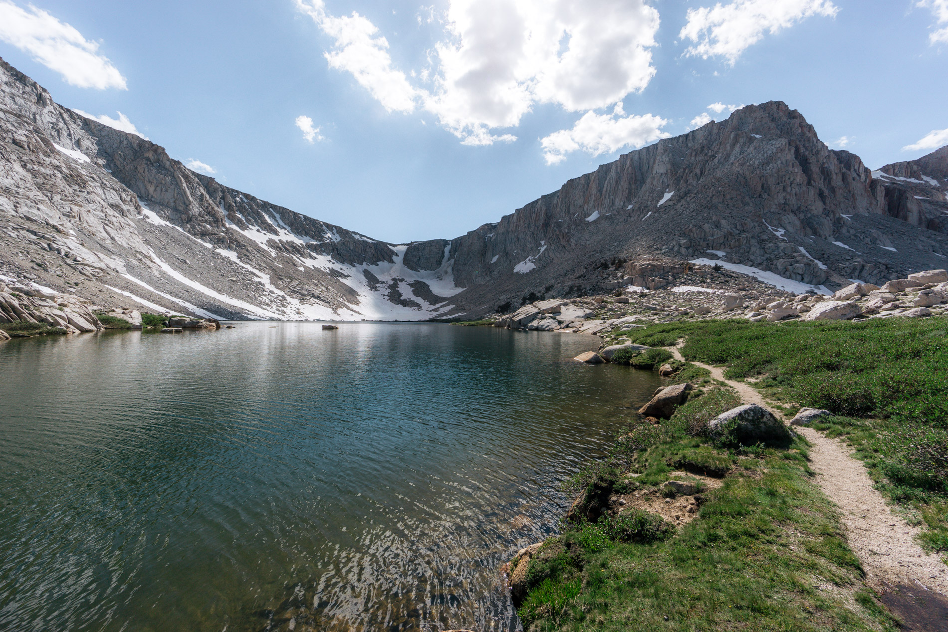
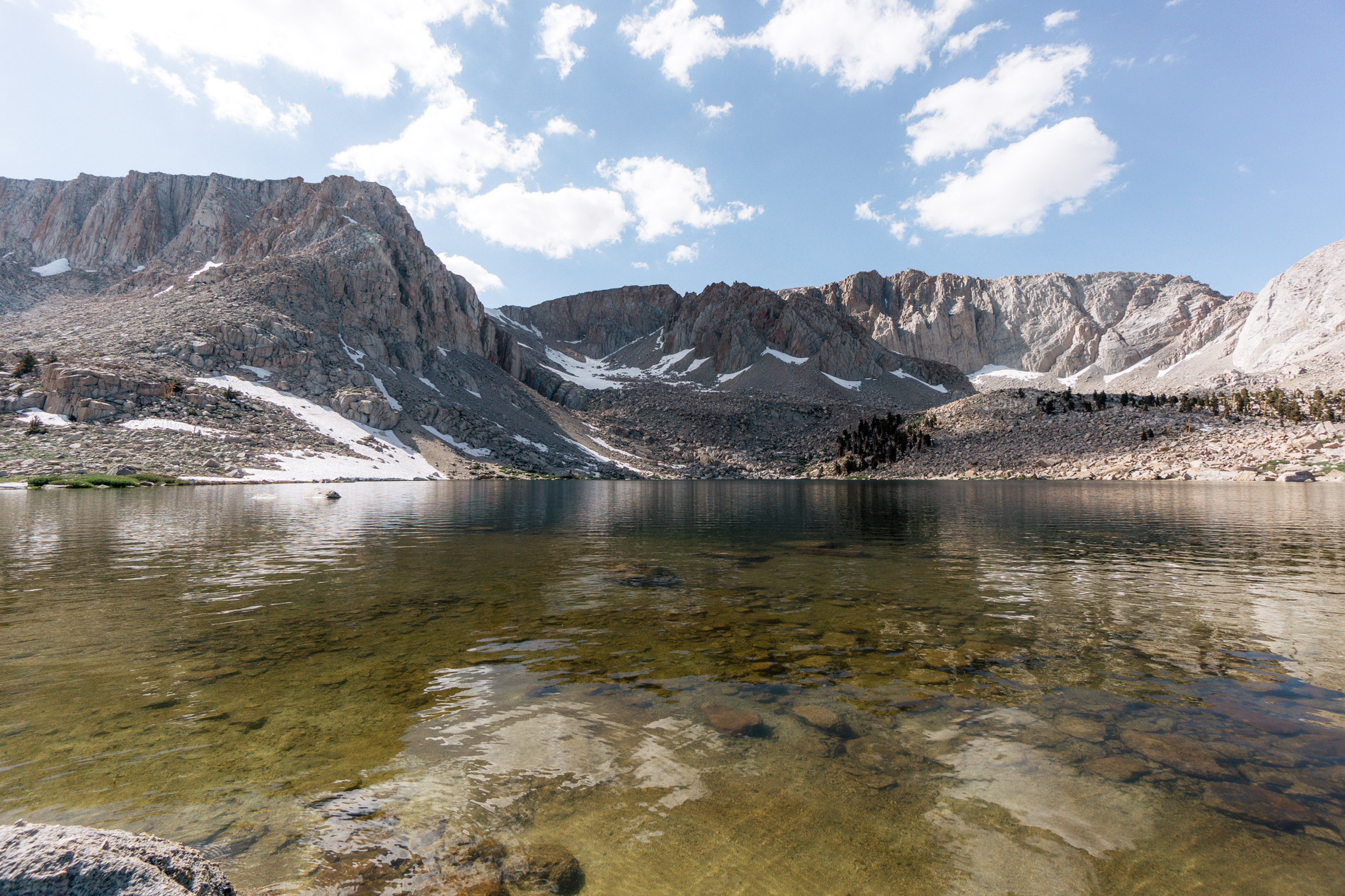
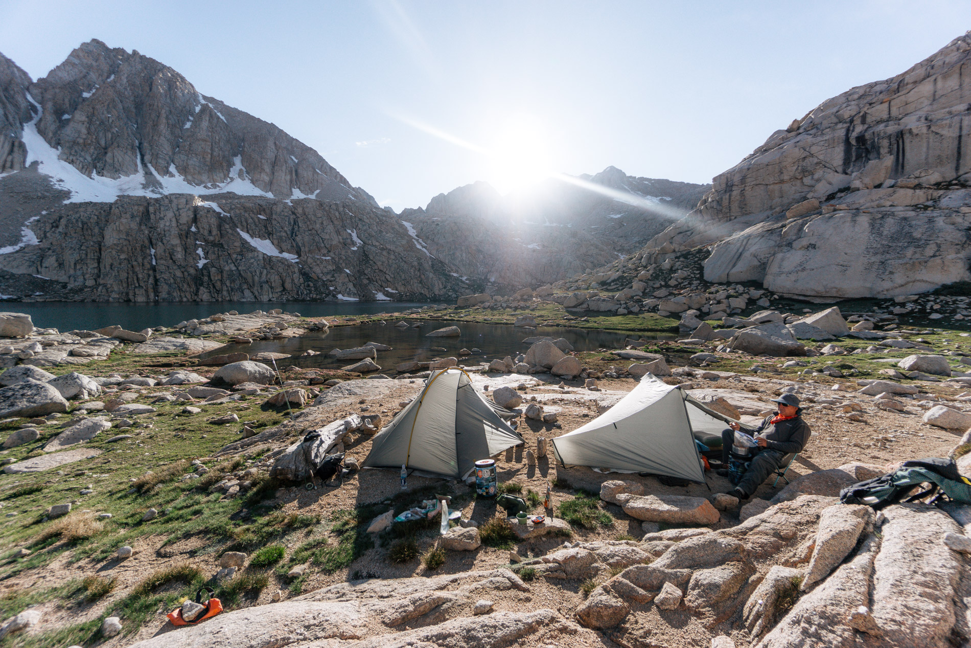
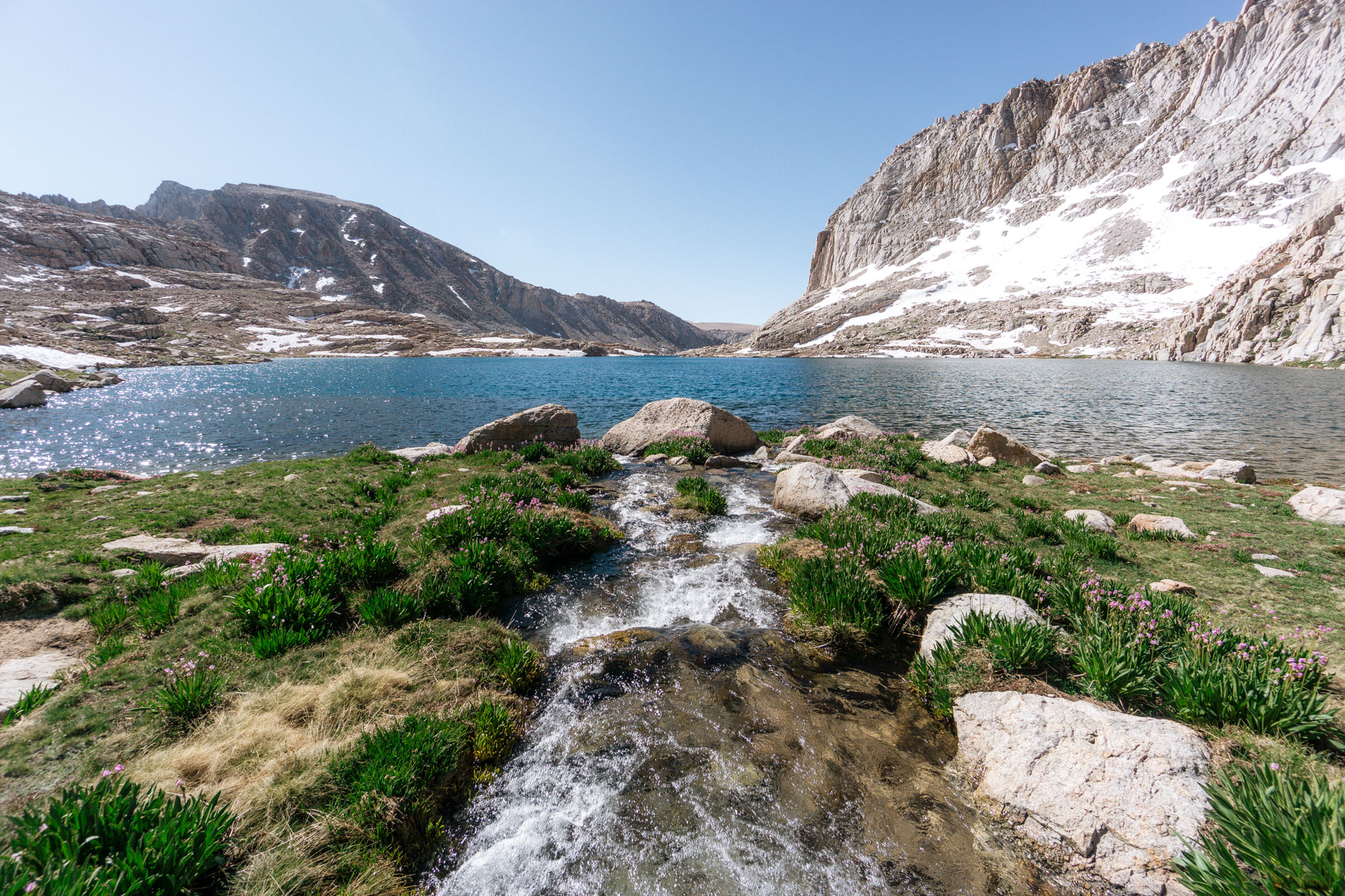
The last hill up to the lake burned us out (don’t have to do that again!), but the thought of a zero day and golden trout fueled the climb up the steep granite hillside. With tents pitched and a couple hours of daylight left, I eagerly busted out my rod to see if the lake would hold the same size goldens as the last time we were here in 2012.
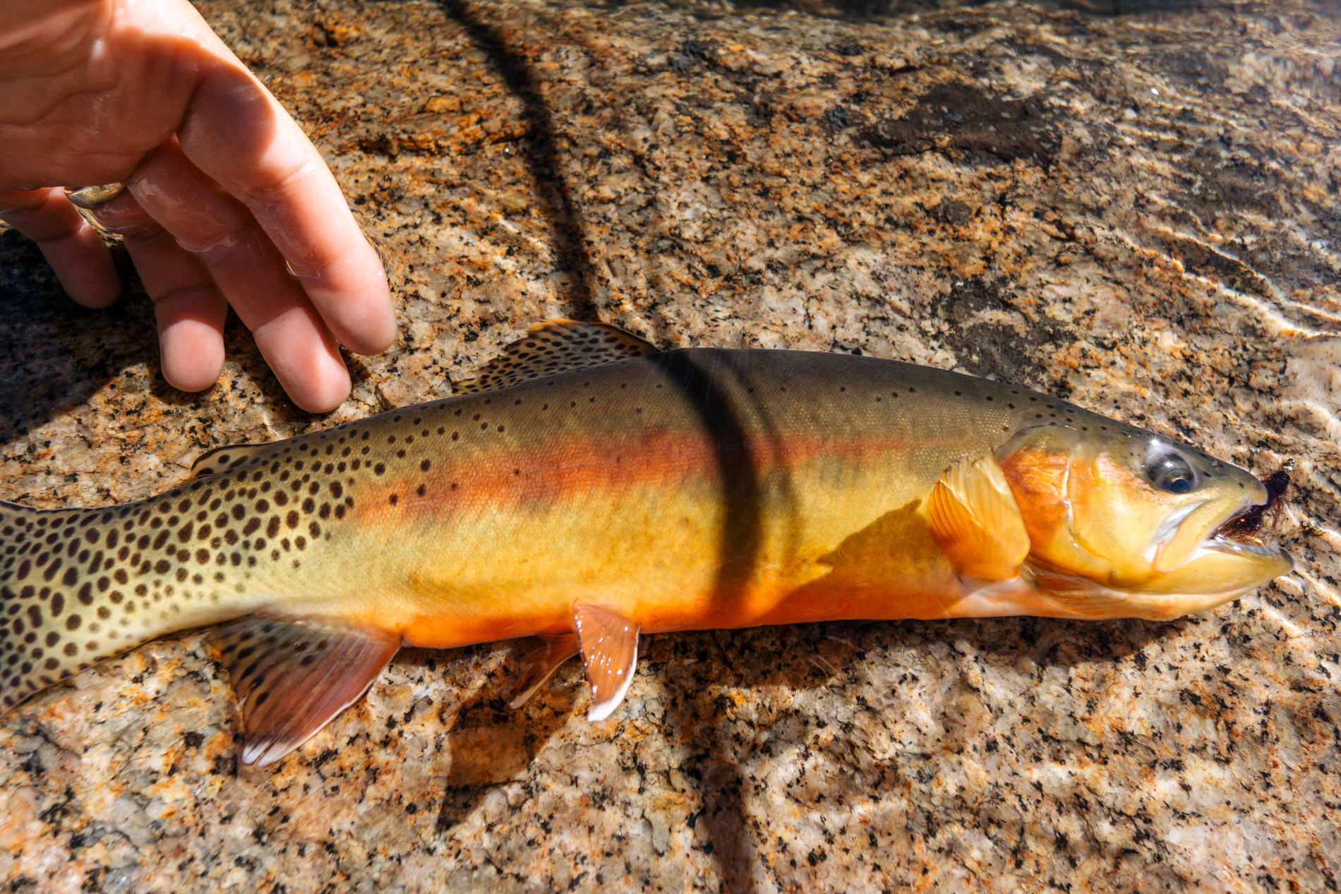
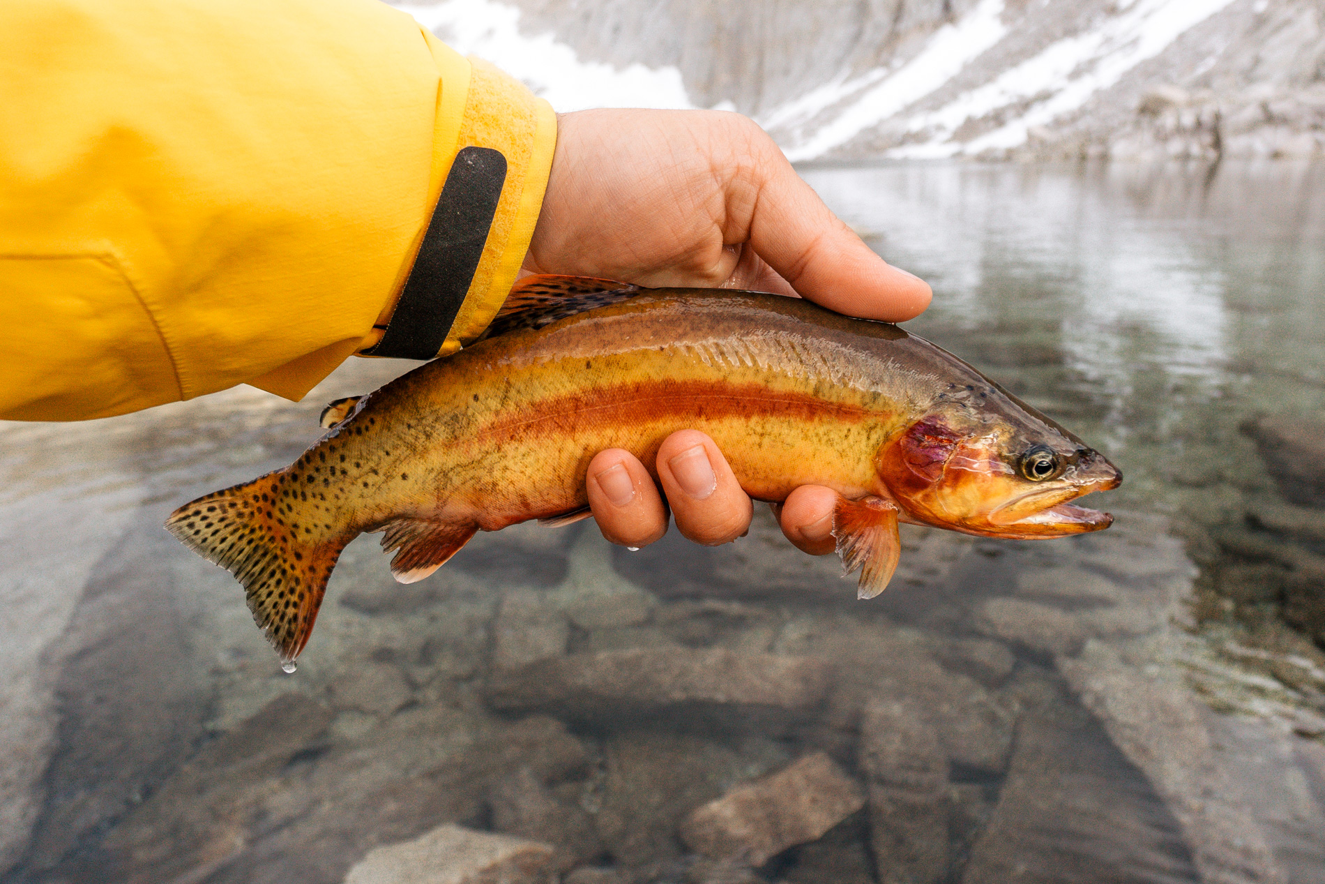
There were tons of hungry, fiesty goldens but they weren’t quite as big as I remembered. The average size in 2012 was a healthy 12″ and the top end 15″. This time the average fish was 10″ and top end about 14″. I wondered what could have changed in 7 years? Perhaps insect life had deteriorated leave the population with less food? Or maybe there was too much reproduction and the lake isn’t able to support the increased number of mouths to feed?
Don’t get me wrong, it was still a blast to fish for golden trout at a remote off trail lake at 11500 ft in the Sierra, but the engineer in me mulled these questions over for the rest of the trip. Still haven’t answered them.
I returned to the tent to make some dinner feeling happy to have found the fish population thriving, though slightly disappointed that they had decreased in size over the last 7 years.
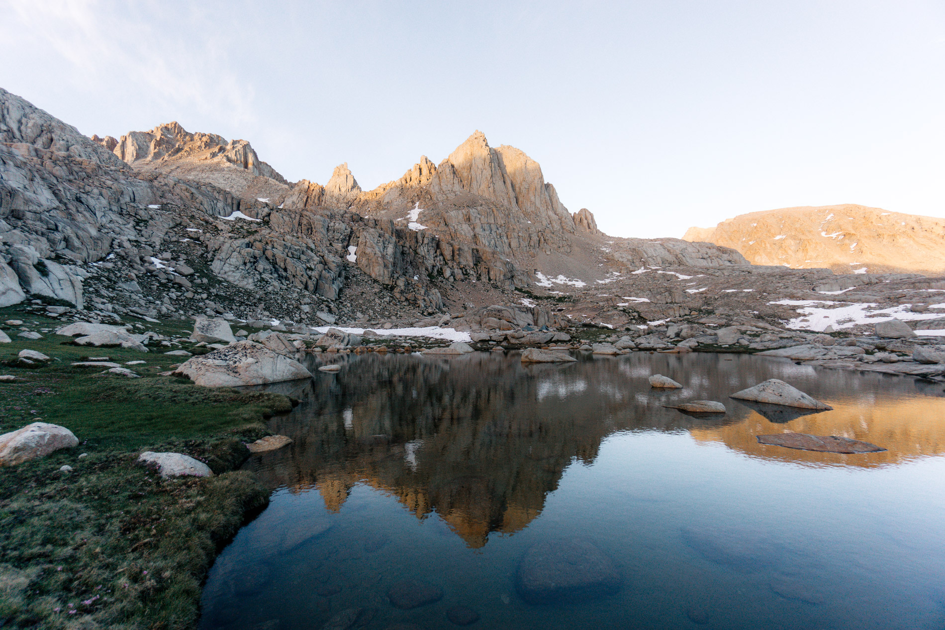
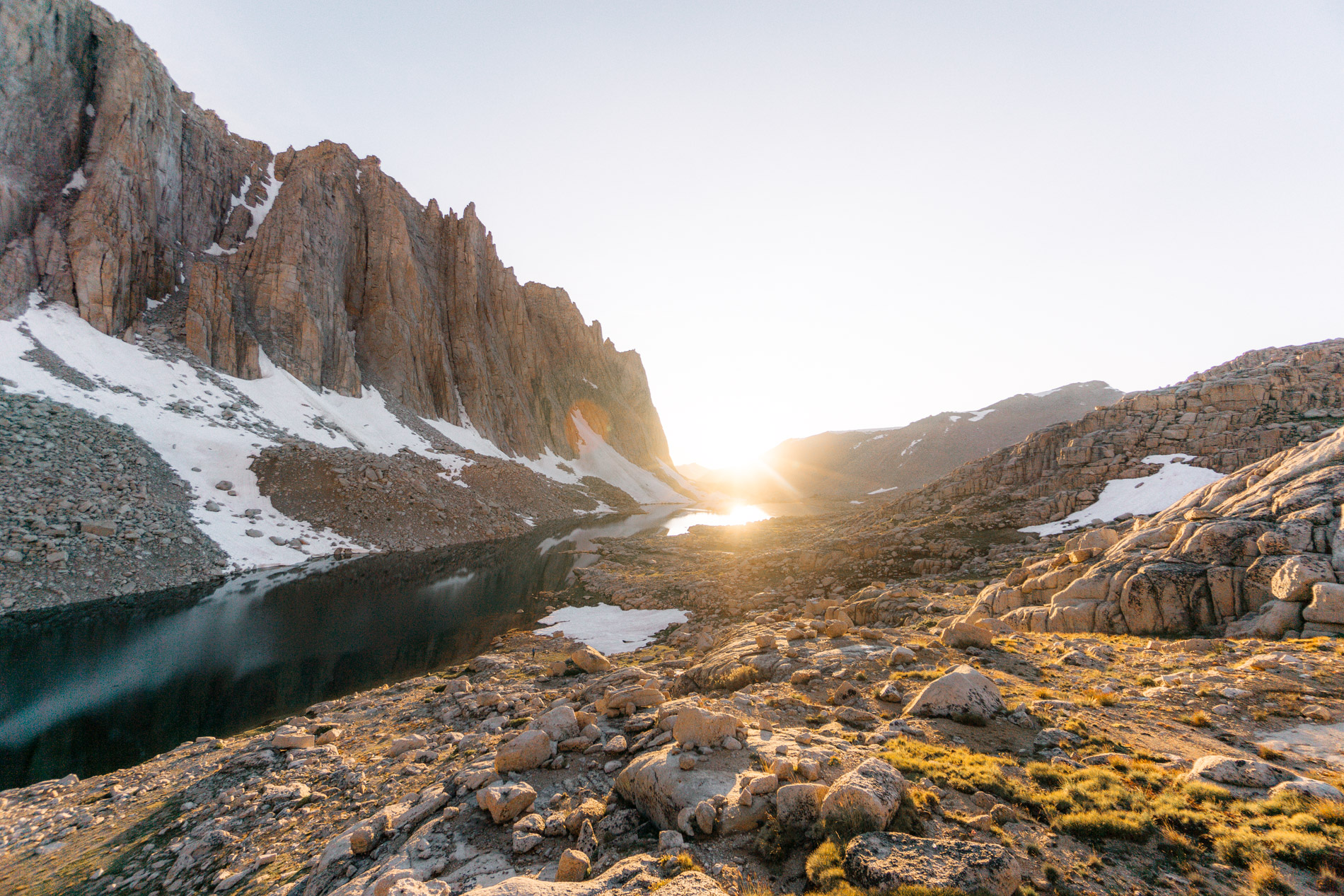
That evening I did my usual walk about taking pictures while the lighting was good and thought about what I would do during my layover day.

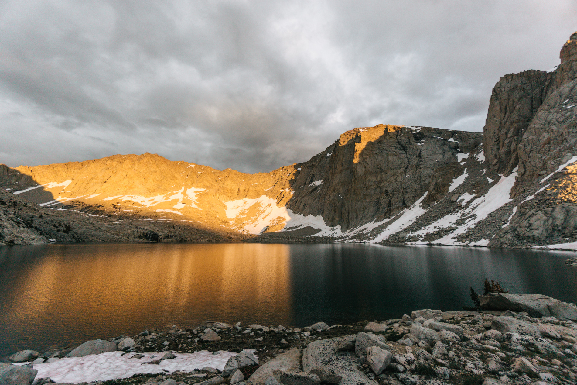
The alpen glow was pretty cool.
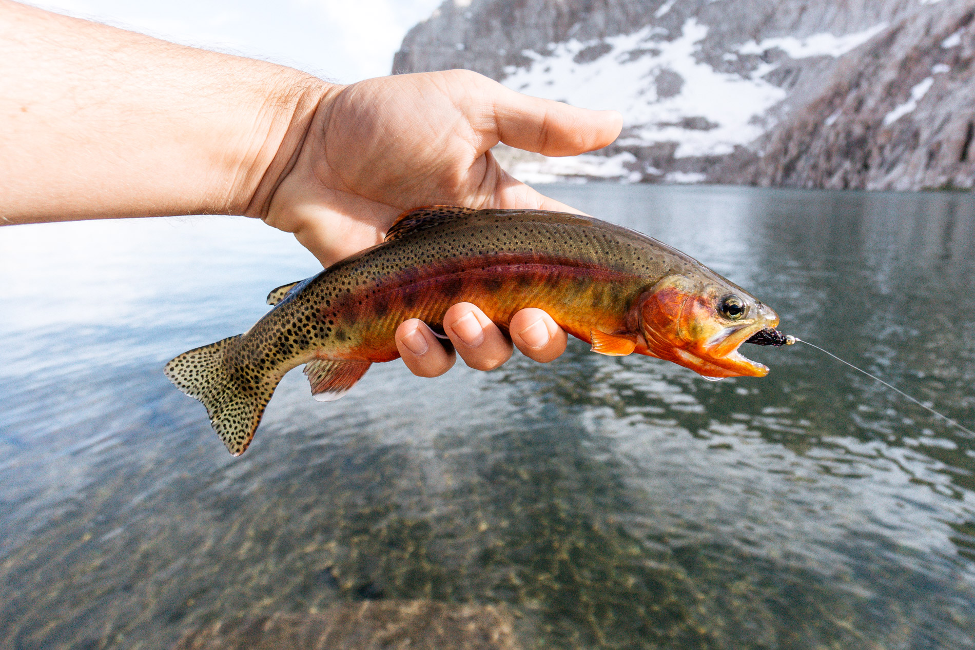
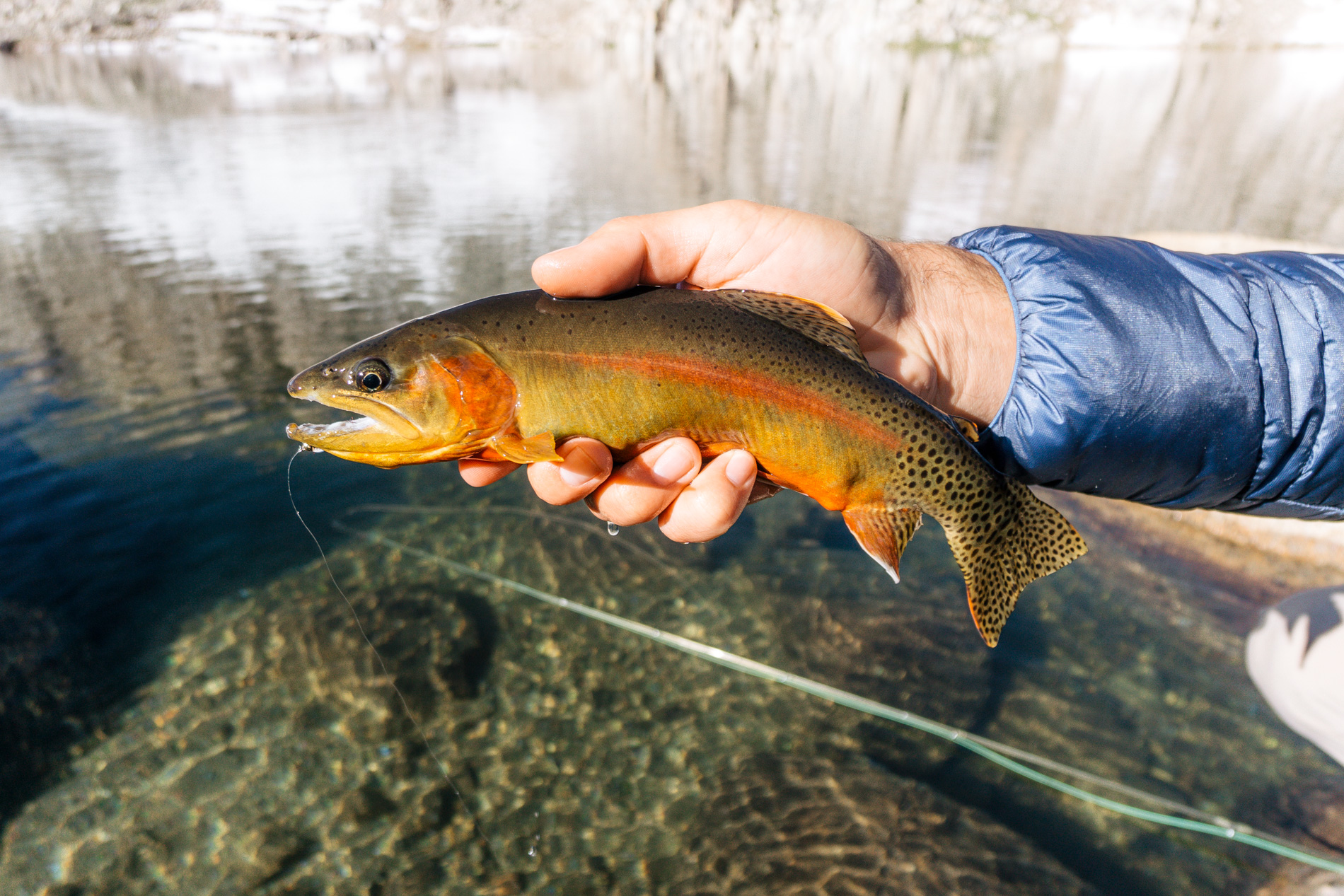
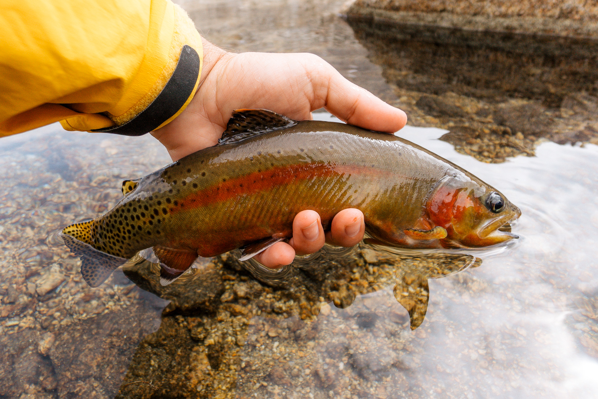
The morning of July 22nd dawned, but I stayed in my sleeping bag getting a little extra sleep on our rest day. By 8AM I was on the water fishing for the numerous goldens in the lake. I employed the trusty double midge setup with an indicator and consistently produced quality goldens.
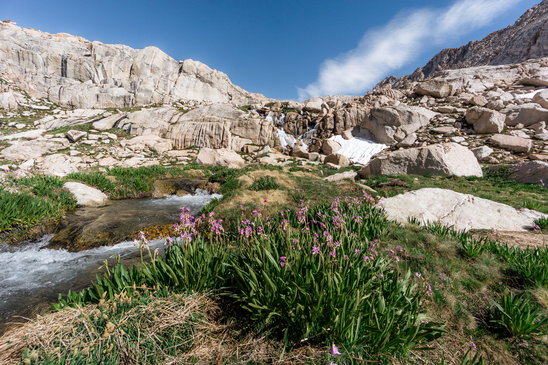
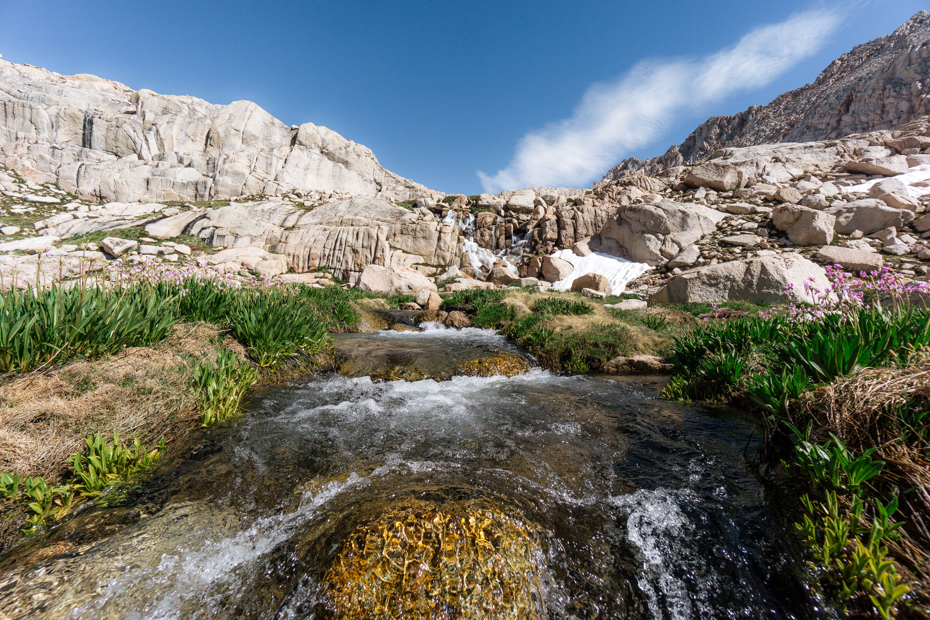
I wandered over to the inlet to snap some pictures of the waterfall framed by shooting stars. The waterfall was full with fresh snow melt and the inlet creek was overflowing its banks – it was still spring at 11500 ft.
I drifted my sno-cone midge through the inlet currents and continued to catch nice fish, but something in the back of my mind was itching to explore a nearby lake. I had seen a youtube video of someone catching a decent golden from this other lake, but had never heard a first hand account of it containing fish.
The lake was up and over a steep shoulder and required a 1 mile hike with 800 feet of elevation gain. Was the hike worth the 70% chance of failure? As is often the case with golden trout – absolutely. No pain, no golden trout.
I packed everything I would need for the afternoon and set off up a steep hill side. At first I tried to traverse it but got to a point where one miss step would have resulted in a slide down a 1000 ft sheer cliff. Probably not a good idea to do that solo.
I back tracked and headed straight over the top of the shoulder. It was steep, but once on top it was flat and easy to navigate. 45 minutes after starting the adventure I finally got a view of the lake. It was tucked in a bowl surrounded by jagged granite peaks. The lake was 95% ice free, but quite a bit of the shoreline contained snow. Wonder if it has fish?

I made my way down to the lake and walked the entire southern shoreline to the outlet hoping to spot a cruiser or some sign of life. Not to be. I reached the outlet without seeing anything. No fish, no spawning fish, nothing. I was disappointed so I ate lunch and filtered water.
The lake was really deep, so I switched to sinking line and leech strategy hoping to pull a fish up from the depths. I fished hard for 2 more hours, with similar results. No cruisers, no hits, no fish. Oh well. Checked it off my list, I suppose.
I headed back to our camp to rejoin my dad. I took it easy the rest of the afternoon, alternating between sitting in the Helinox chair and fishing. Sounds perfect, no?
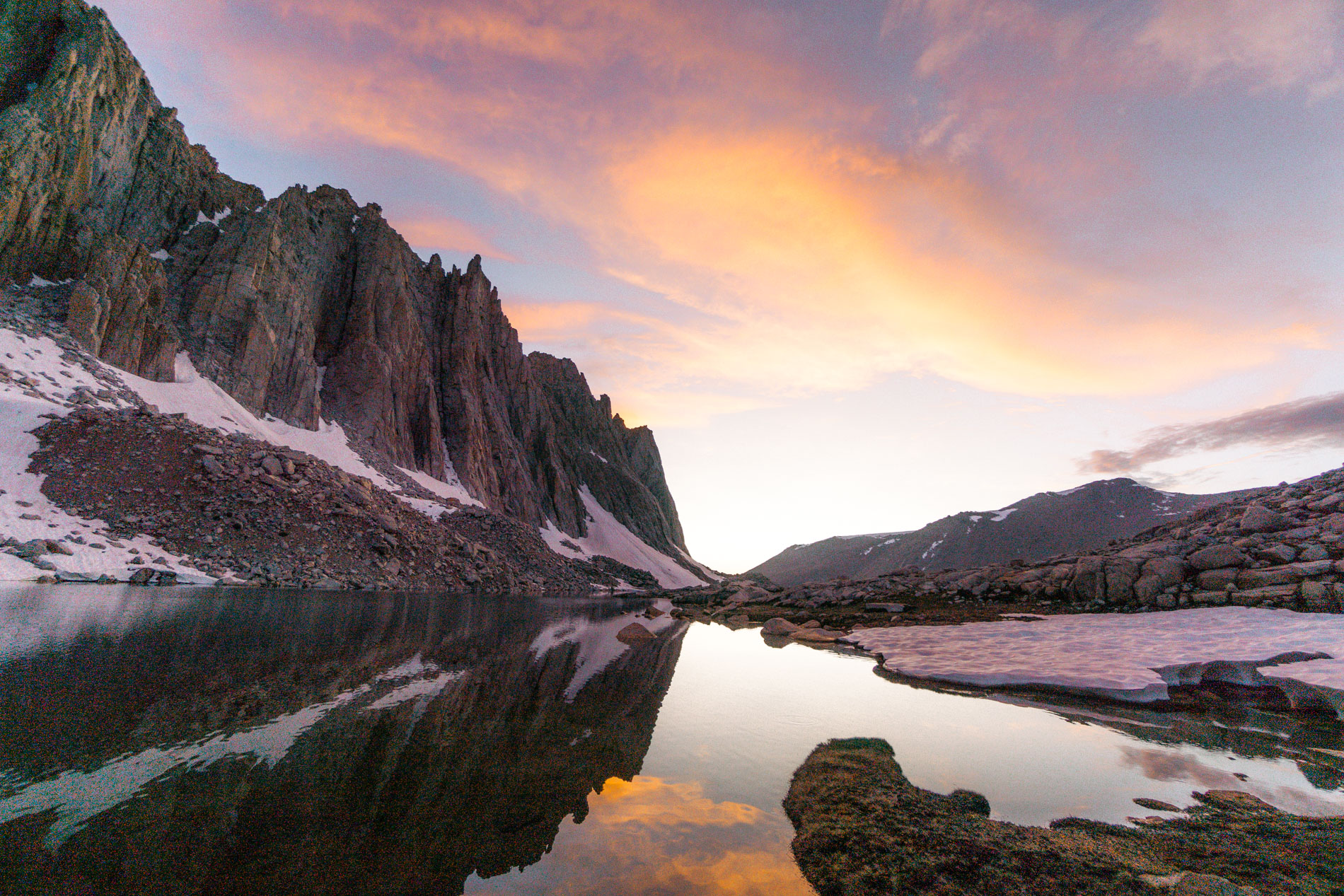
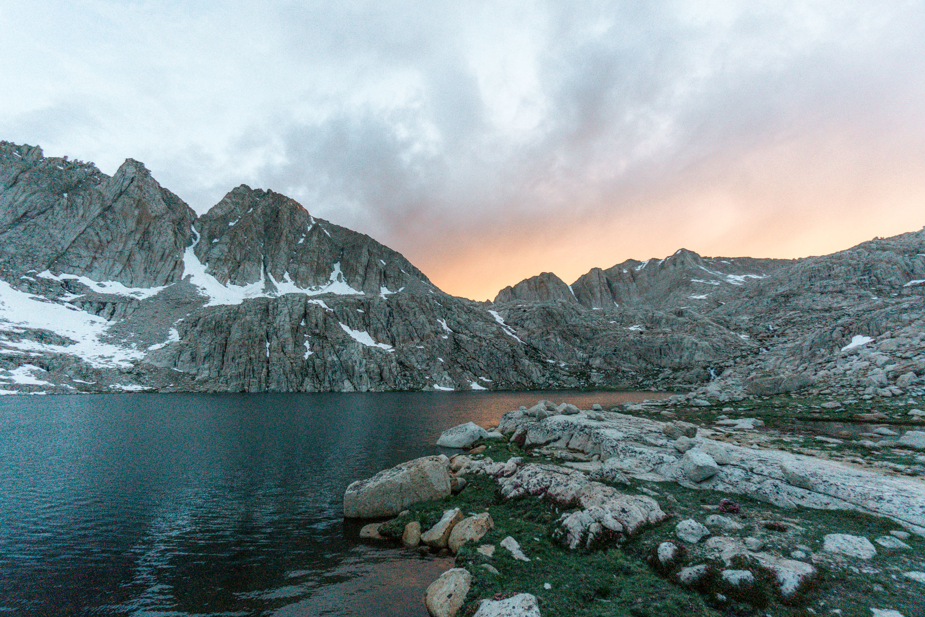
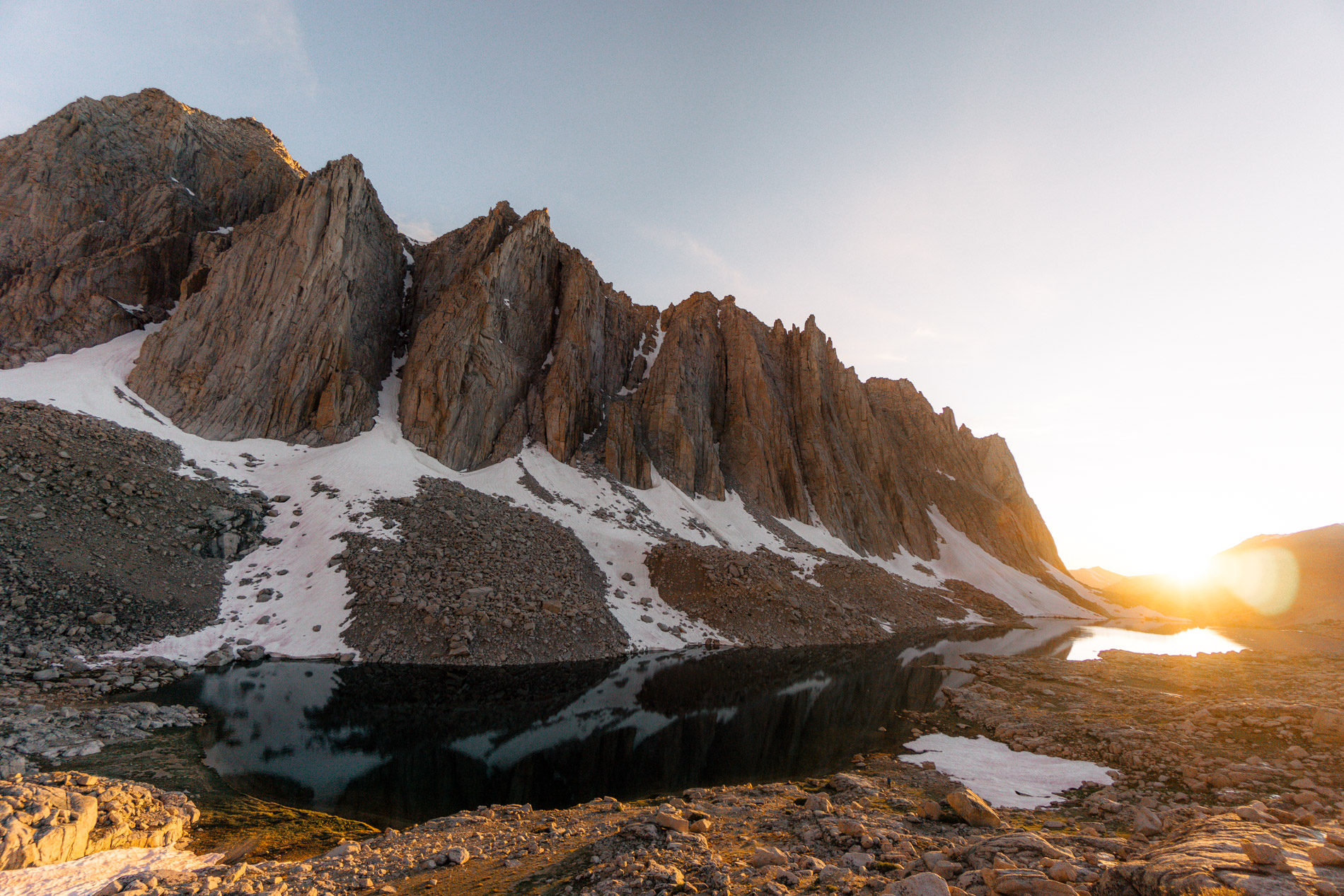
The most interesting thing that evening were the clouds. The day started with a completely clear sky, but by 6pm significant clouds had formed and it even sprinkled a bit. The weather pattern had changed, and the rain was a foreshadow of what was to come. The clouds provided an amazing sunset though.
Sunsets with clouds require patience. The good stuff comes after the sun has already gone down. The longer you wait, the better it gets.
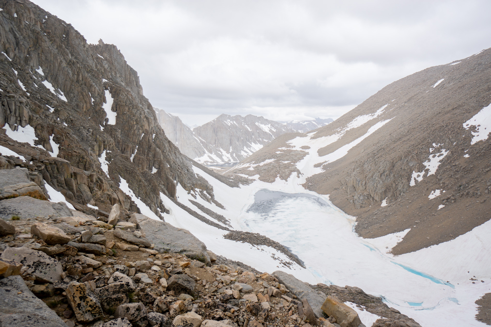
July 23rd (day 4), was a 5 mile cross country hike over a Class 2 pass with 1200 feet of elevation gain. Not exactly easy, but shorter than the day 2 monster. The only problem? It was cloudy and cold and it was only 7am.
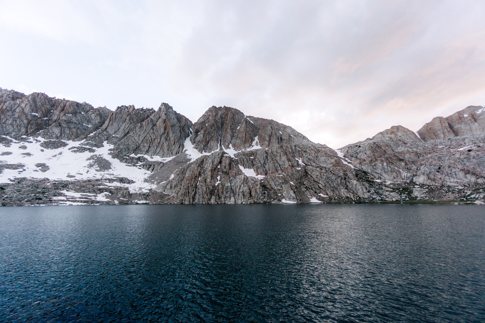
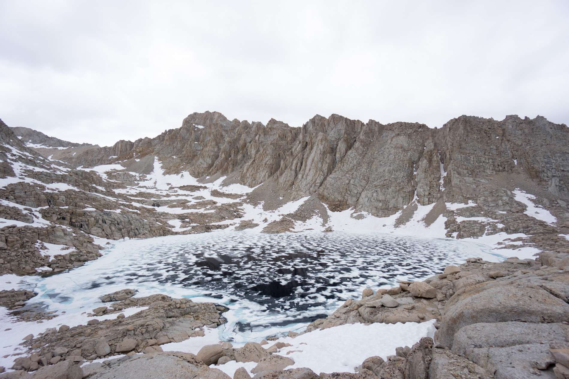
We set off following the inlet creek high up into the basin. We snaked our way through the rocks following grassy chutes. After about 30 minutes of walking we crested a hill and looked down on the upper most lake in the basin. It was still frozen. On July 23rd.
It started to drizzle, so we tossed the rain jackets on and continued to navigate our way to the top of the cross country pass. The route is ordinarily easy going – you just follow the flat spots between the small cliffs – but this year the snow made it slightly more complicated.
Our route was about 50% on dirt and 50% on snow to the top of the pass. We would cross a long snow bank, get off, assess the next part of the route, hike through cliffs, cross another snow bank; repeat. There was one point where we were trying to traverse a steeper snowbank but it was quite narrow between rocks and as soon as I stepped on the narrow section I post-holed up to my waist. Whoops!
I wriggled loose and immediately jumped onto solid ground a little spooked. Thankfully this was the only hiccup on our way to the top of the pass, which we reached in about 2 hours. At that point it was still drizzling and the view down the valley on the other side looked like a winter wonderland.
Is this really summer?

The other side of the pass was steep and loose, so we descended slowly but eventually got to a point where we could jump onto the giant snow bank, which was much easier. The traverse around the lake might have been the toughest part of the hike. It was a steep snowbank with no sun cups – a slip would result in an icy plunge. Nice.
Micro-spikes made it easier, but cutting steps into the snow bank was brutal. It was mentally and physically taxing, but we got around. (Don’t have to do that again!)
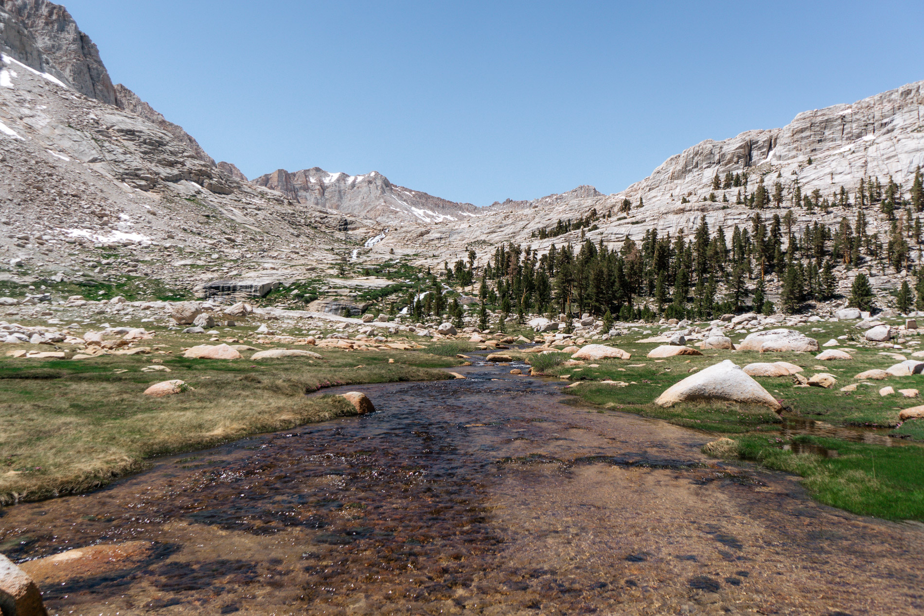
The lake we were going to camp at was just a little bit more than a mile down the valley. It was easy walking on large granite slopes, and the target lake soon appeared.
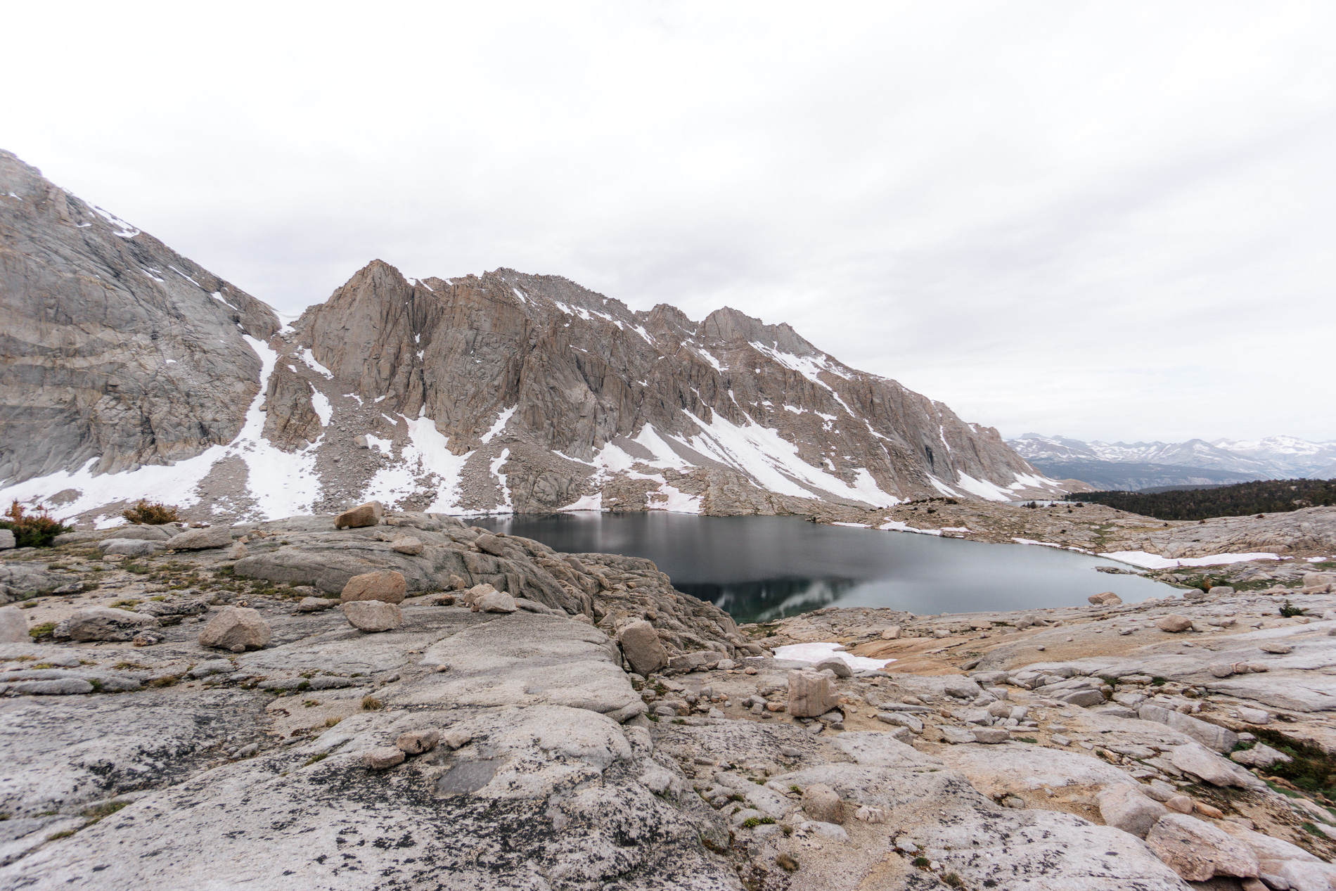
We finished hiking at around 12pm leaving plenty of time for fishing that afternoon. In 2012 we visited this lake and I notched my first skunk at a lake that holds fish in the Sierra. It was frustrating, but coming back was a big reason for this trip.
In short, the fishing was amazing. The sno-cone midge prevailed.

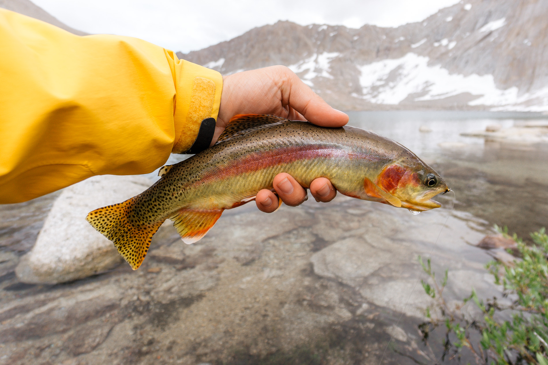
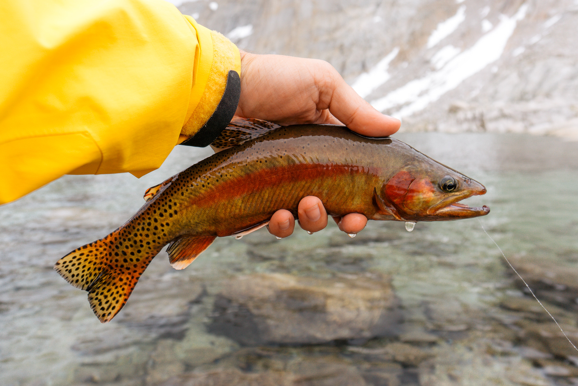
The fish were bigger in this lake than the one previous and they fought hard. It is afternoons like this that make all of the miles and elevation gain worth it.

Once again the clouds hung around until sunset, which made it interesting. This was the most dramatic sunset of the entire trip and I ran around like a mad man trying to capture it as best I could.
Once again, patience was the key as the sun turned the clouds a fiery red. It blew my mind.
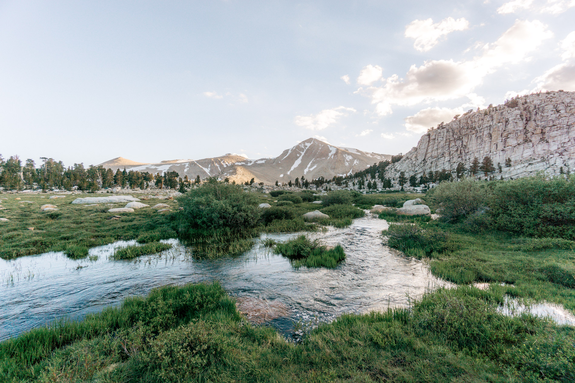
July 24th (day 5) was a little bit longer hike, but it was on trail and we were going to explore a part of the Sierra neither of us had ever seen before. We followed a use trail down past the lakes in the sunset pictures above and then around and into the canyon to the north. It was the first time we had hiked through trees since the Foxtail Pine forest days ago.
The trail bottomed out in a giant meadow where several forks of a small creek flowed and was flanked by tons of wildflowers. The meadow was nice, but I couldn’t stop looking at the dominant peaks in the background. That is where we were going.

After crossing the meadow we found the trail that leads up into those towering peaks. There were a few annoying creek crossings where we took our boots off to cross and then put them back on, only to find we had to repeat just 1/4 mile down the trail. Despite that we made good time working our way up the trail past a few of the smaller lakes that sat right at treeline. Eventually we headed off trail just above the infinity edge lake in the picture below.
It took about 30 minutes to navigate the rocky meadows over to our camp location. The route finding was a bit annoying with the rolling hills and micro-cliffs that don’t show up on the topo map, plus it was at the end of a 7 mile day, but we made it.
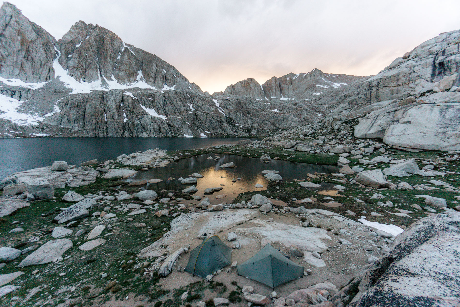
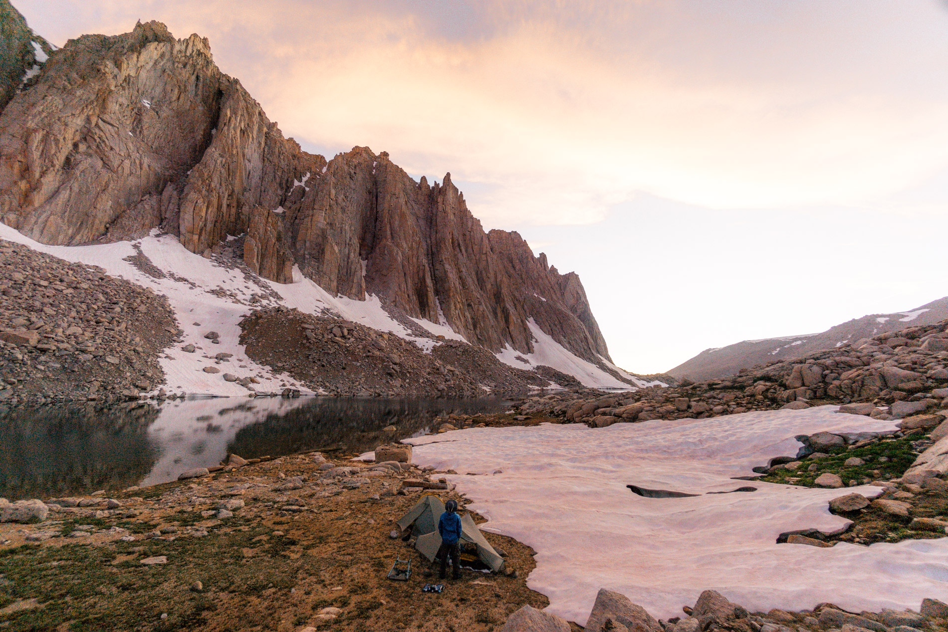
When we reached the lake we took the first available flat spot, which happened to be next to a snow bank (you can just barely see them in the picture below). We immediately set up our tents because the clouds were threatening. It was 12:45pm when we finished getting organized and by 1pm it was beginning to rain. We got into the tents and unfortunately didn’t get out (save for 15 minutes to go to the bathroom) until 6pm!
It rained and hailed complete with thunder and lightning. I found it exhilarating at first, but got bored after a while. I had waited all year to fish these lakes, but got rained out. Around dinner time, the storm broke up and we got out of the tent to stretch the legs and eat dinner, but fishing would have to wait until tomorrow.
The lingering clouds once again created an amazing sunset.
While I was out taking pictures of the sunset, I tripped and fell forward going down hill. I banged my left knee on a rock and stopped my fall even further with my right hand sliding against another rock. Despite how quickly it all happened, it seemed to happen in slow motion for me, as I watched my camera swing forward and bang against the same rock I hit my knee on.
Fortunately, I escaped with just a bruised and scraped up knee and some scratches on the palm of my right hand. Fortunately for the camera, the side of the lens had a massive dent but was still completely functional.
I was a bit timid walking back down the hill to my tent, but after I got patched up with some band-aids I took (in my humble opinion) one of the best pictures of the trip.
The goal for July 25th (day 6) was to rest, recover and catch some fish! Initially I planned a day hike to another lake within the basin, but given that I hadn’t even fished the ones we were staying at and my fall from last night, I didn’t wander too far.
We were fishing the upper lake by 8am and managed to get in 2.5 hours of fishing before the clouds started building again. The fish were quite large but quite spooky. They would dart away at the first sign of a person. I stuck to my double midge rig and managed to catch a few. Surprisingly, I got equivalent action on the Jojo Chironomid larvae as I did the trusty sno-cone.

By 11am the weather was starting to look dicey again. I couldn’t believe it was going to rain even earlier than yesterday! Once again we got in the tents and stayed in them until 5pm, except for a 30 minute window where we squeezed in a lunch. In total, it rained and hailed for 12 hours over 2 days – woof.
I listened to the rain and hail pitter patter on the tent and dozed off. Every once in a while I would wake up and poke my head out of the tent, but this is what I usually saw:
When we got out of the tents at 5pm, it looked like the rain was going to be over but some low clouds started rolling up the valley. It looked like some tule fog from the central valley – creepy.
Despite the low clouds, it didn’t rain anymore and I managed to get back up to the upper lake and fish for a couple more hours. I caught 3 more fish and possibly my longest of the trip.
It was too cloudy that night for any sunset pics. As I was cooking dinner a few rain drops even fell on me.
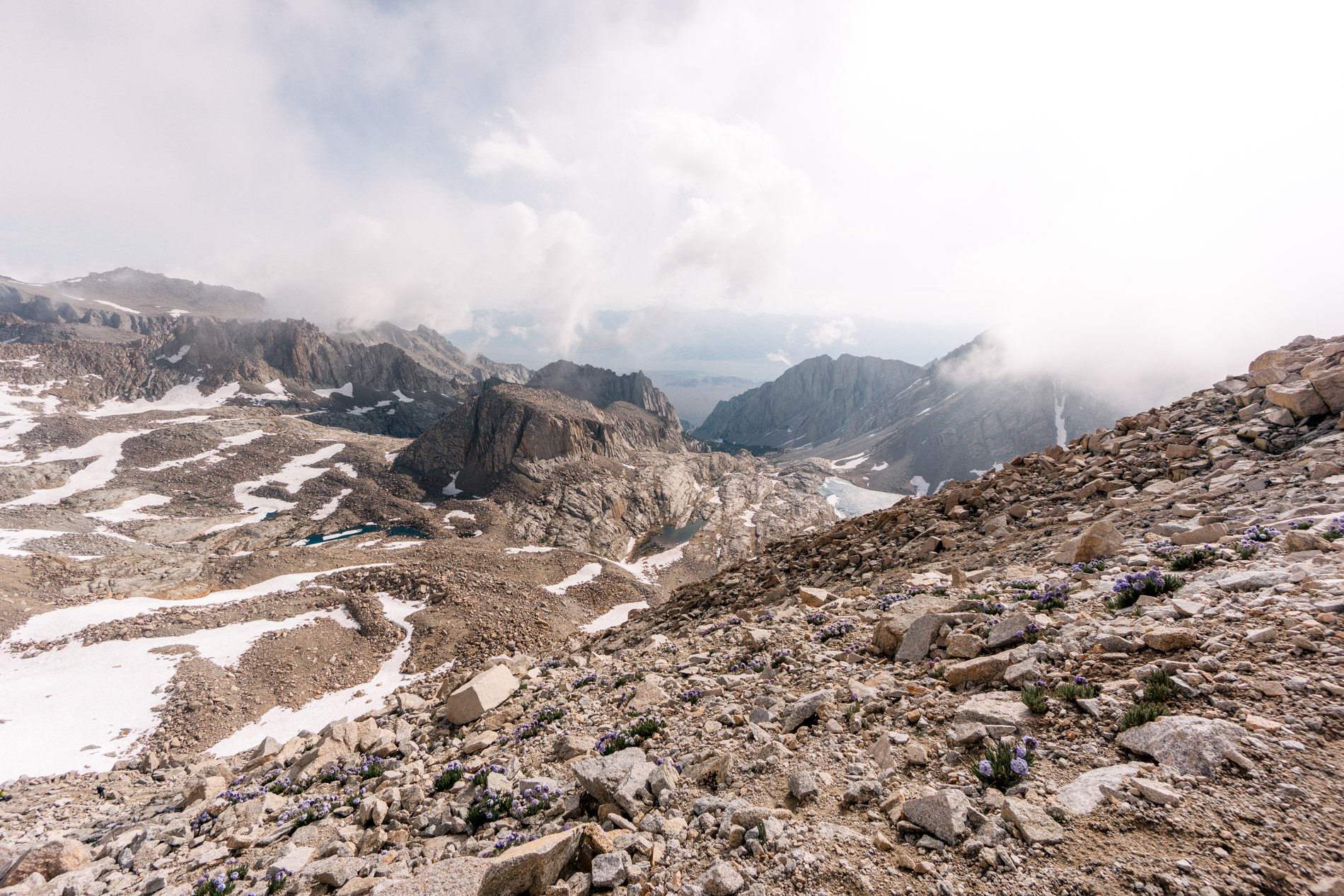
July 26th (day 7) was going home day. We had about 12 miles and 2100 ft of elevation gain, plus 5700 ft of elevation loss. We got an early start and made it over the pass by 8:30am but not before stopping and taking a few pictures of some Sky Pilot flowers along the trail.
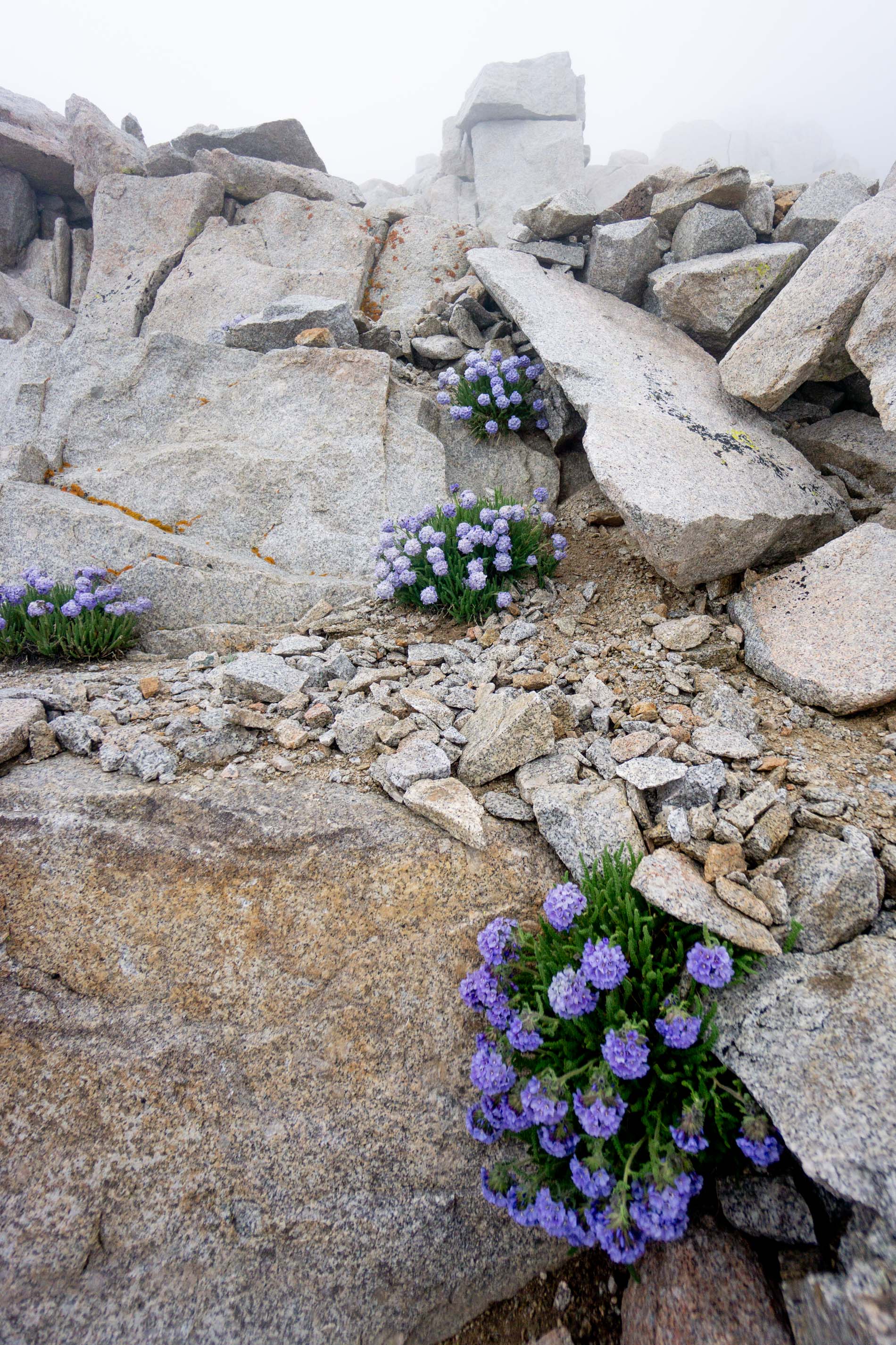
I had read about these flowers and was hoping to find them on our trip. Man, was I happy we came across them. They are amazing.
They grow in such extreme environments where there is hardly any soil and basically no other plant life. But there they are – a brilliant blue tucked up against granite boulders. It was quite startling to round a corner and find one of these in front of you.
Apparently each of the little flowers is only at full bloom for one day. I guess we were pretty lucky to find so many near peak bloom!
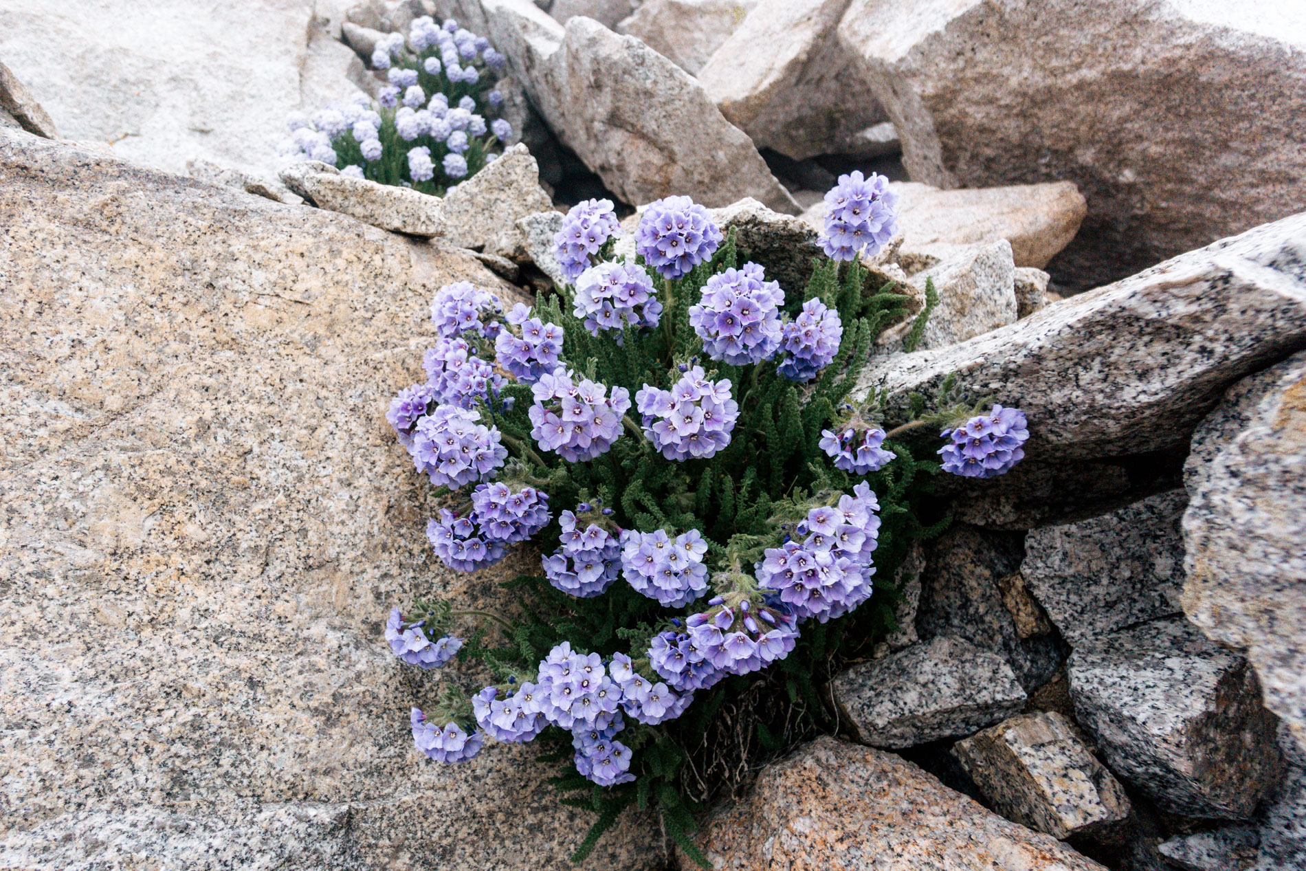
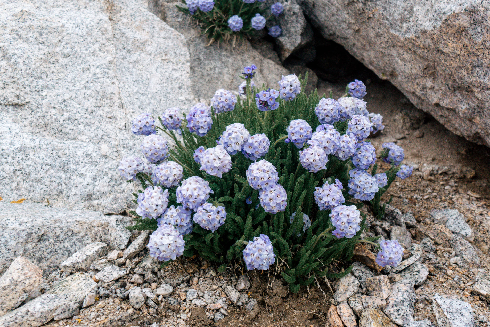
Once on the other side of the pass, they became even more abundant! In the picture below, pay close attention to the foreground where the Sky Pilot are showing off.
The hike down was a typical Sierra east side exit – long with a ton of elevation loss. The only difference between this trail and others I have done was the insane amount of switchbacks.

It was hard to get any momentum on the upper part of the trail because it was pretty rocky and steep, but we went into warp speed the last 4 miles and covered them in about an hour and 20 minutes. I was thankful to be done because the last section is much lower elevation and exposed to the hot summer sun. I couldn’t wait for some real food and a shower!
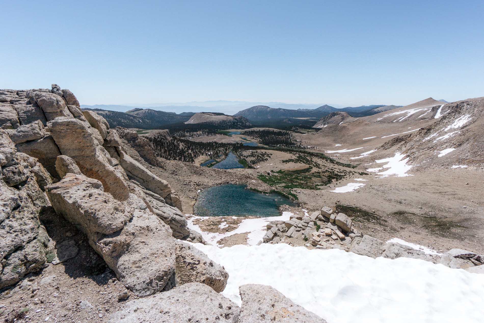
I think a fitting end to this post is a parting shot of a 14’er with some hovering clouds – very appropriate given the weather we had.