We only had one day in Bryce Canyon National Park and chose the Figure 8 Loop hike to tour the highlights and hoodoos of this one-of-kind desert destination.

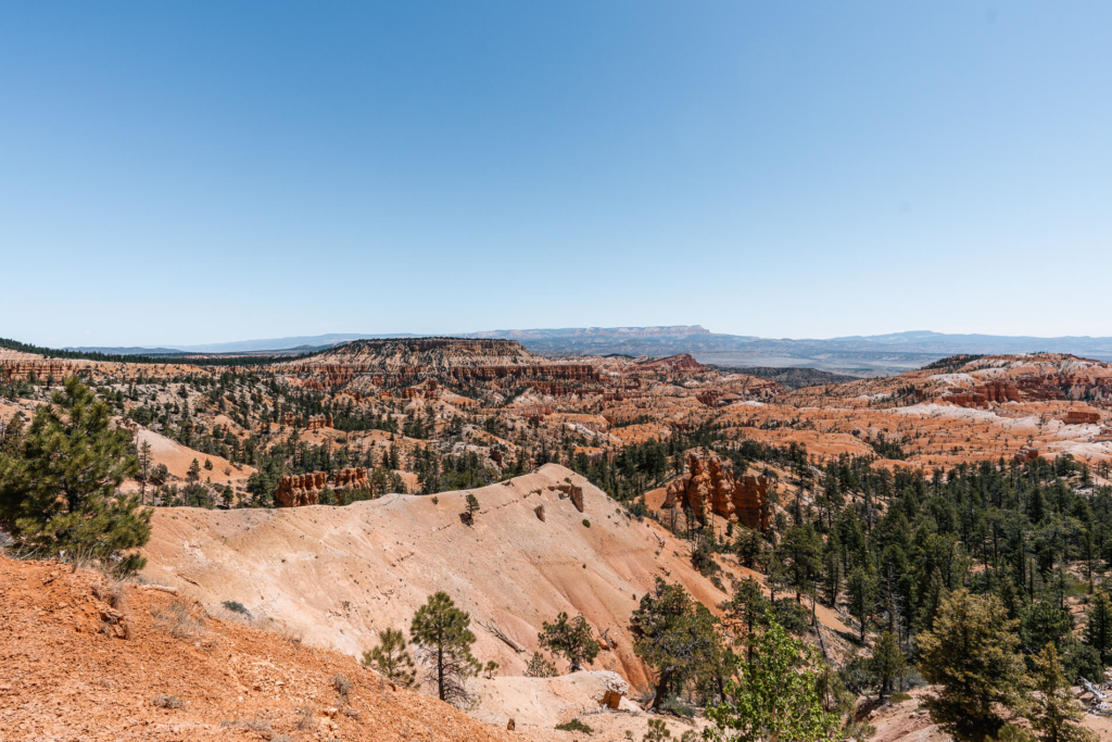
Bryce Canyon is a relatively small National Park consisting of a geological amphitheater made of sandstone hoodoos. For our Memorial Day weekend trip through southern Utah we set aside only one day to explore the park, so we picked a hike that weaved through the most popular areas.
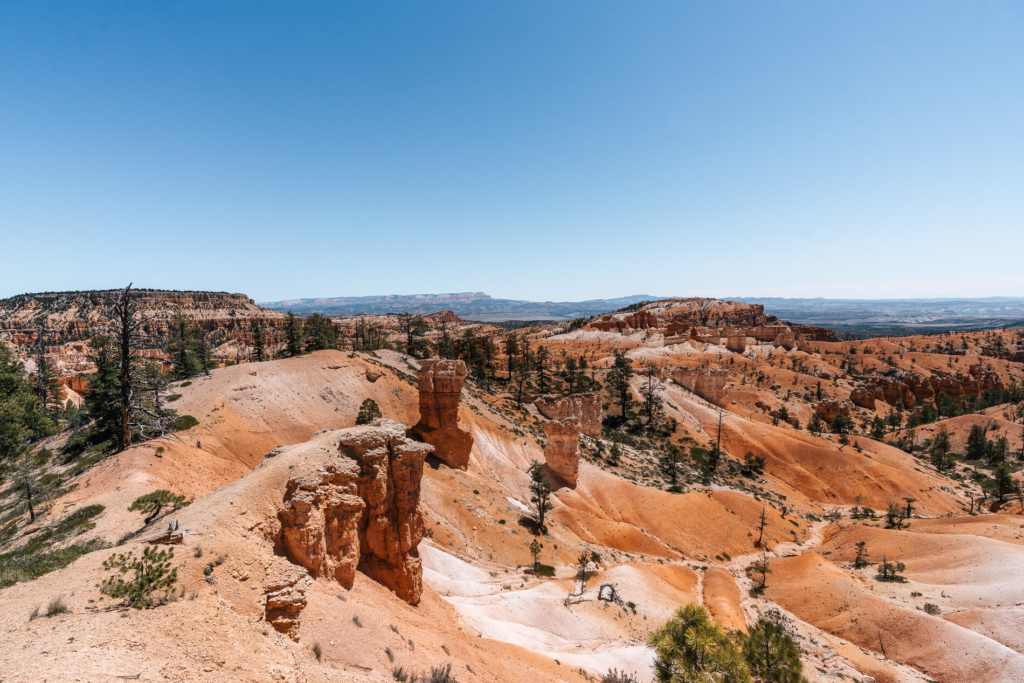
The Figure 8 Loop is a 6.3 mile loop that starts and ends at Sunrise Point. It starts through the Queens Garden, then goes around the Peak-A-Boo Loop and finishes heading up either Wall Street or the Navajo Trail, thus completing a “Figure 8.” Wall Street was closed the day we were there due to frequent rock falls (this is apparently a frequent occurrence).
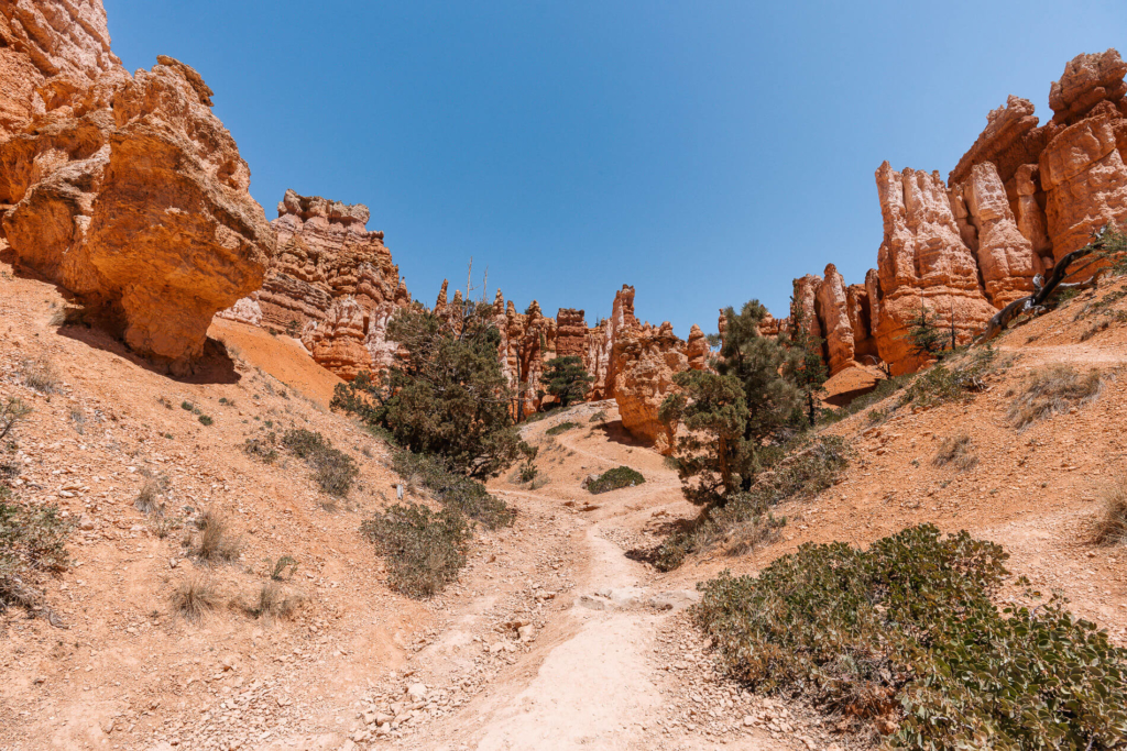
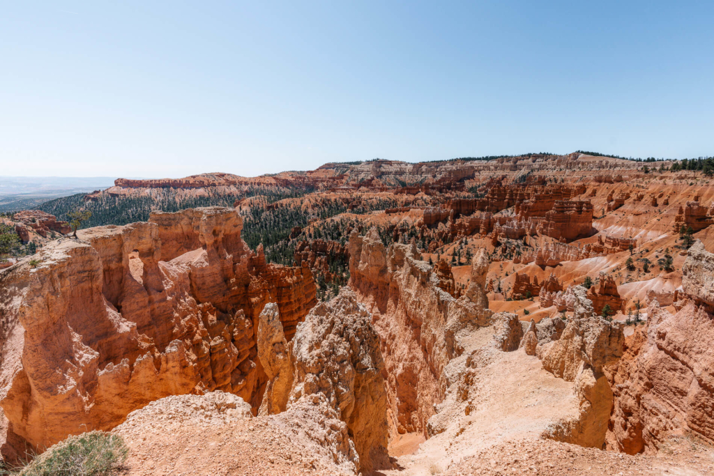
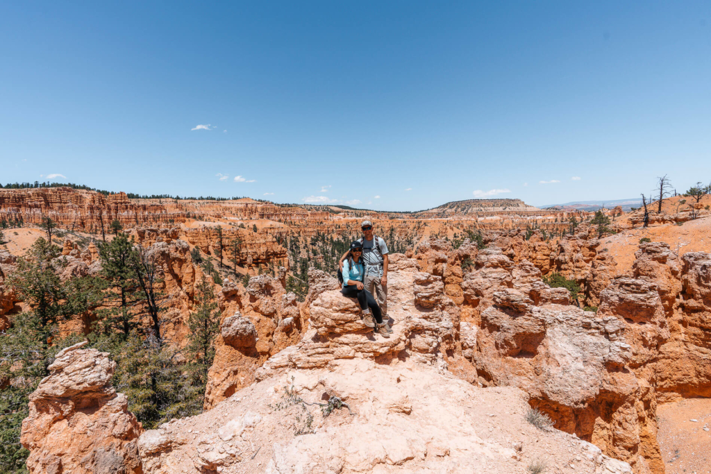
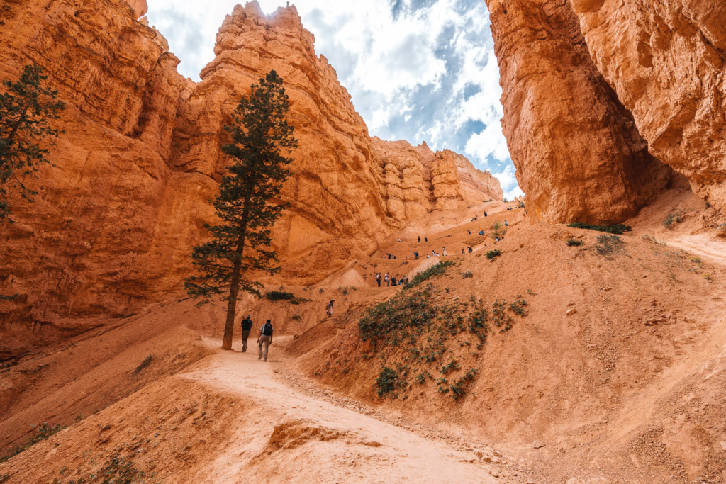
The first part of the trail descends into the ampitheatre and winds through some of the most amazing hoodoos the park has to offer. The trail is named “The Queen’s Garden” because there’s a hoodoo with a silhouette resembling Queen Victoria.
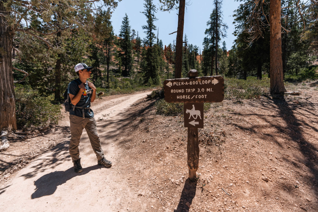
From the end of the Queen’s Garden trail we walked past the end of the Navajo Trail and Wall Street and around to the start of the Peek-A-Boo loop. At this point we sat in the shade for a while and ate lunch. Despite Bryce Canyon being at nearly 8000 ft of elevation, it was a very warm day in the sun. Definitely bring plenty of water and sun protection if you plan to hike longer than an hour.
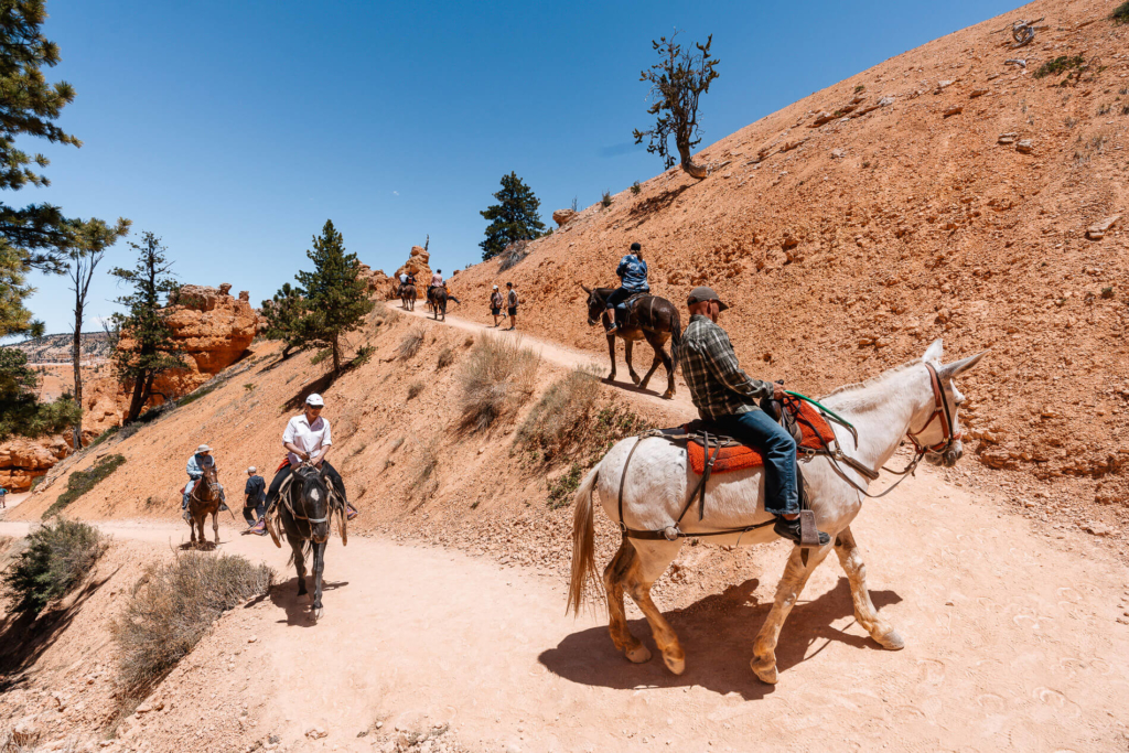
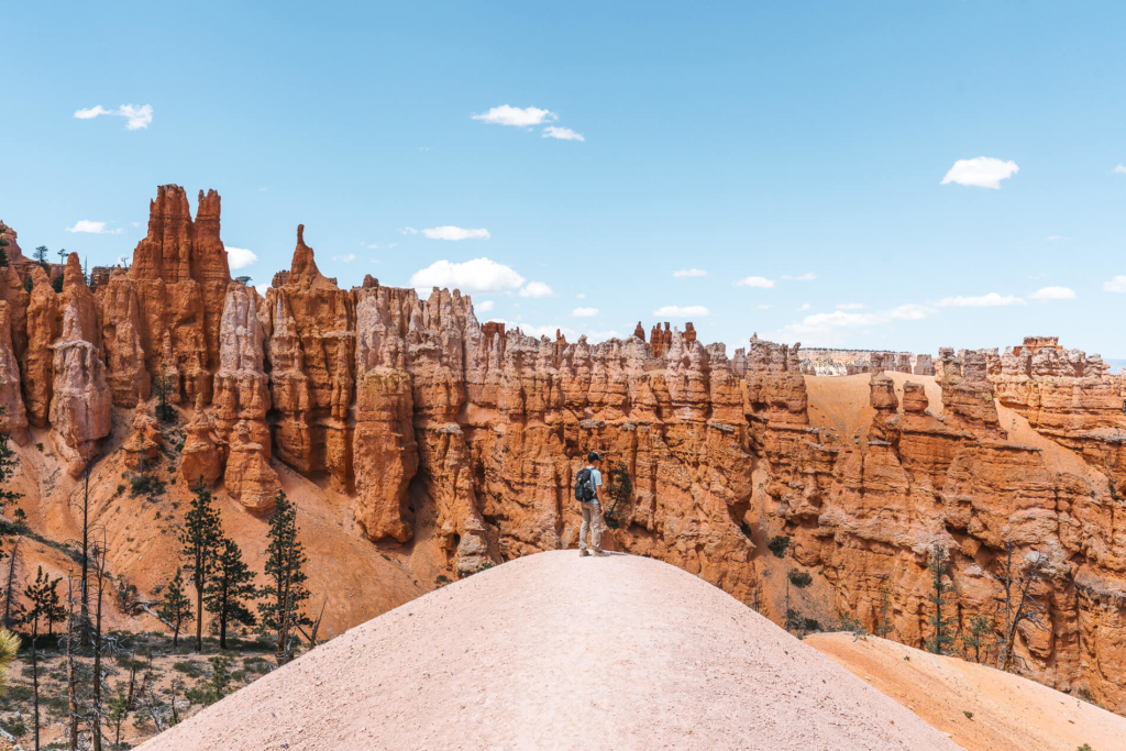
After lunch we started up the east side of Peek-A-Boo. While we were in the middle of the first climb, a mule train tour passed us.
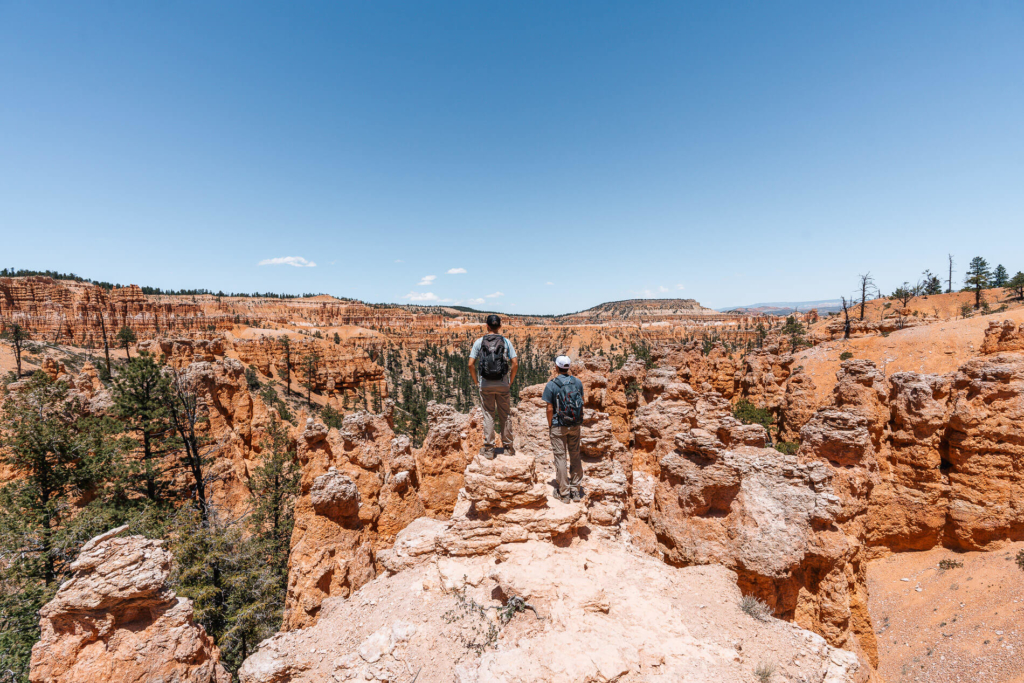
Once on top of the hill, the views to the north over the entire park were incredible and definitely worth the hot, sweaty climb.
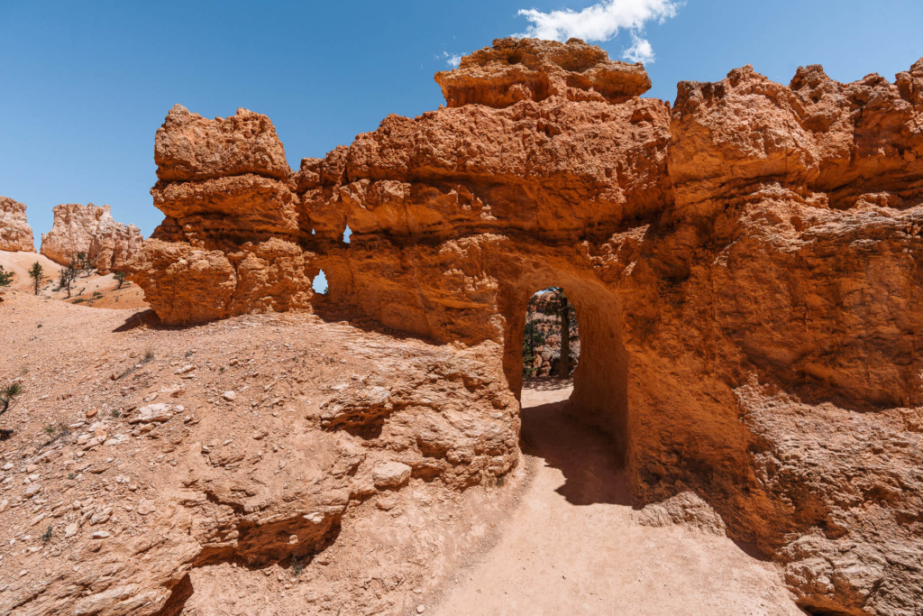
The Peek-A-Boo loop goes through the most varied terrain on the hike – it climbs up and over multiple ridges, around sand dunes and even through tunnels. All while being surrounded by the endless hoodoos that Bryce is so famous for.
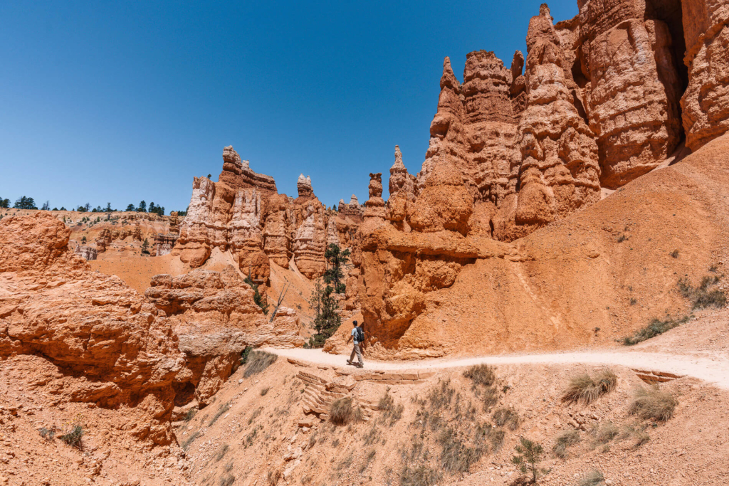
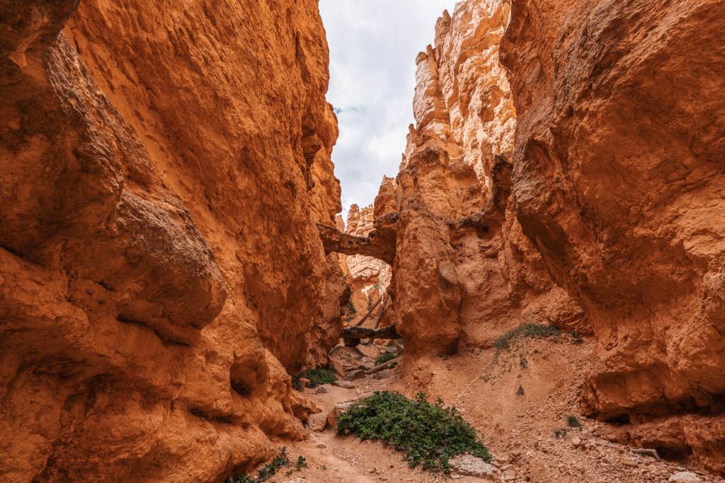
This part of the trail was remarkably different and passed through some narrow slot canyons which showed signs of flash floods and erosion.
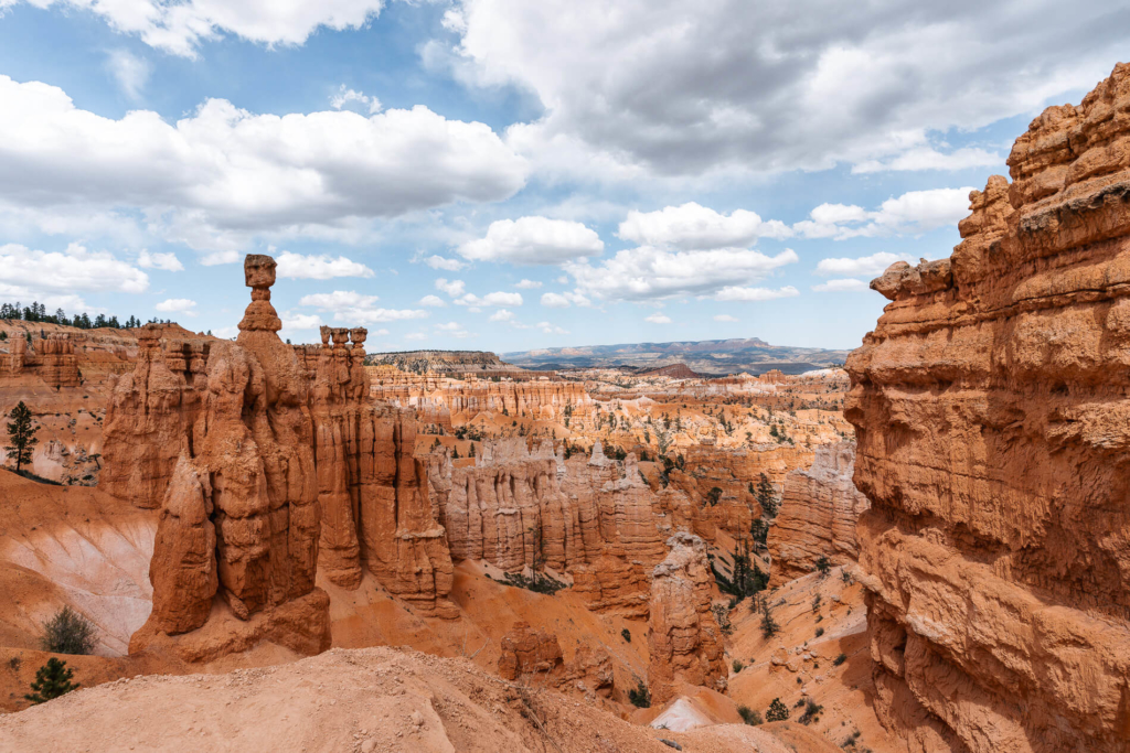
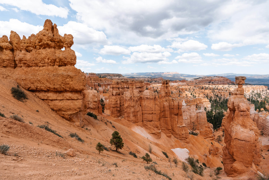
The clouds started to roll in as we were climbing the switchbacks, which was sweet relief after the previous warm and dusty 5 miles. At the top of the trail we passed by Thor’s hammer and were able to see some more of the park from just under the rim. The clouds made for some cool lighting.
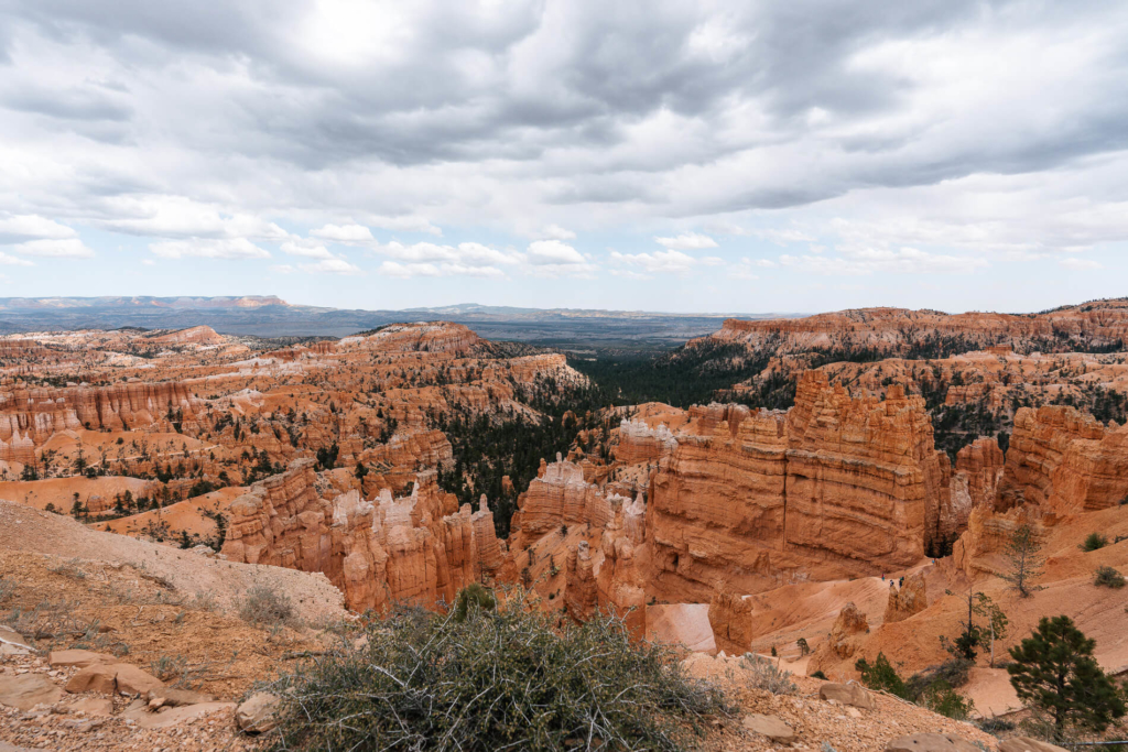
Once at the top of the Navajo Trail, it was a short walk from Sunset Point back to Sunrise Point along the paved Rim Trail. The Figure 8 Loop was a nice introduction to Bryce Canyon National Park – it goes through the heart of the park showing off the orange canyons and hoodoos.