White Pocket is an elusive desert gem to many because of its remote location within Vermillion Cliffs National Monument. We finally decided to make the trek with our 4Runner and plenty of recovery gear on a cold sunny winter’s day, and were lucky enough to see it blanketed in snow.
After Christmas, we headed up to the Utah-Arizona border to explore some new spots in the desert. On our first night, we stayed in Kanab, Utah, since our original plan was to try for the walk-up permit for Coyote Buttes North, a.k.a. “The Wave.” Alas, our plans were foiled by the government shutdown – the BLM office was closed and therefore not running the permit lottery. So instead, we thought we’d finally try to make it to White Pocket in Vermillion Cliffs National Monument, a.k.a. (at least according to the poster in the restaurant where we had dinner), “The Wave Without the Permit.” We’ve shied away from attempting to get to White Pocket in the past due to the many reports we’ve heard about how sketchy the road is to get there and how many people often get stuck. But since we had the 4Runner and recovery gear, we thought why not just give it a shot. Below is our experience driving to White Pocket along with some tips, but if you’re not interested feel free to skip down to the pretty pictures!
How to Get to White Pocket
We thought the map on the BLM brochure was very helpful for the drive. We approached from Highway 89 to the north. House Rock Valley Road is the main byway for the entire Vermillion Cliffs National Monument and runs north-south connecting 89 to the north and 89A to the south. Wire Pass Trailhead (to Buckskin Gulch and Coyote Buttes North/South), White Pocket Road and even the Fredonia “winter road” are all along to House Rock Valley Road. It’s a well-maintained dirt road passable by all cars unless it’s wet. After driving 23 miles south from 89 on House Rock Valley Road, there will be remnants of an Old Corral to the right and to the left is Road 1017, the turn off to White Pocket. Road 1017 is a well-maintained dirt road and passable by passenger cars, and takes you 6.2 miles to the east to Pine Tree Pocket Ranch. This, however, is as far as you can take passenger cars.
The 4×4-Only Section
Once you get past Pine Pocket Ranch, the road gets a little tougher to drive. There is a sign stating: “Know the difference: 2WD, AWD, 4×4”– this is where it’s HIGHLY recommended that only 4×4 high clearance vehicles continue. The best way to describe these roads are single track with deep ruts where people have repeatedly driven on the soft sand. There are many sections with deep holes and loose sand requiring high clearance and good traction. There are also a few steep parts that could be tough to get up on the soft sand. This is where our journey probably differs from almost all other trips to White Pocket: we drove this road in late December after a snow storm, which firmed up the sand considerably. We actually found it fairly easy to drive in these particular conditions in our 4Runner. We’ve read many reports from different times of the year where people got stuck in the deep sand and needed to be pulled out. We had a 4×4 high clearance vehicle but we also had lots of recovery gear – so be prepared!
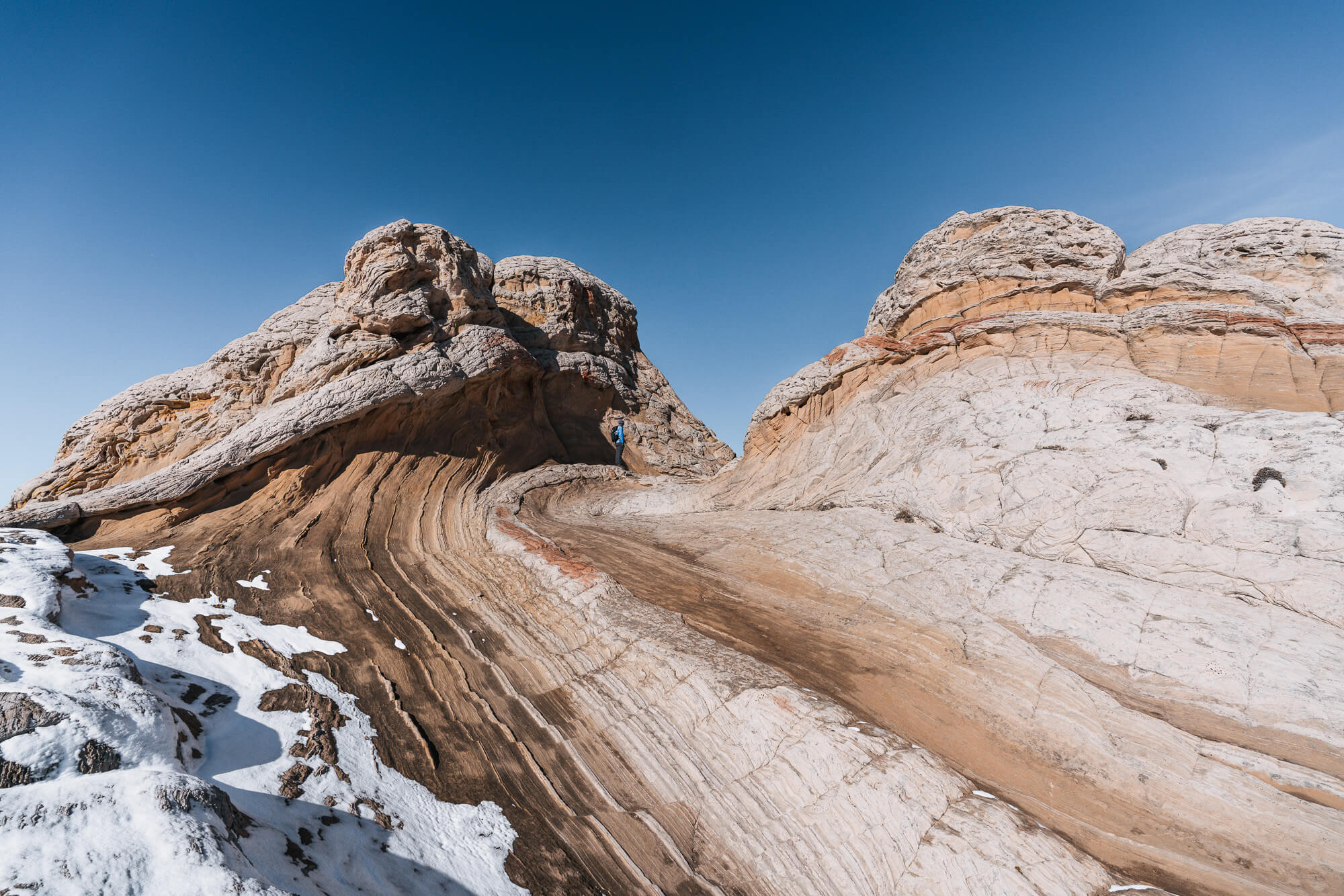
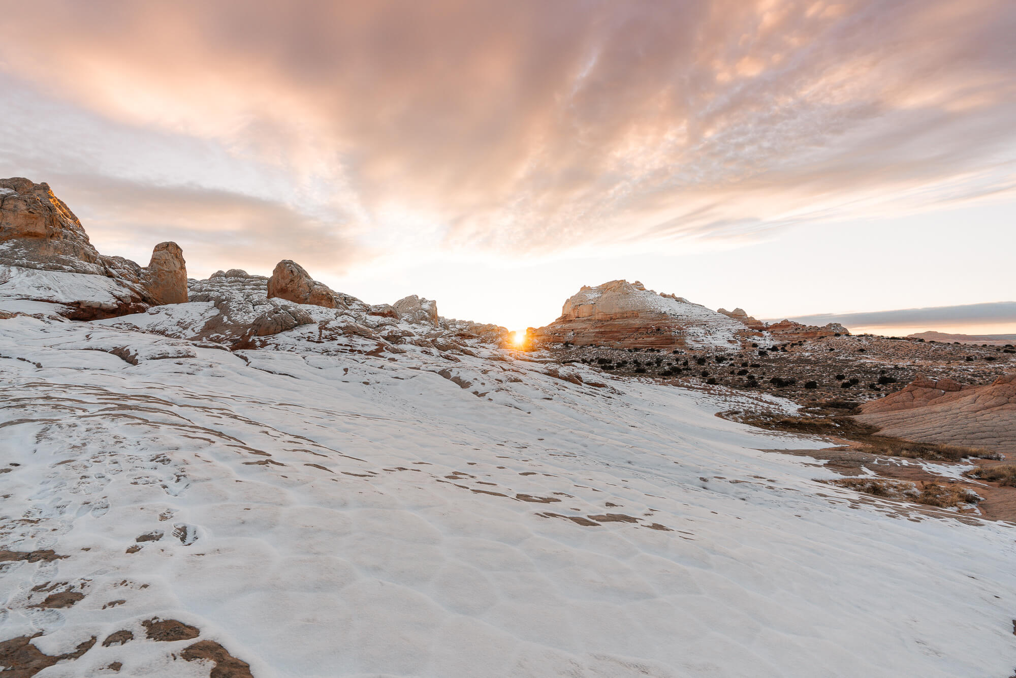
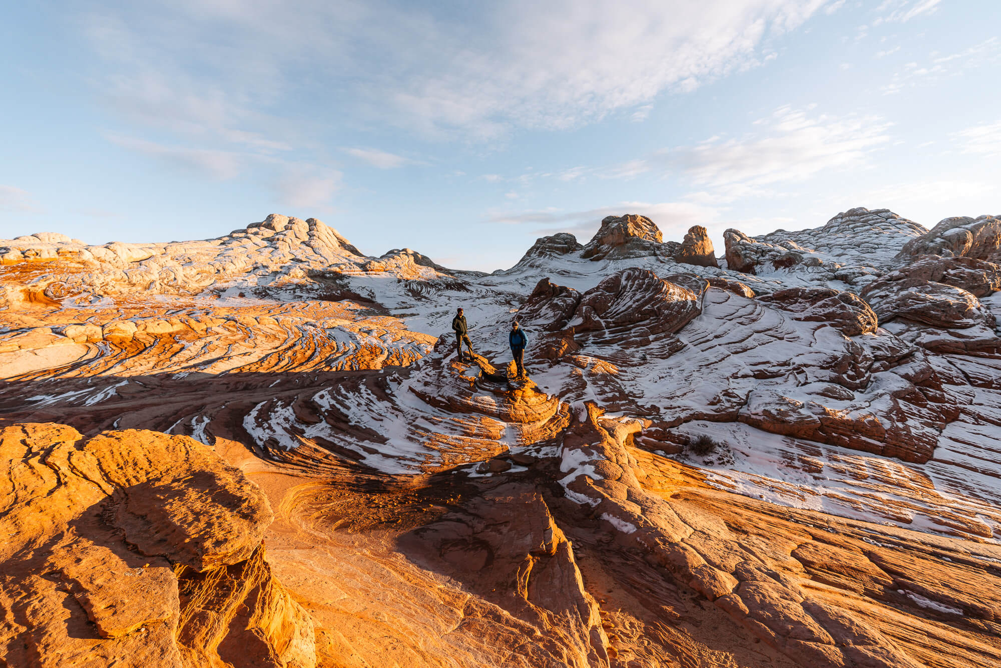
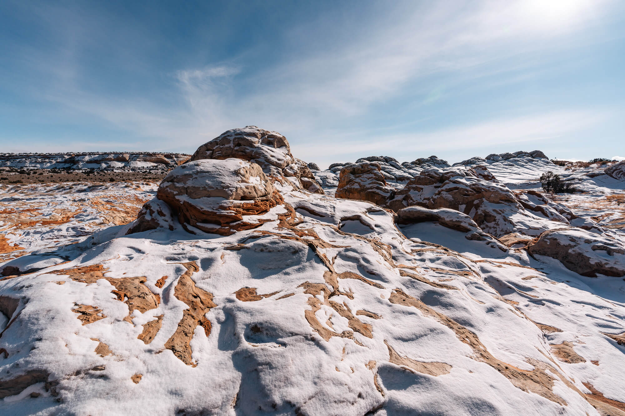
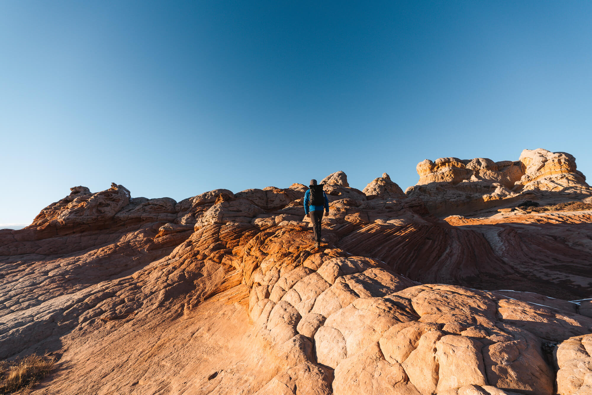
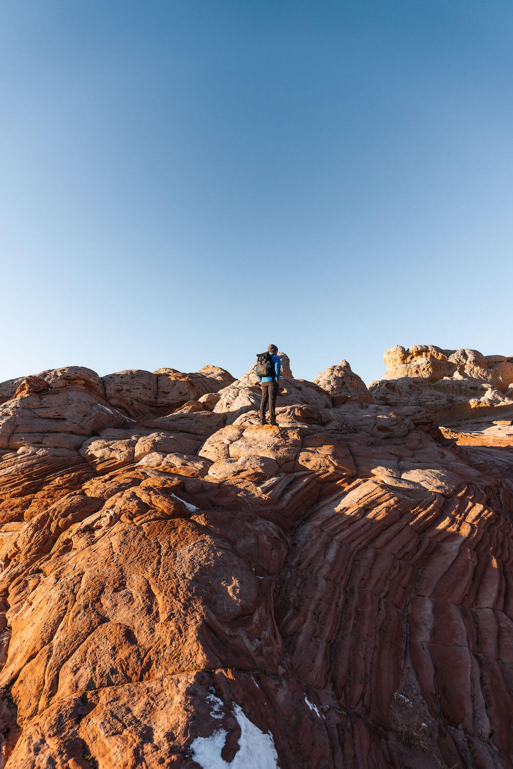
It took us about 2 hours to drive from the turn off at highway 89 to the parking lot at White Pocket. During the drive we steadily gained elevation and it slowly turned into a winter wonderland with snow a few inches deep on the ground and clinging to the trees. After we finally arrived at the parking lot, the air temp was 25 degrees at 11AM! There were two other cars already there. After eating some lunch, we set out on a short sandy trail that dumps you onto the open field of swirling white and red rock. From this point forward its a free for all – wander and explore to your heart’s content.
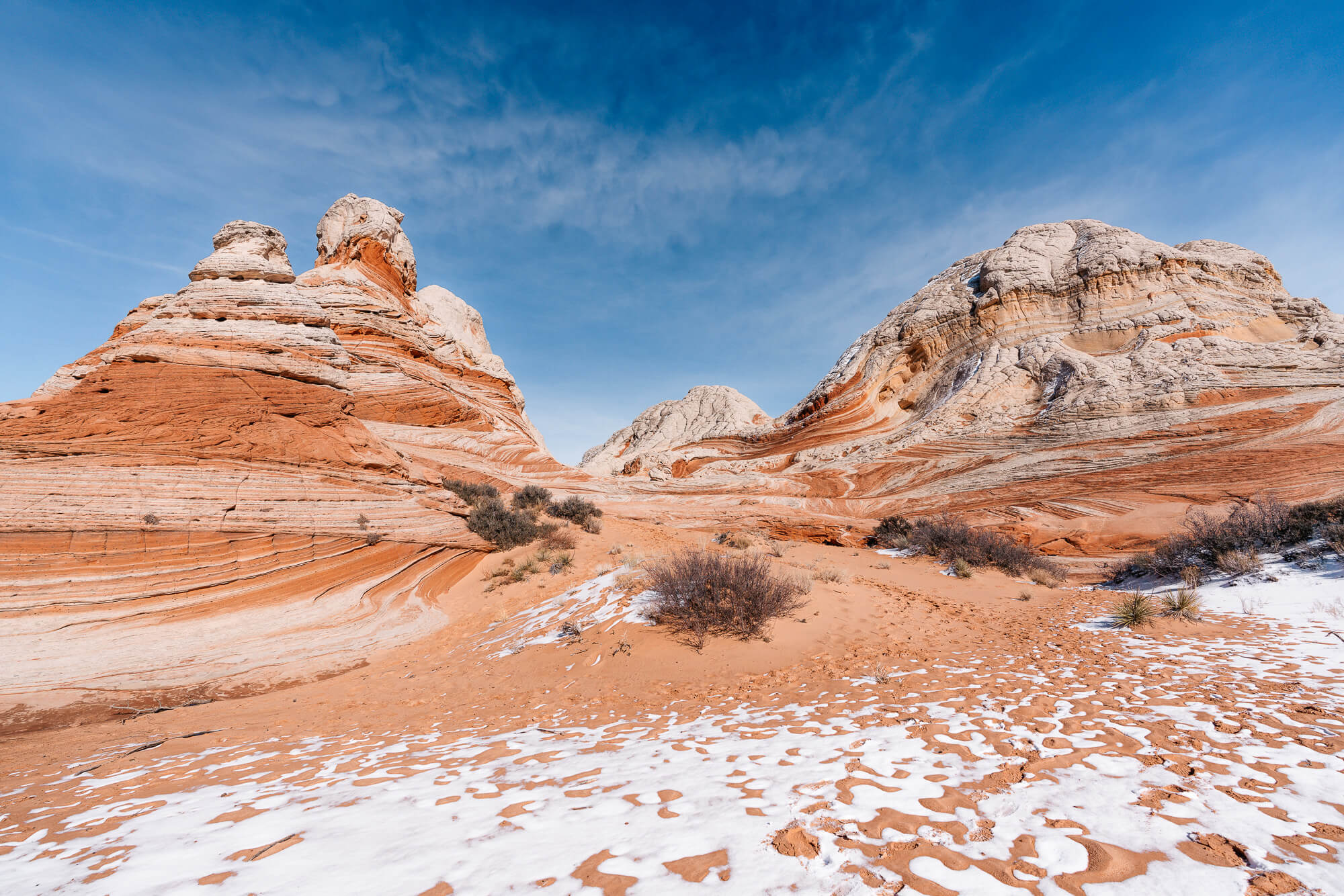
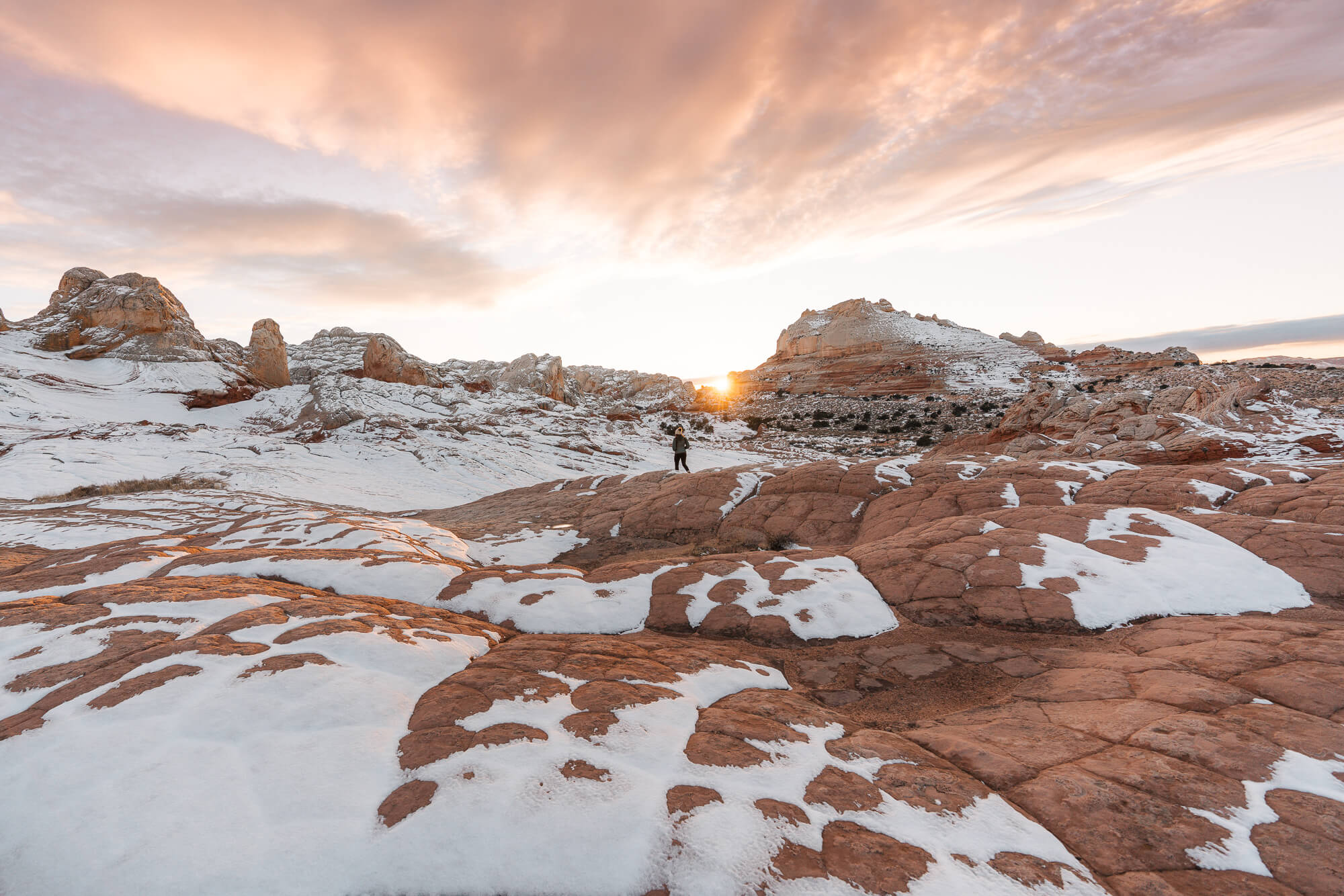
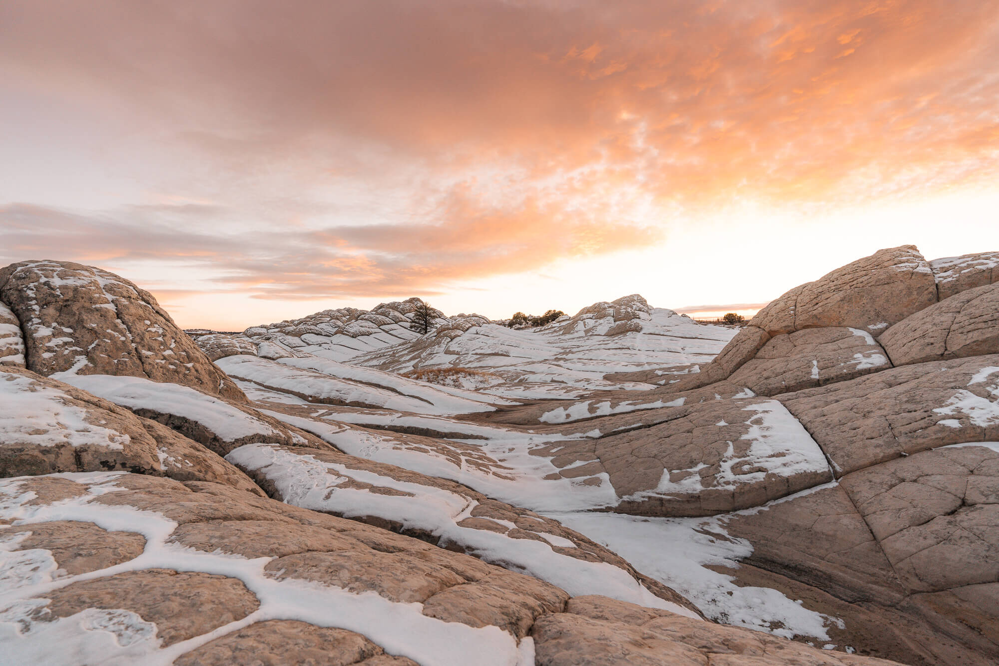
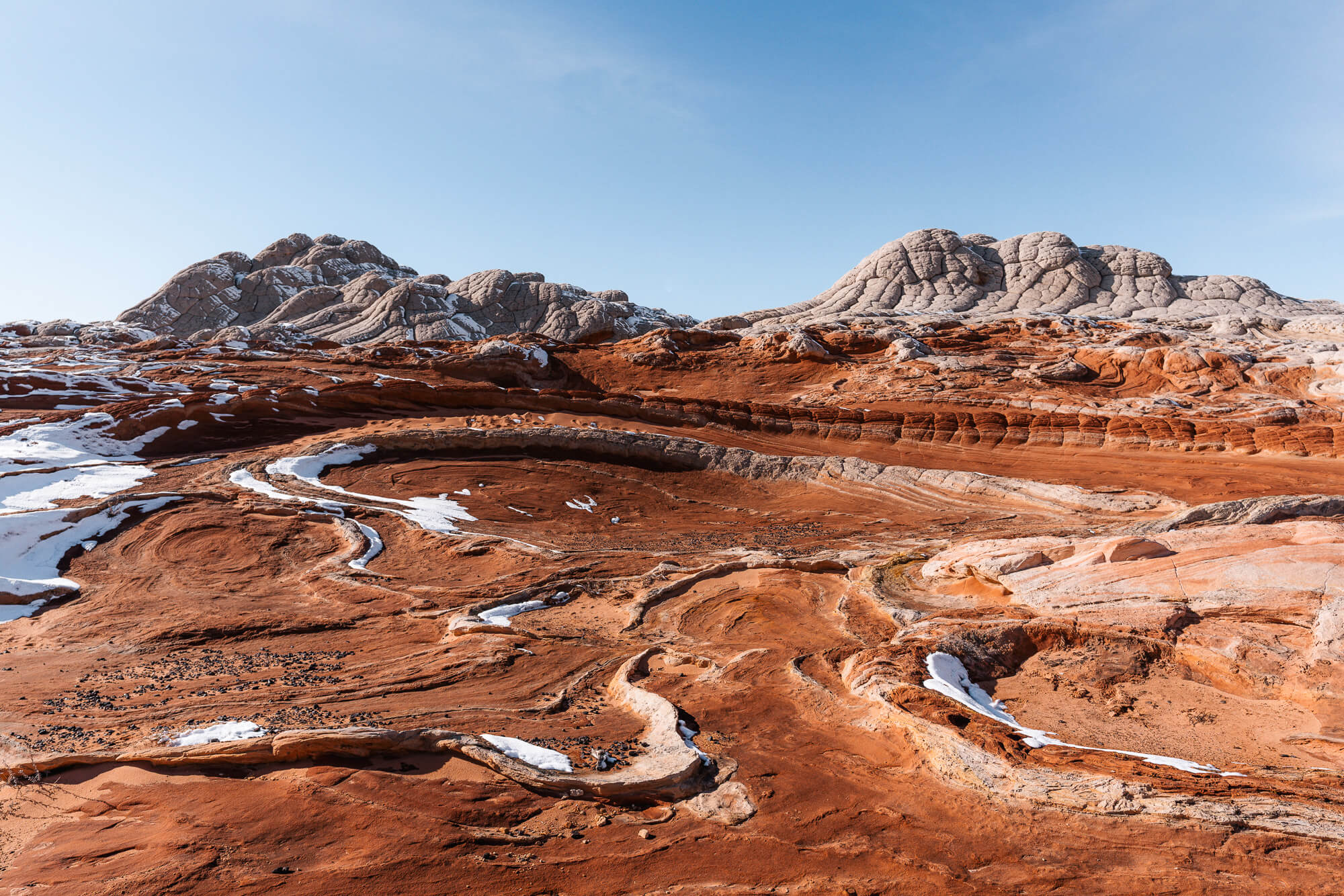
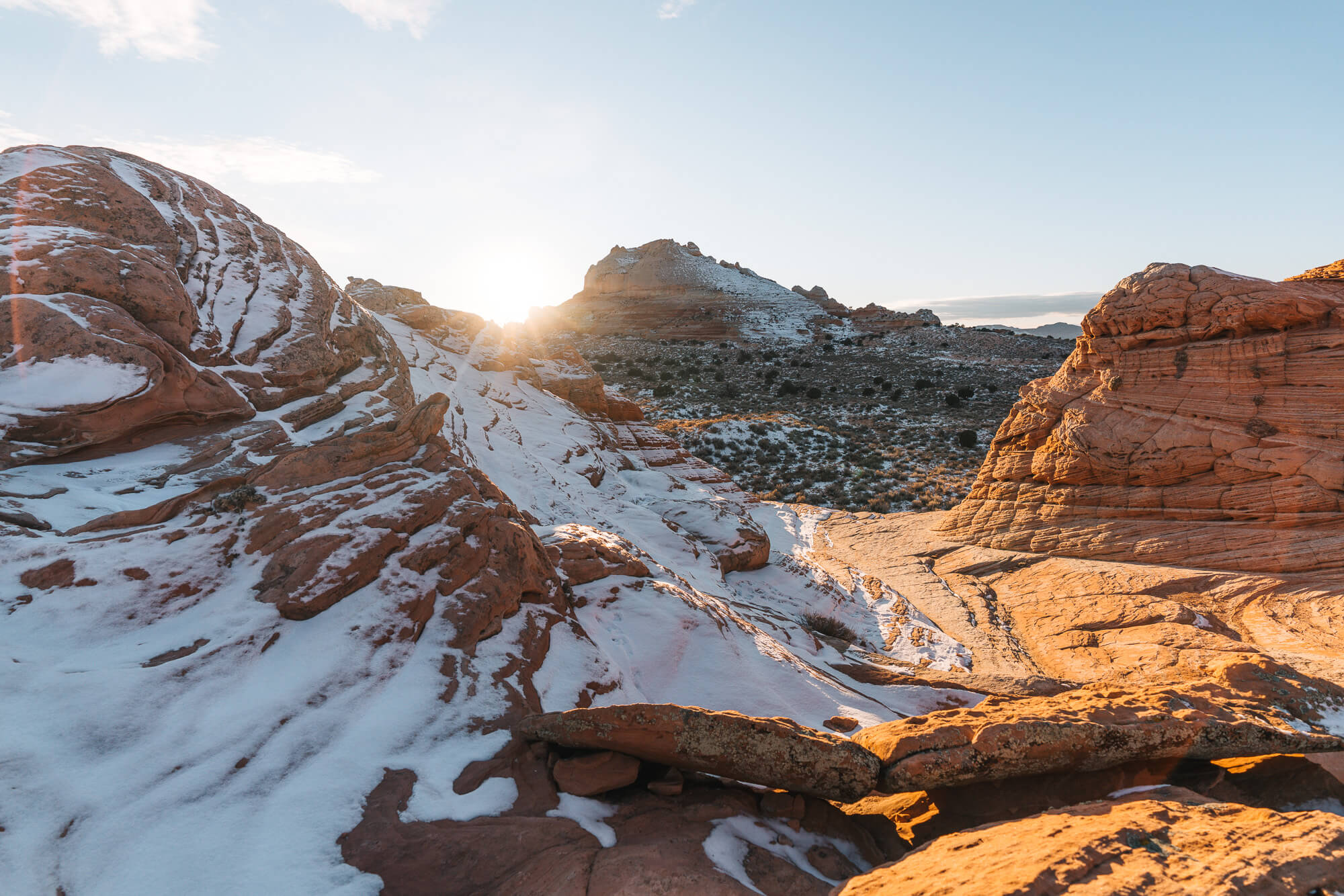
As the sun got higher and the day warmed (to 30 degrees!) the snow started to melt on south facing slopes but continued to cling in the shade of north slopes. There were completely different views just by turning around.
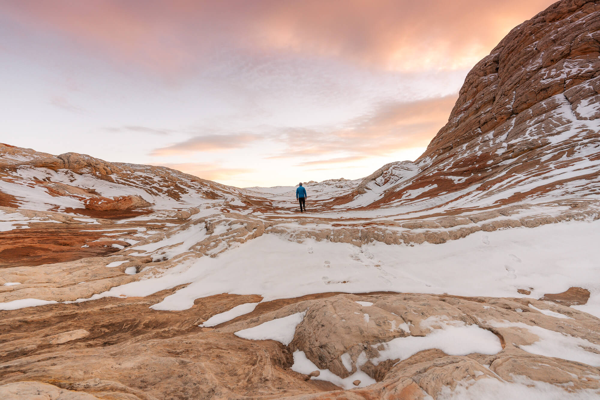
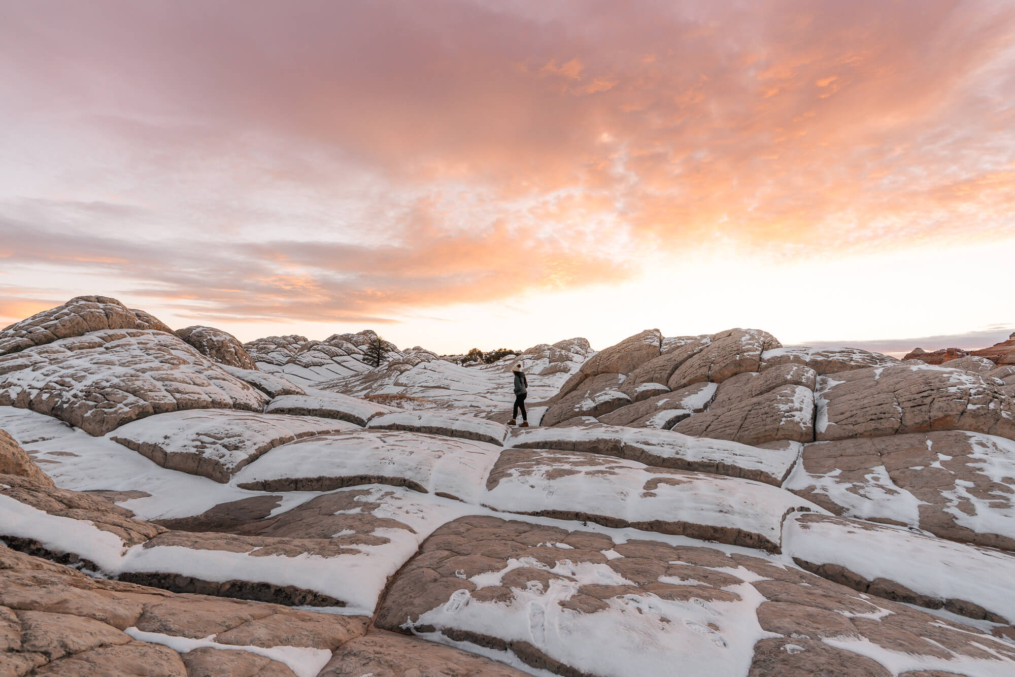
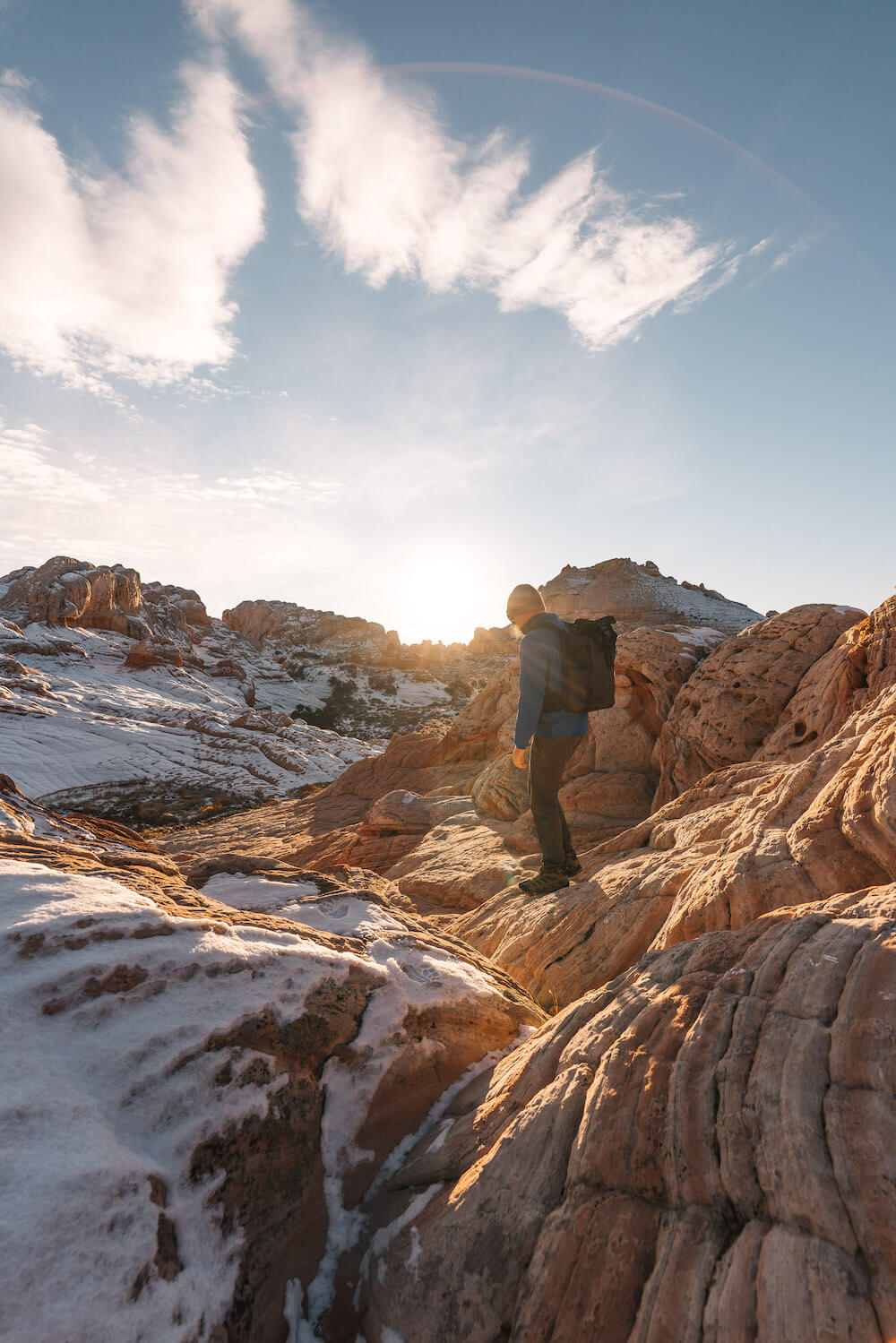
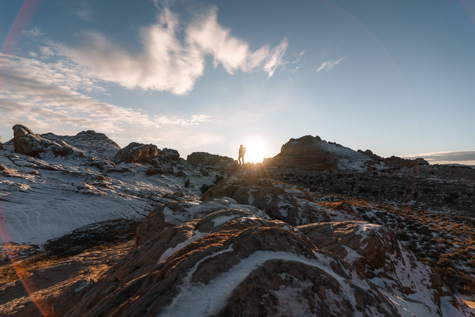
After a few hours of exploring we headed back to the car to warm up a bit and rest before a sunset excursion. We played cards for a while and enjoyed each others company while waiting for the sun to sink lower in the sky. As afternoon turned to evening a few clouds started to show up that would be absolutely stunning later on. We retraced our steps back out to the rock formation and set off in a direction that we had yet to explore.

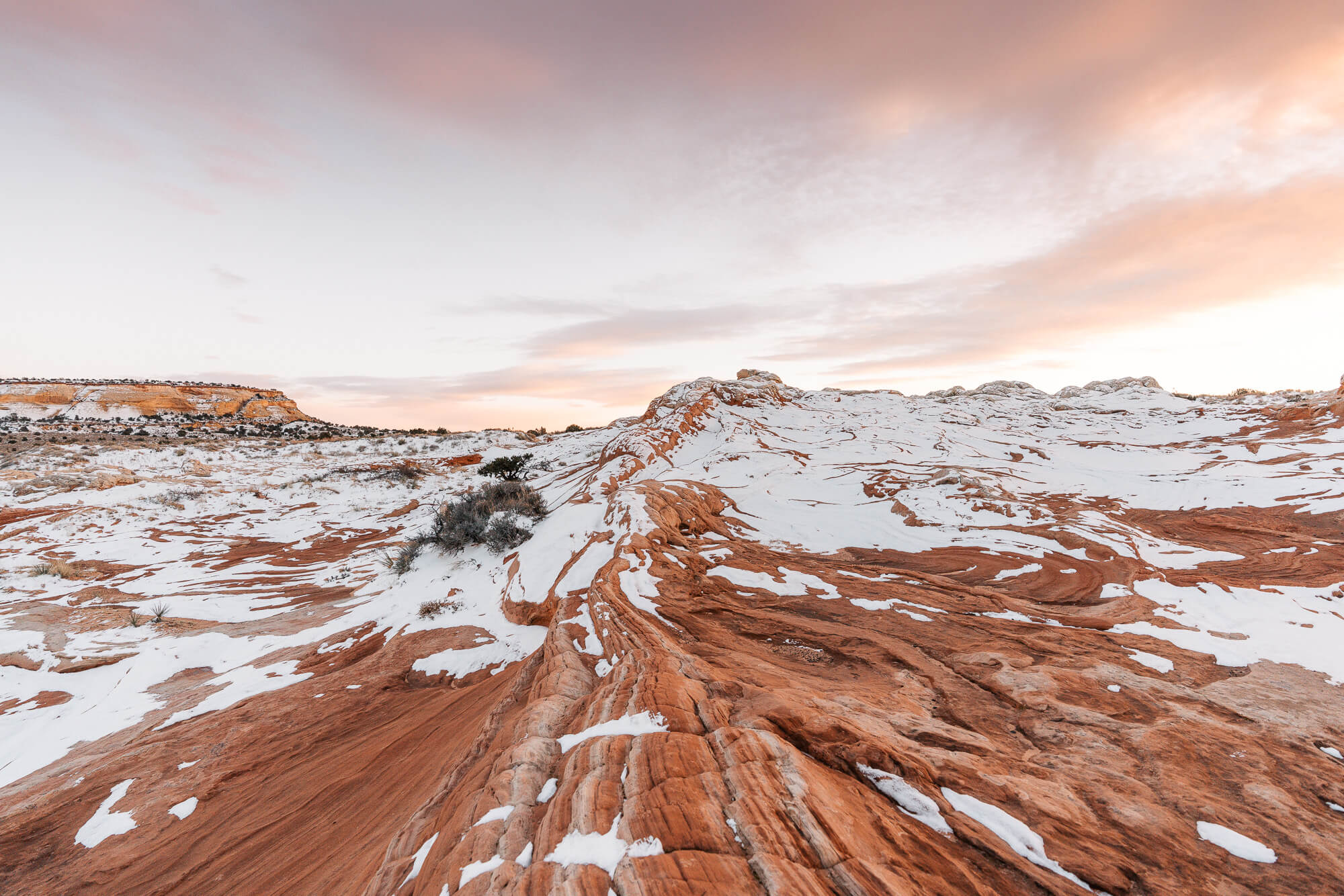
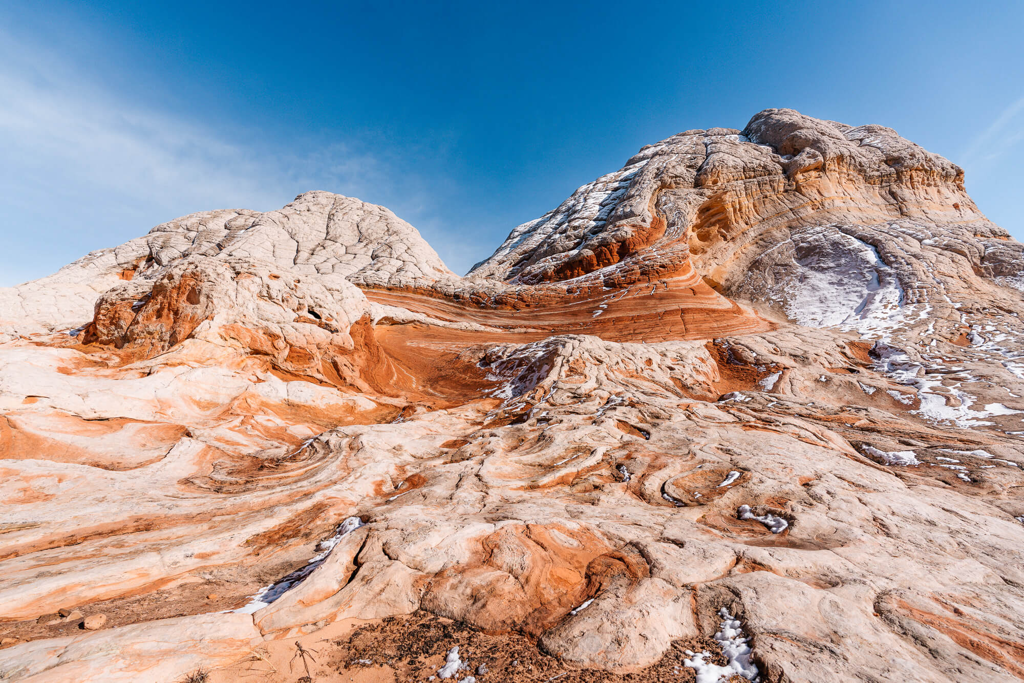
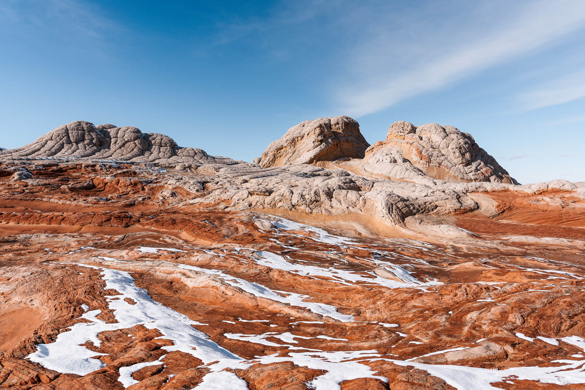
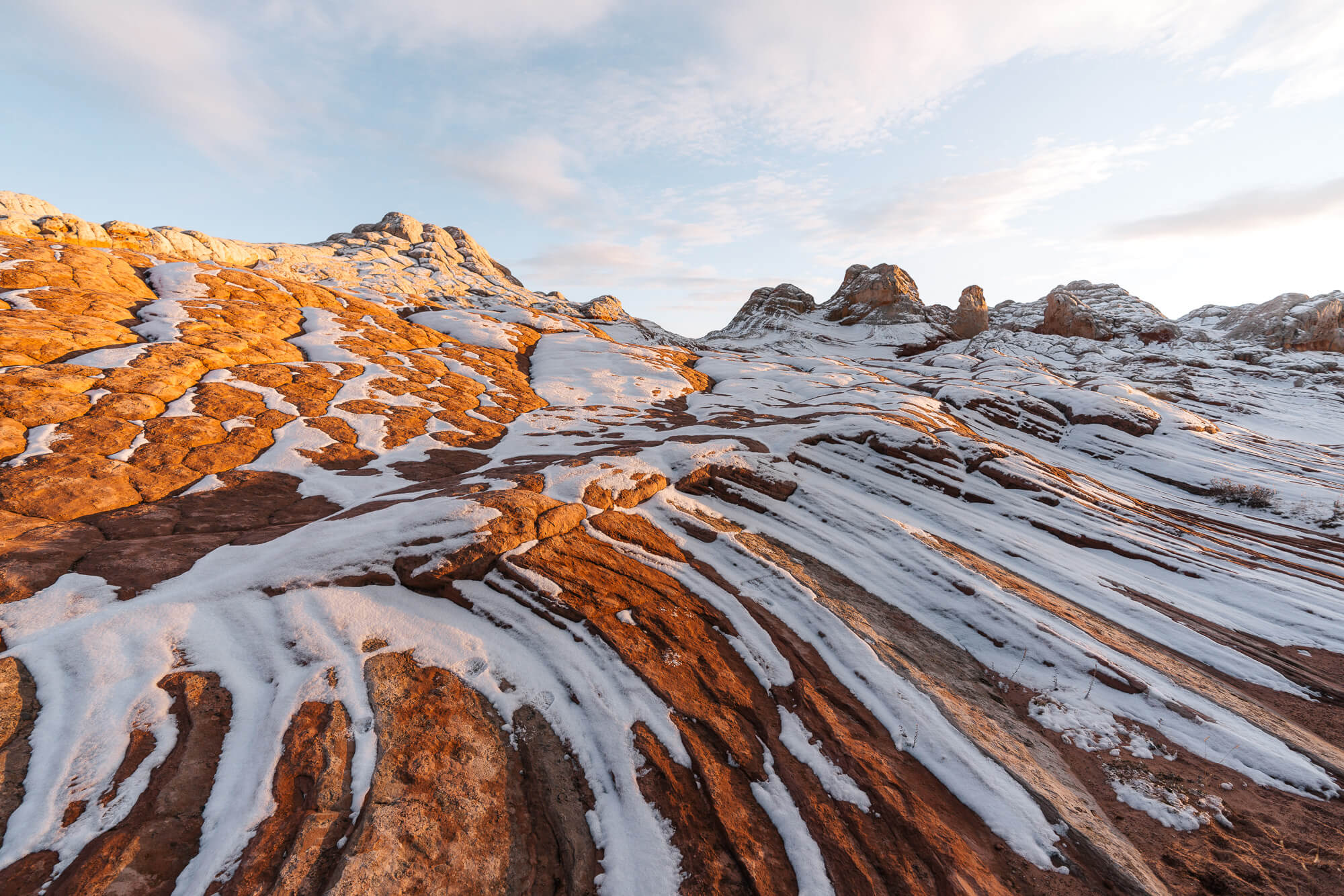
How White Pocket was formed is still unclear and something geologists have debated. Some believe it was caused by soft sediment deformation or in other words when the sand was soft it twisted and contorted then solidified into the structures we see today. The red sandstone has iron in it while the white does not. Others believe White Pocket was the result of a sand-slide caused by an earthquake where the white sand mixed with underlying layers which eventually got deposited in a pond where it solidified into the current formations. Regardless of its formation, it is quite the sight.
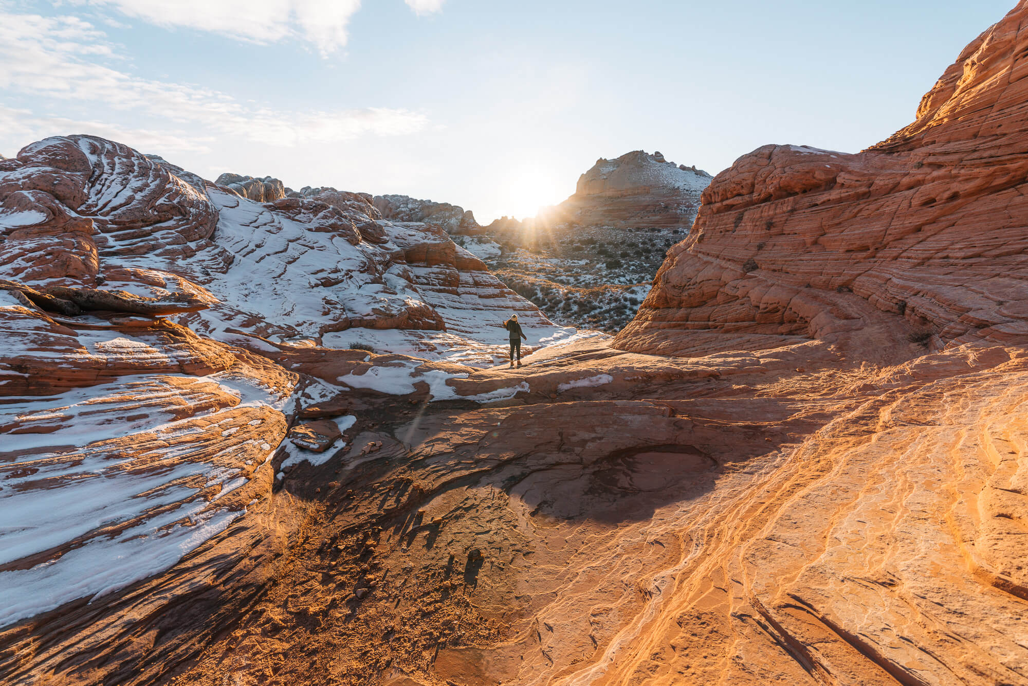
Sunsets in the desert are usually pretty stellar, but the orange glow on these striated wavy rock formations covered in snow is a rare sight that’s hard to beat! We can’t yet compare White Pocket to The Wave, but what we can say is that White Pocket is definitely the desert at its finest and most unique. It’s definitely one of those “the journey is half the adventure” trips, and it’s well worth it. We will leave you with more of the many photos during this spectacular sunset!