Getting to the top of Four Peaks involves some dirt road driving, a little easy hiking, and a bit of questionable climbing.
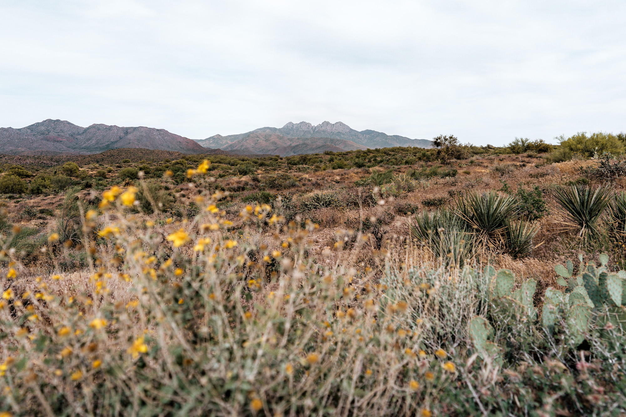
Four Peaks is a standout in the eastern skyline of the the Valley of the Sun. The mountains are fairly high in elevation compared to the desert around them, and the rapid change in elevation leads to a rapid change in environment. In the winter, Four Peaks is often covered in snow the days after a storm; and in the summer offers some respite from the sweltering heat of the valley.
A few years ago on one of our regular day trips to the Rim to the escape the heat, we finally decided to look up how to get to the top of Four Peaks. A quick internet search told us: yes you can, but no, it’s not easy.
Hiking to the top of Four Peaks involves some climbing to the top of Browns Peak, the tallest and northernmost (leftmost from the valley) of the peaks. And although we still question ourselves on our way down the scree chute (more on this fun feature later), we’ve now done this awesome little Arizona adventure three times.
The journey to the top of Four Peaks begins with the drive. It’s not the quickest and easiest one. If you’re going to attempt it coming from the Phoenix Metra area, make sure to carve out an entire day and be ready for some dirt road driving.
There are two ways to approach the trailhead:
The no SUV/4×4/high clearance way
If you don’t have an SUV or a vehicle with some ground clearance then you have to approach the trailhead from the east side of the Mazatzal Range. Take Beeline Highway 87 until it meets AZ Route 188, then head south towards Roosevelt Lake. There is be a turn off just before the lake onto El Oso Road, a dirt that and goes all the way to the spine. From there, turn south onto Pigeon Spring Road which dead ends at the trailhead. This route involves less dirt road driving, but is nearly double the amount of miles and takes 20 minutes longer.
The more fun, off-road way
If you have an SUV or a vehicle with ground clearance you can approach the trail from the west side, which shortens the mileage substantially and the drive time a little bit. The downside to this route is the 20 miles of dirt road driving once you leave Highway 87. The exit is Cline Cabin Road and from there you follow a maze of bumpy dirt roads until you meet Pigeon Spring Road on the spine. Google maps is your friend, but do your research ahead of time because there is very poor service out there.
Hiking Four Peaks is best done in shoulder season – snow and ice can linger on the peak in the winter, but summer can still be hot with temperatures reaching 90+ degrees. We’ve always hiked it in early May, and the temperature is usually pleasant until the hike down in the afternoon, when it can get a little warm.
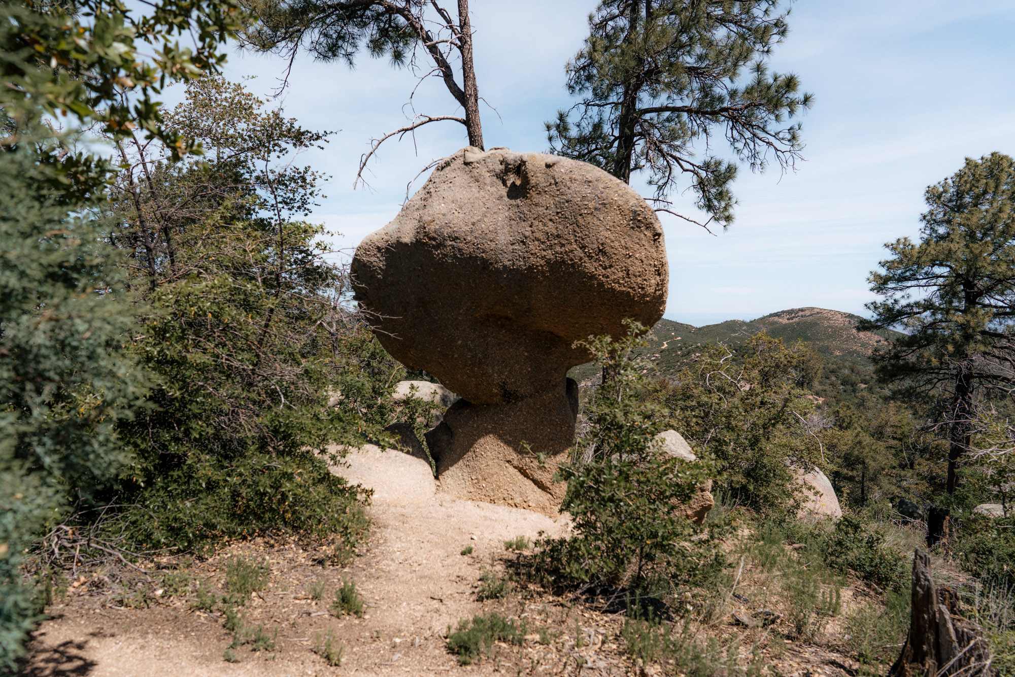
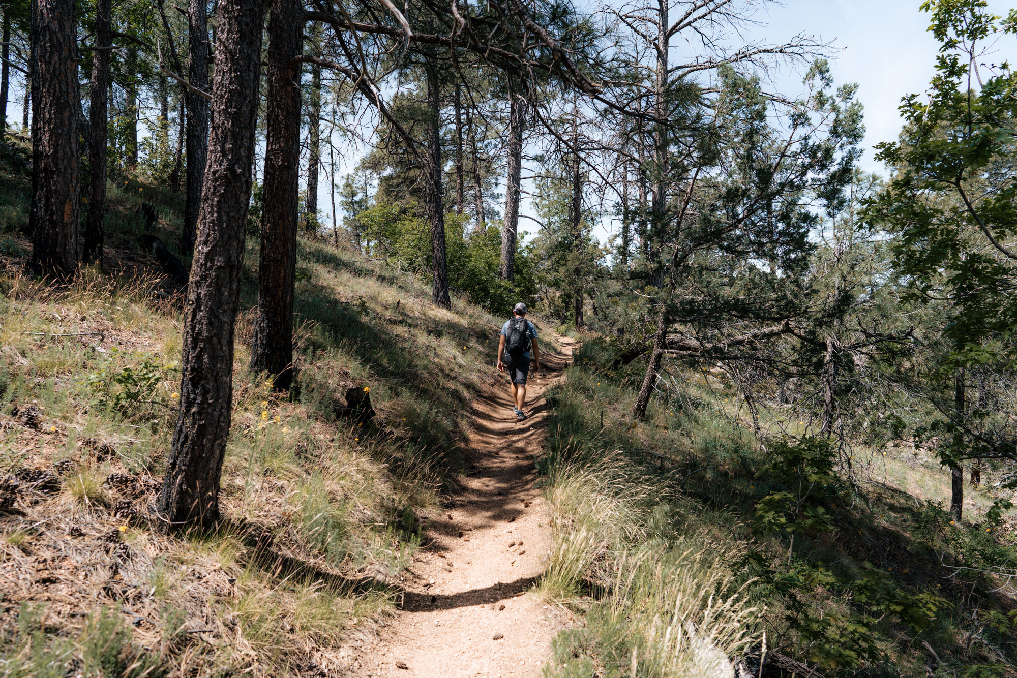
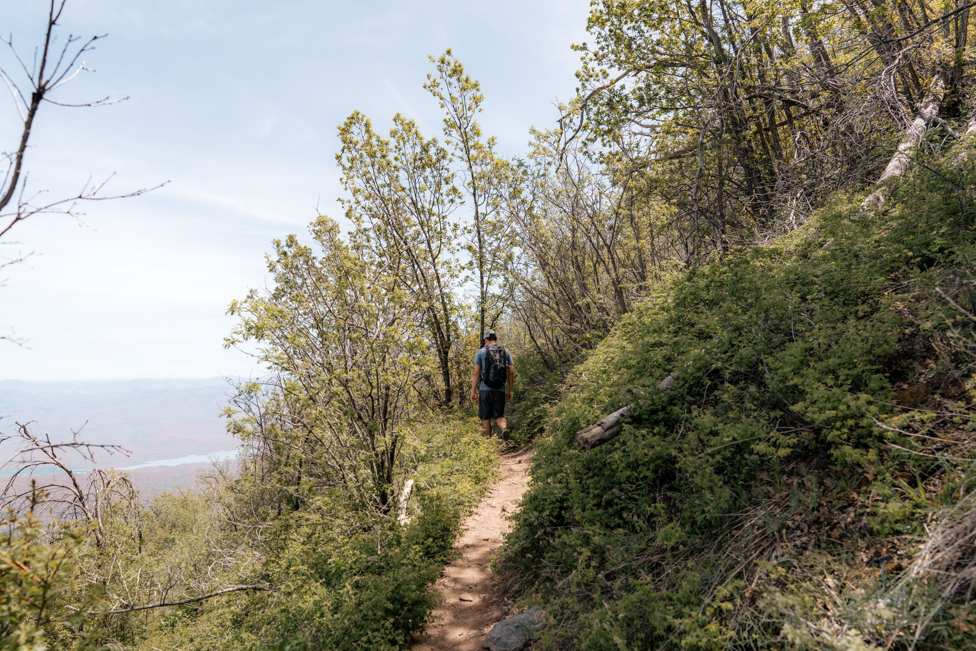
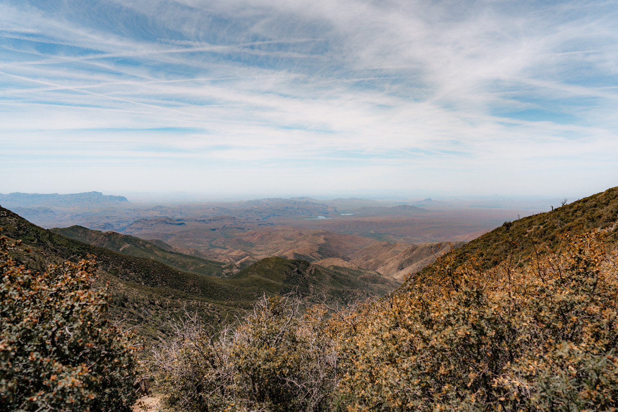
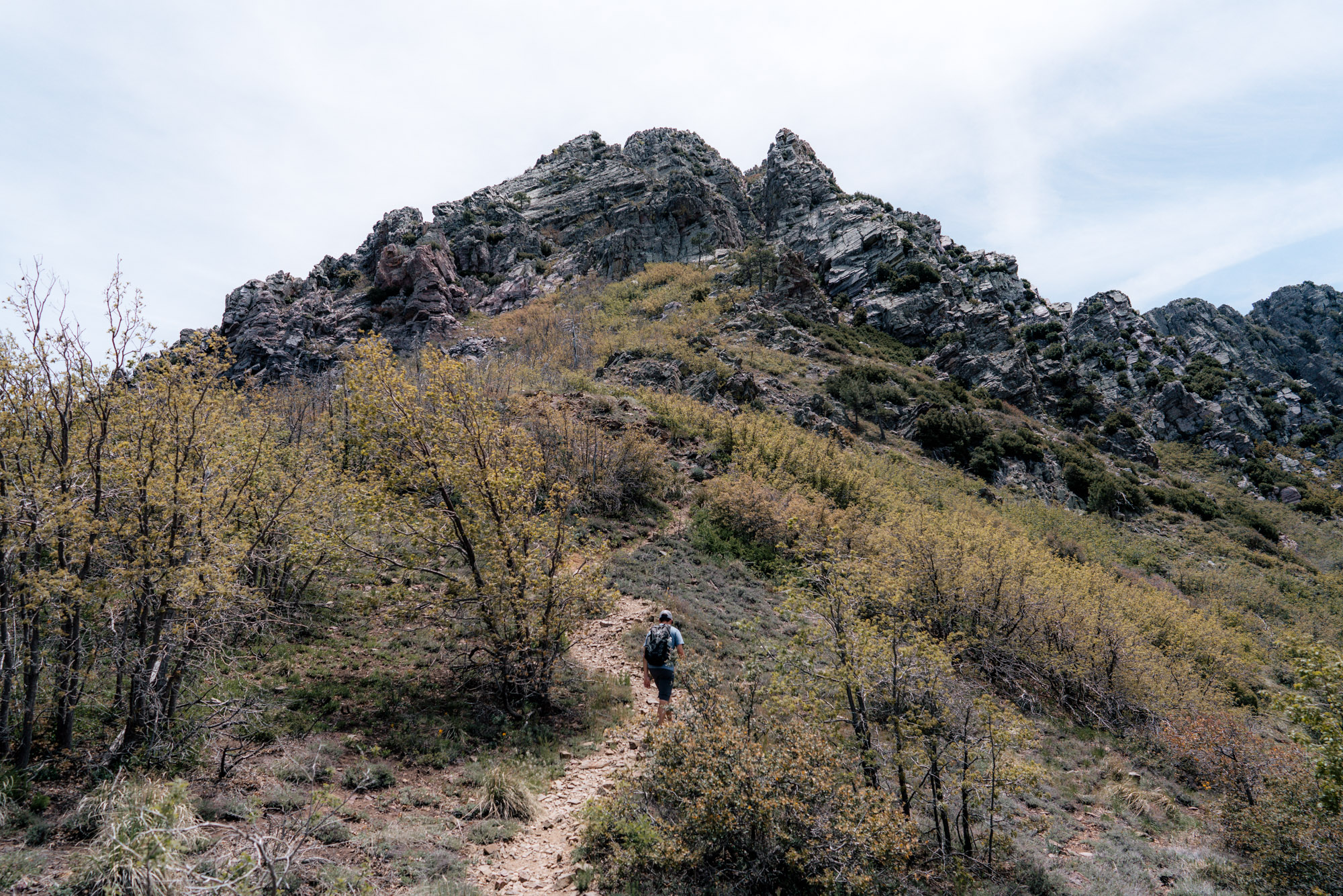
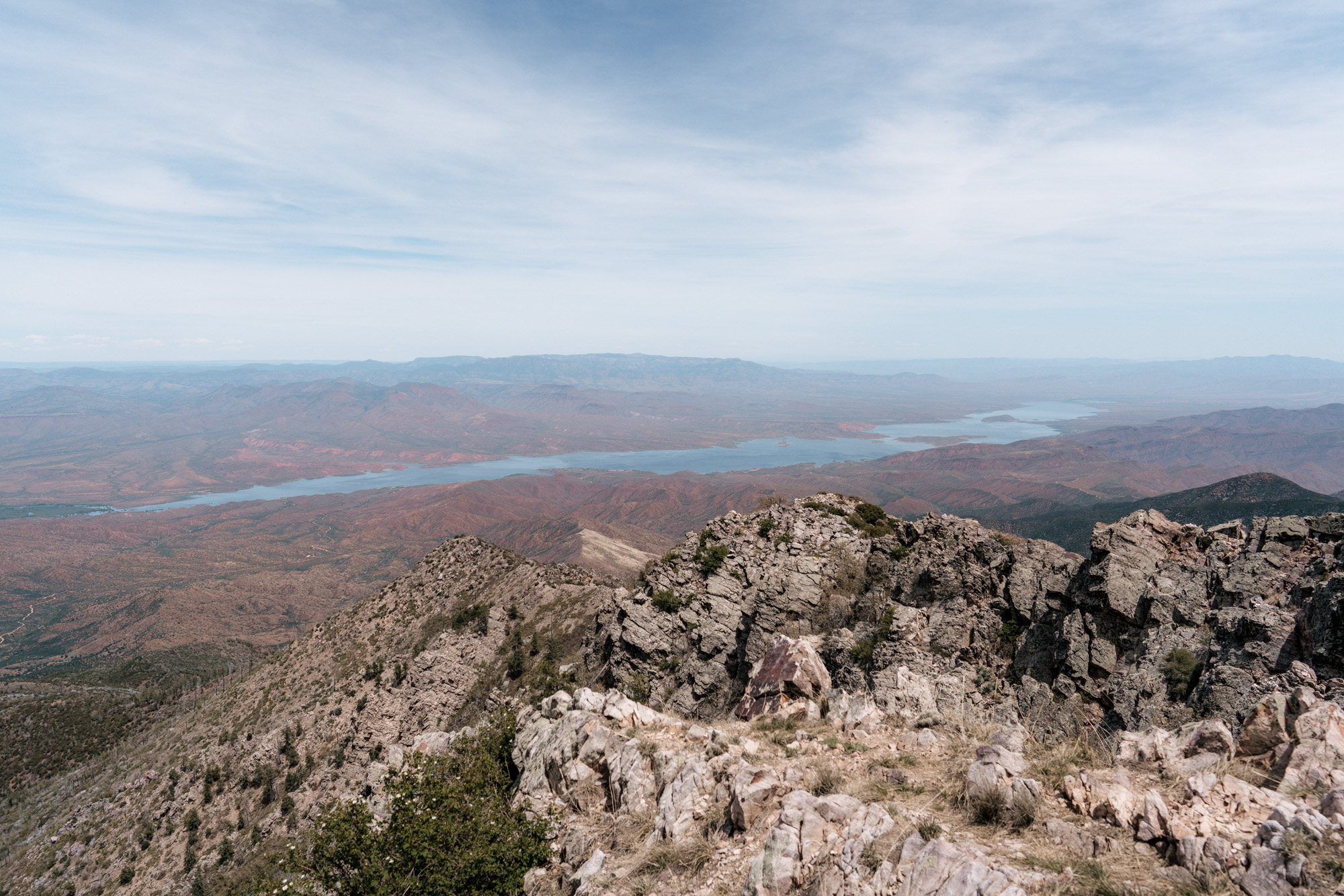
Upon arriving at the trailhead, there’s a lovely smell of pine trees and some great views of Roosevelt Lake to the east and Phoenix to the west. The trail starts with some switchbacks up a hill which are mostly shaded and goes past a Woodstock look-a-like rock.
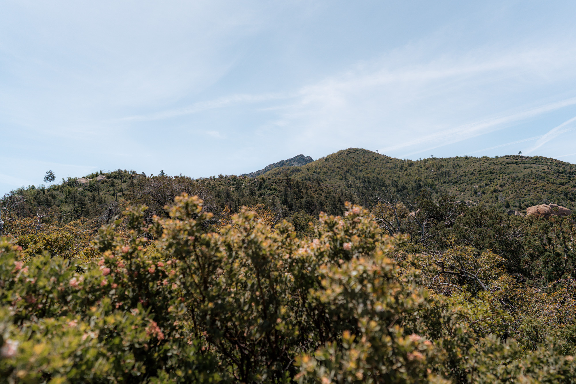
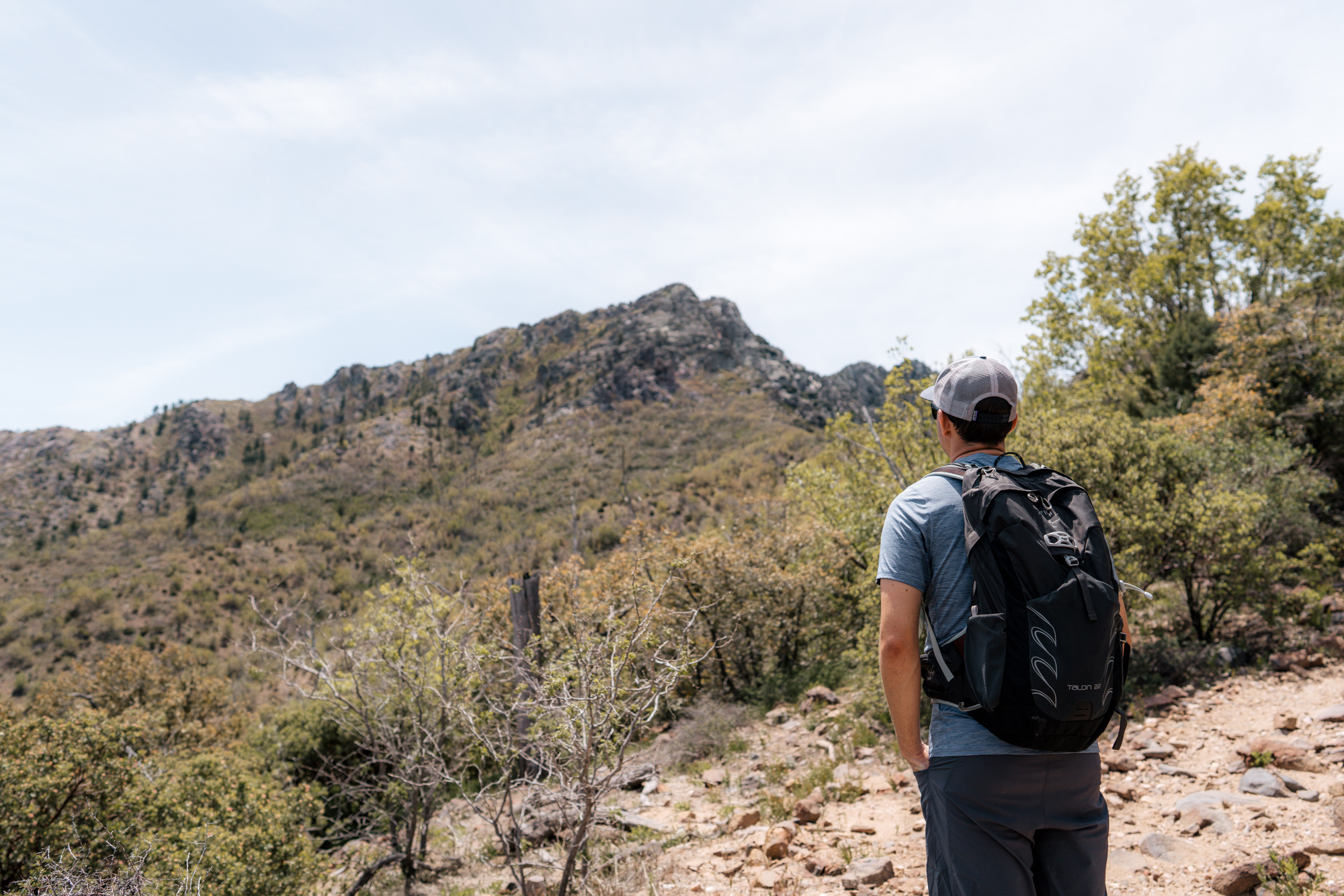
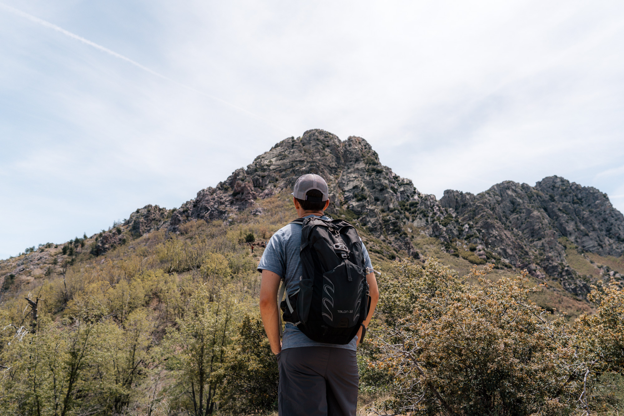
Once the trail gains the immediate ridge, Browns Peak starts to poke its head out in the distance.
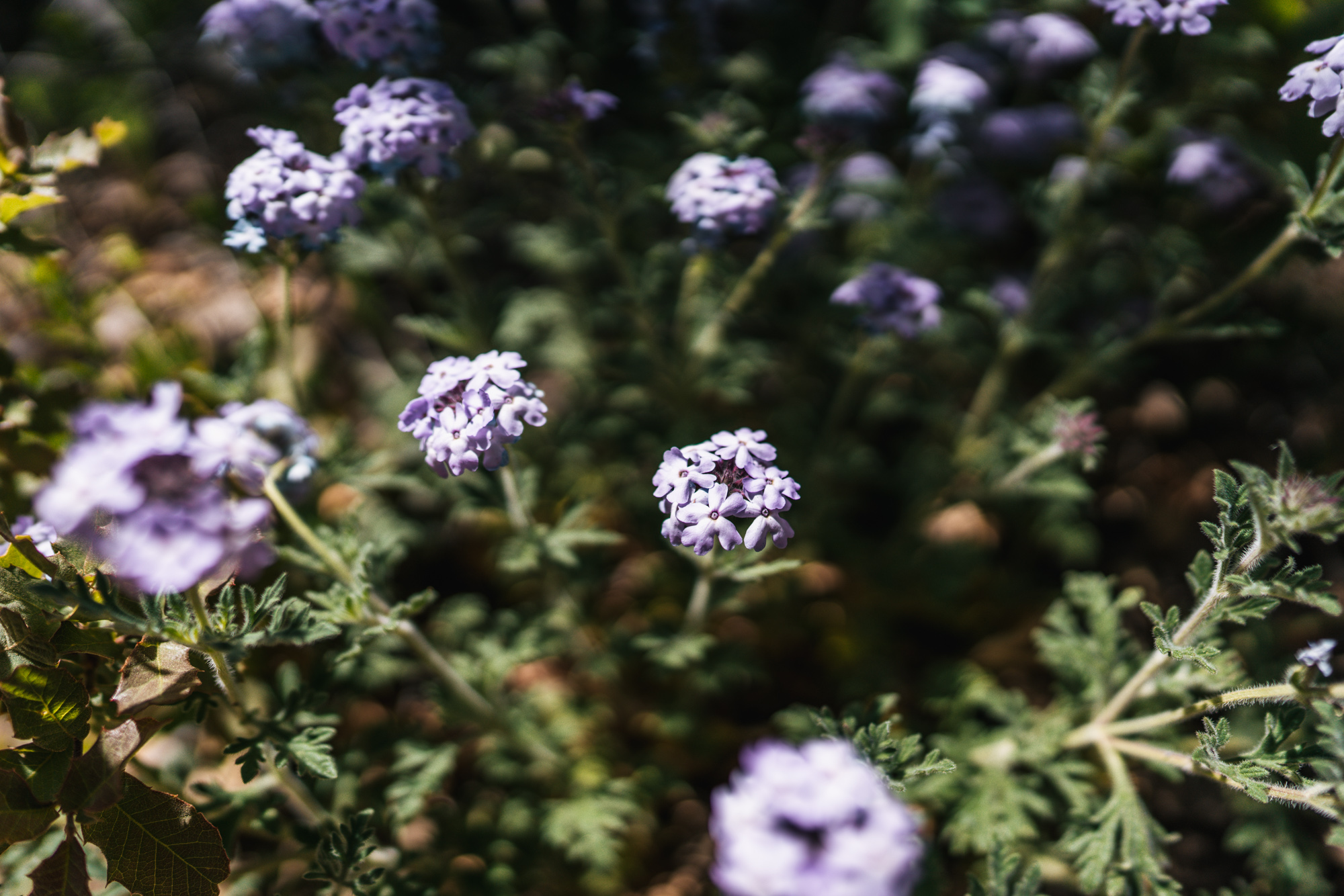
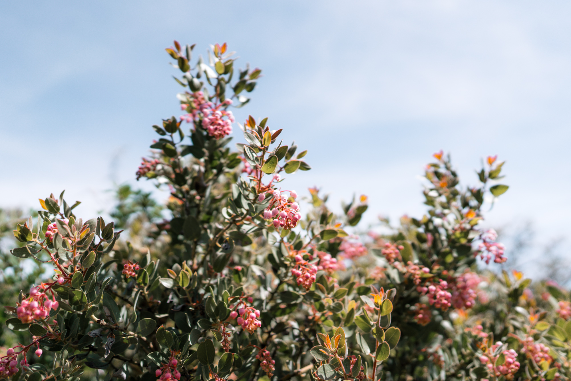
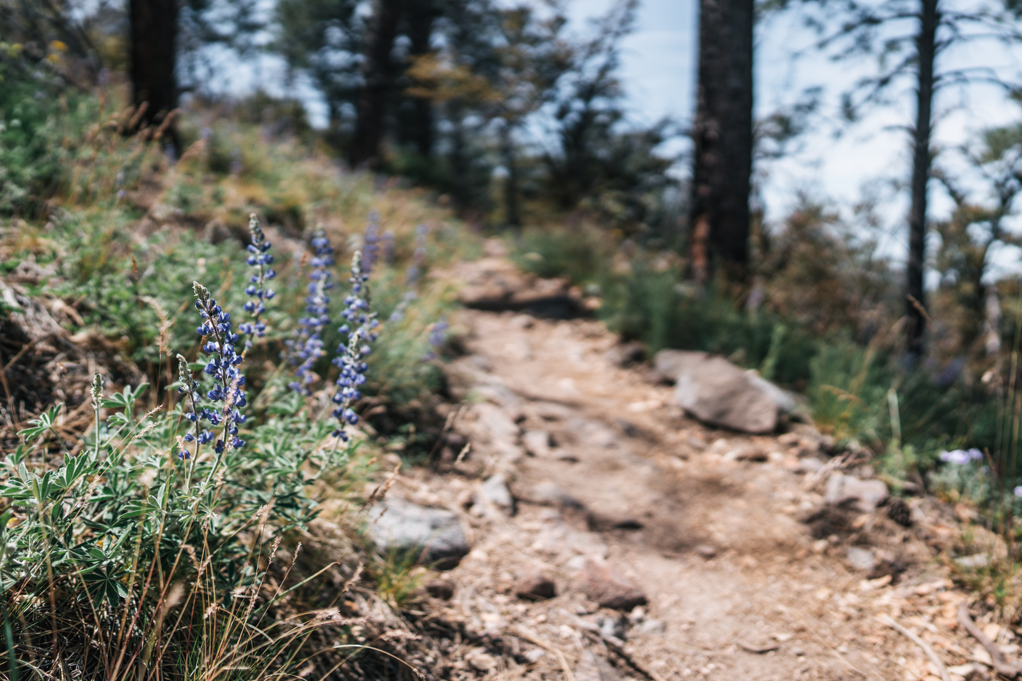
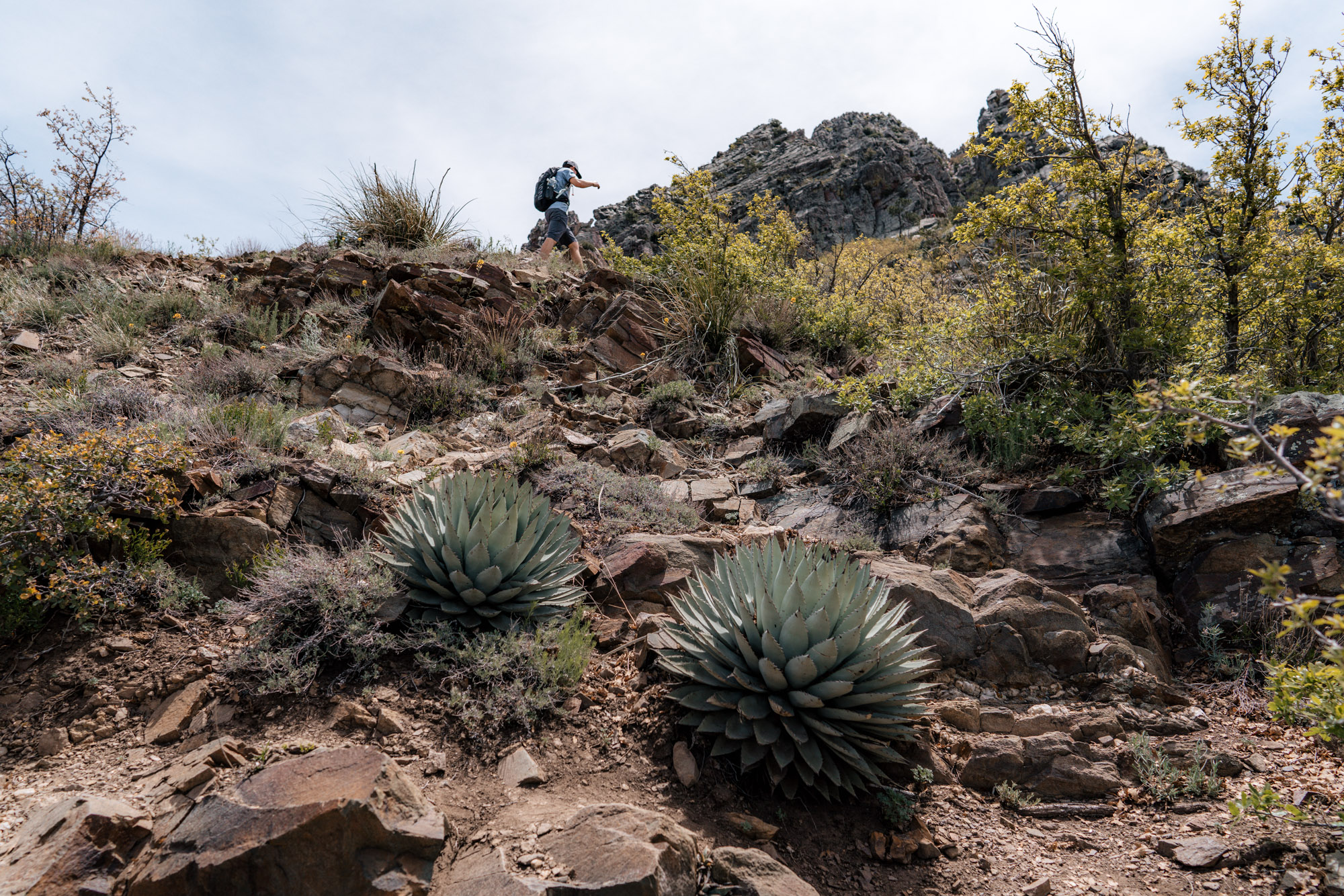
If you do this hike in the spring like us, the wildflowers on this part of the trail can be absolutely stunning. The timing is different every year and depends on the amount of rain and sun. On this particular year there were some, but we’ve seen better.
After some climbing along the ridge, the trail drops onto the northern slope of the mountain just to the north of Browns Peak, which has some dense vegetation and always seems to be a bit cooler.
Eventually the trail rounds the side of the mountain and you can see the summit once again.
Shortly after, the trail summits the saddle. It’s a flattish low point between Browns Peak and a smaller hill to the north. It’s a nice spot to take a rest and gather some energy before the hardest part of the hike. There are even a couple dispersed campsites with fire rings in this area.
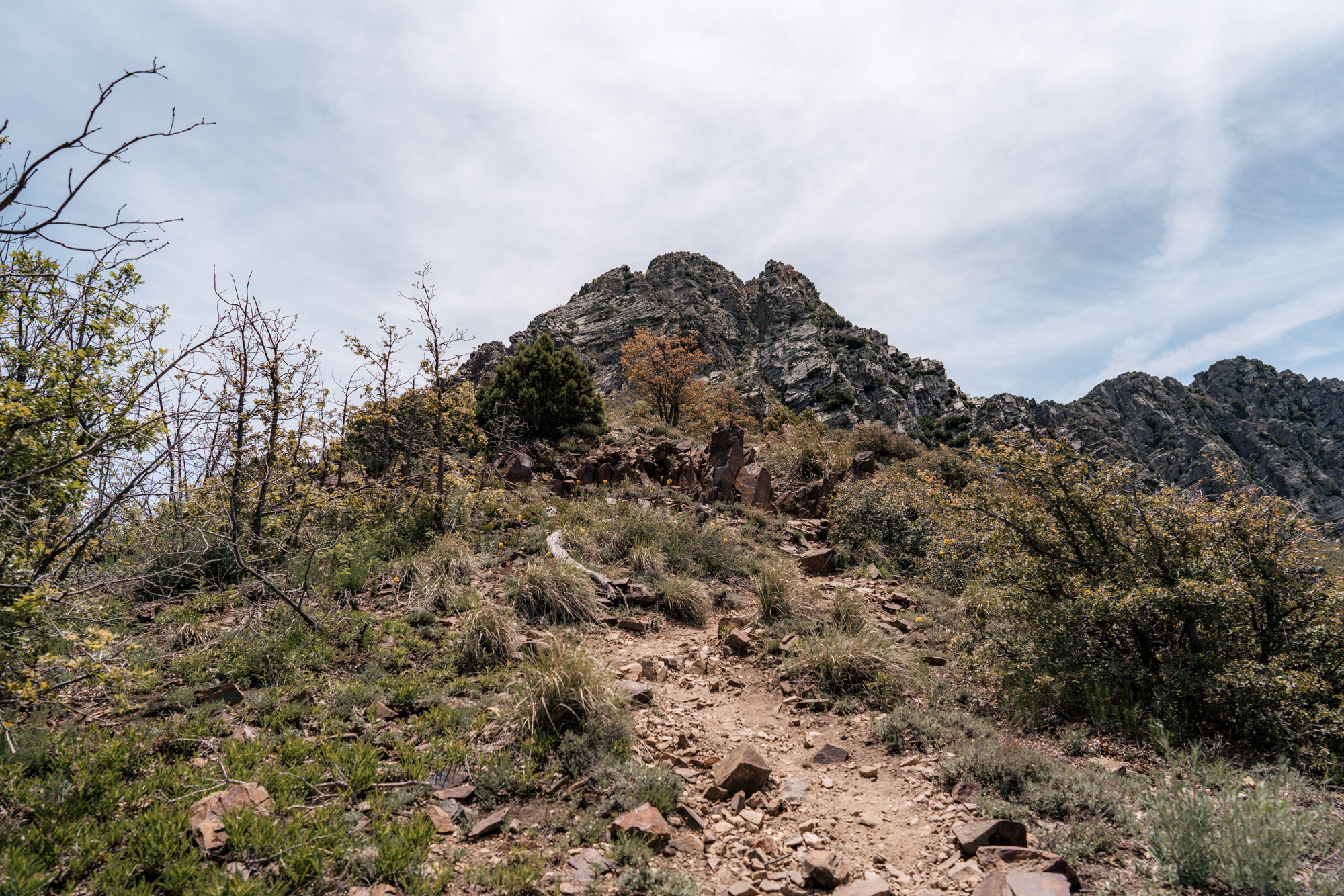
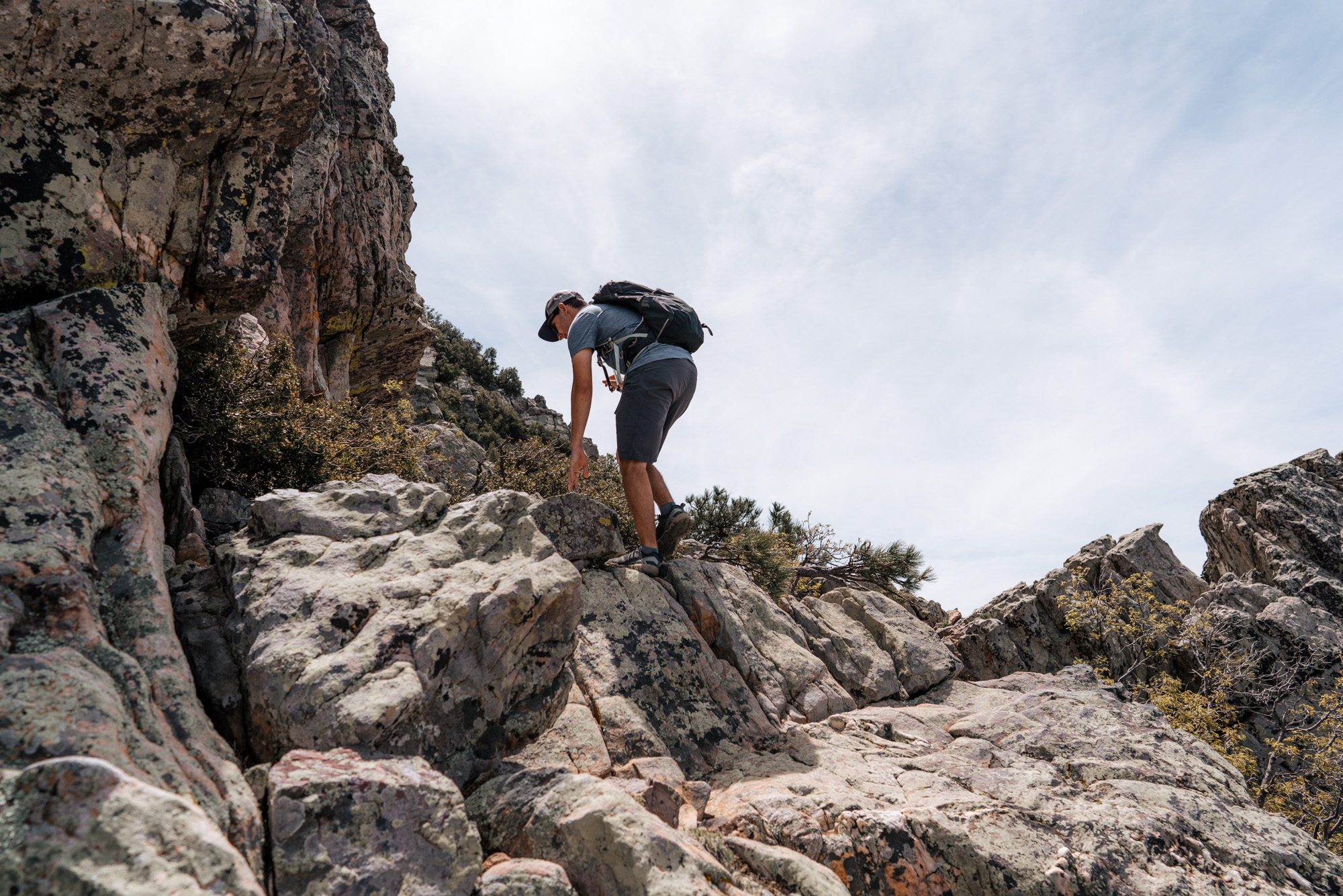
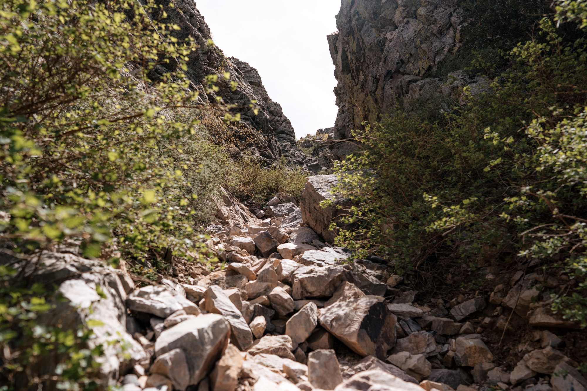
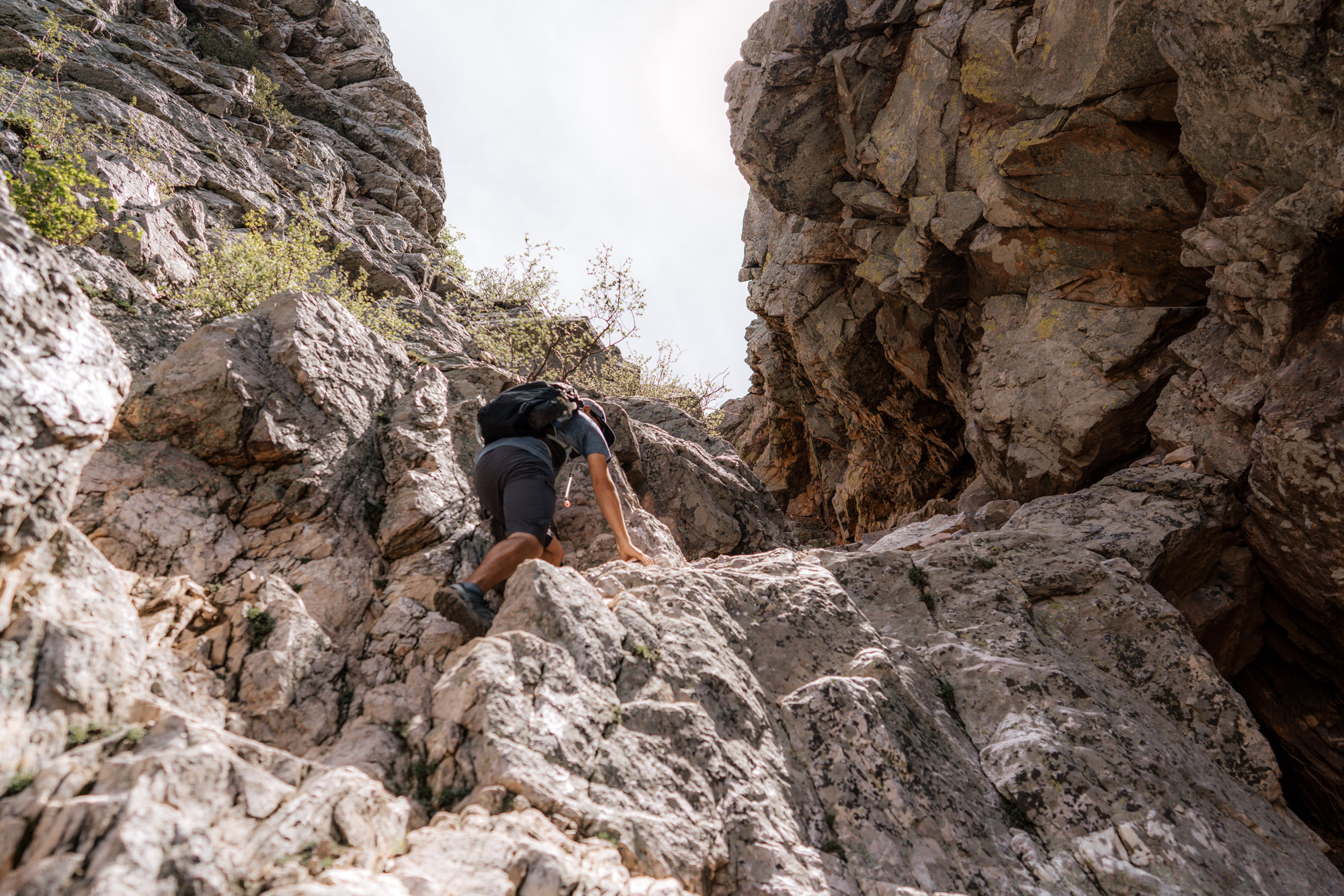
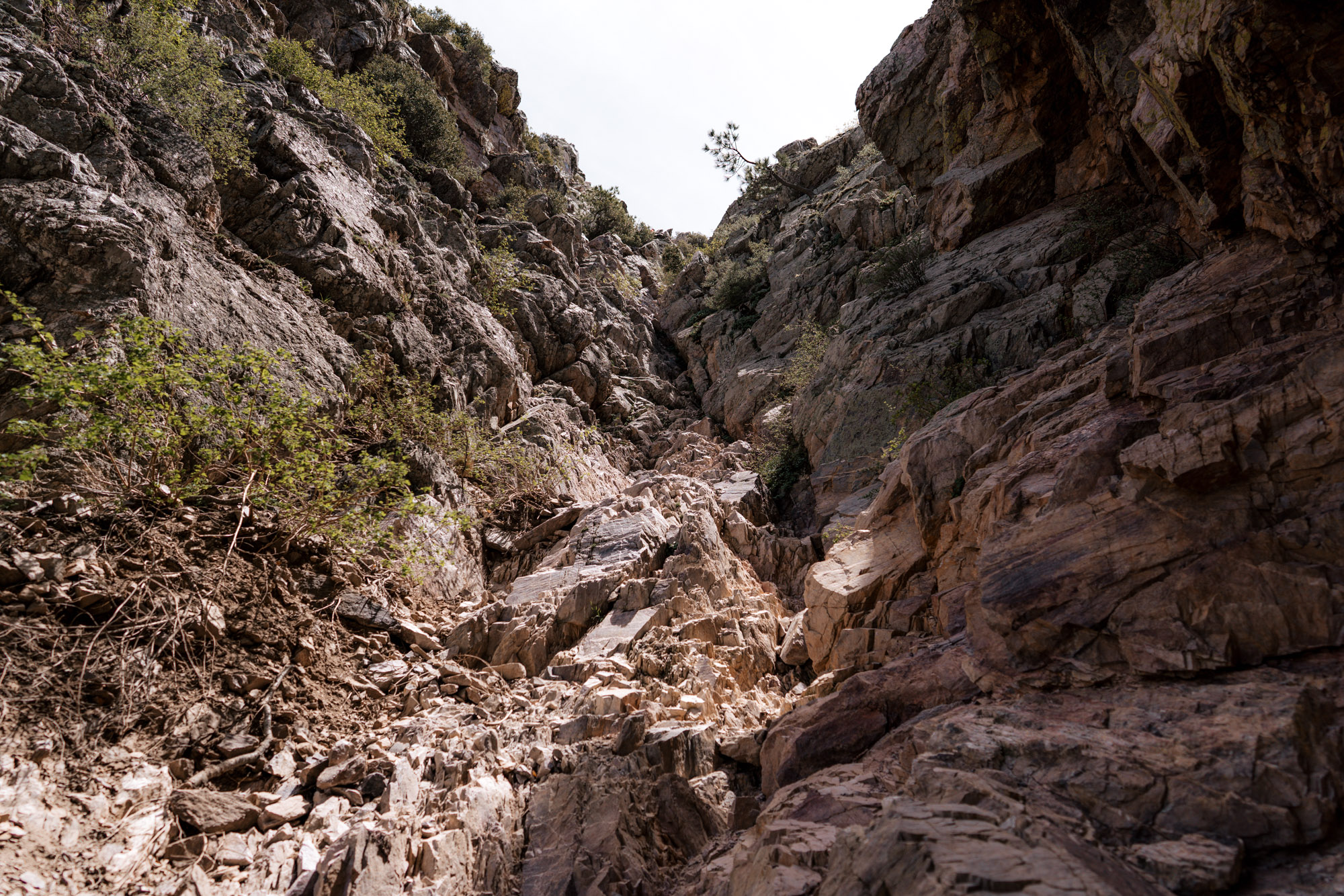
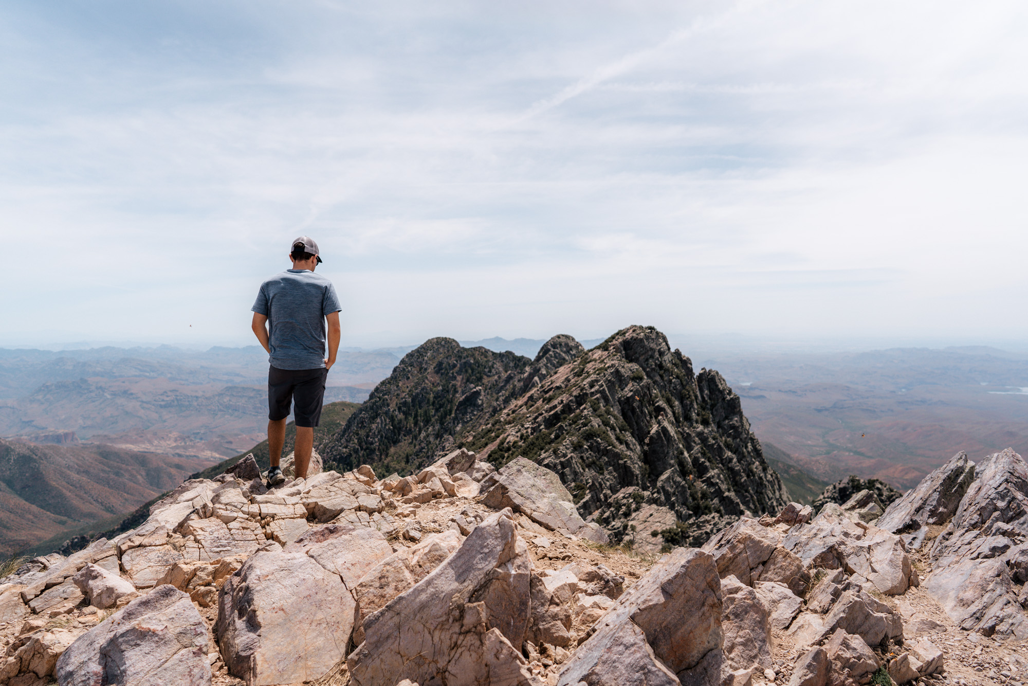
At this point the “official” trail ends, but there is a strong use trail the rest of the way, and it goes straight up the ridge into a scree chute.
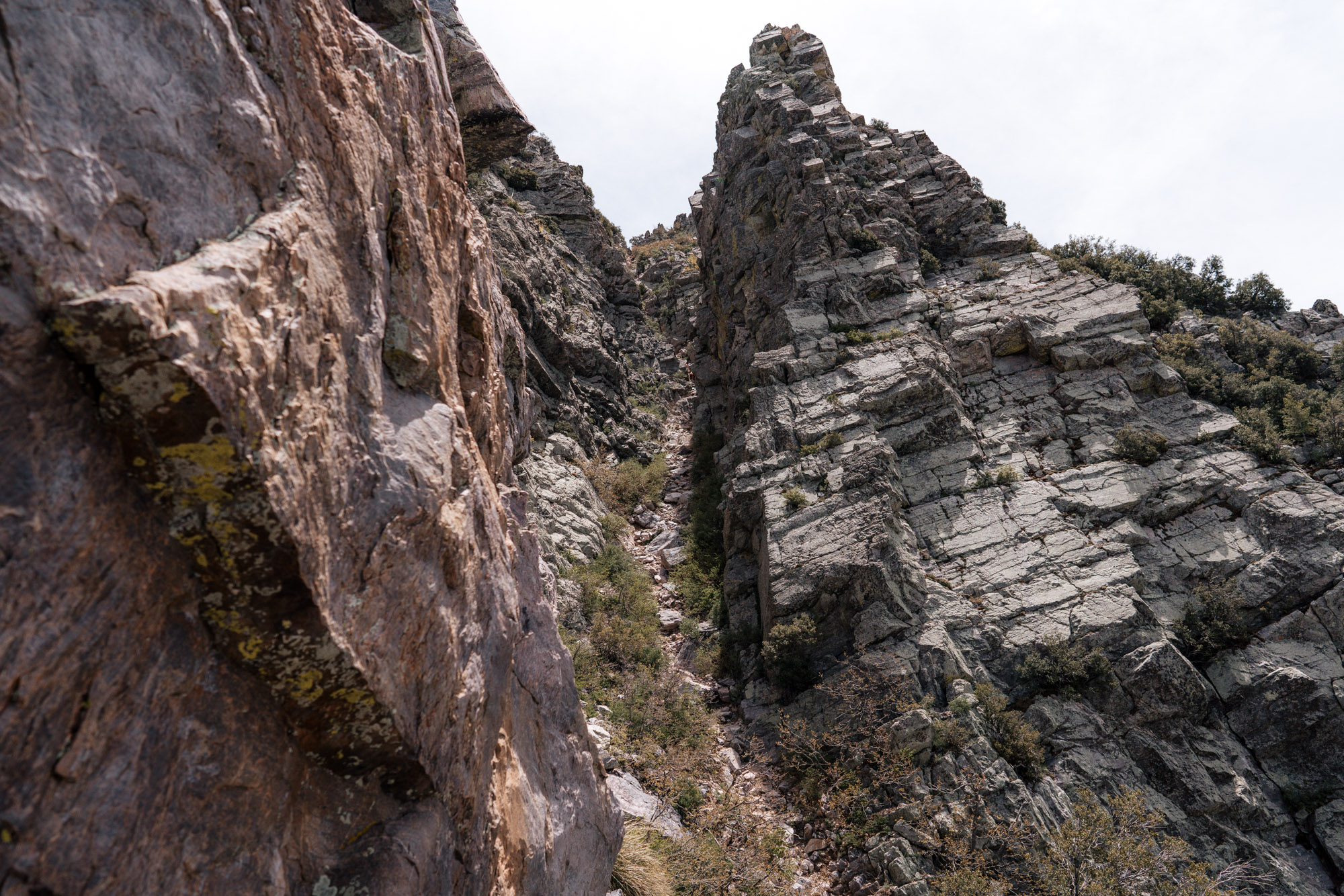
Time to address the elephant in the room: The Scree Chute. The last part of this otherwise pleasantly easy hike is a pretty brutally steep (at least to those who usually just hike and not climb) scree chute requiring a bit of Class 2 climbing. We strongly recommend using caution when attempting to summit. If you get in the chute and don’t feel comfortable, just turn back. Because if you’re scared or nervous going up, going down will be worse.
The next few pictures will show the scale and steepness. According to some topo maps, the chutes gets between 46 and 50 degrees from horizontal. If that doesn’t mean anything to you, let’s just say it’s steep AF.
It takes about an hour to get to the saddle but prepare for another 45 minutes (give or take depending how you navigate the chute) to the top.
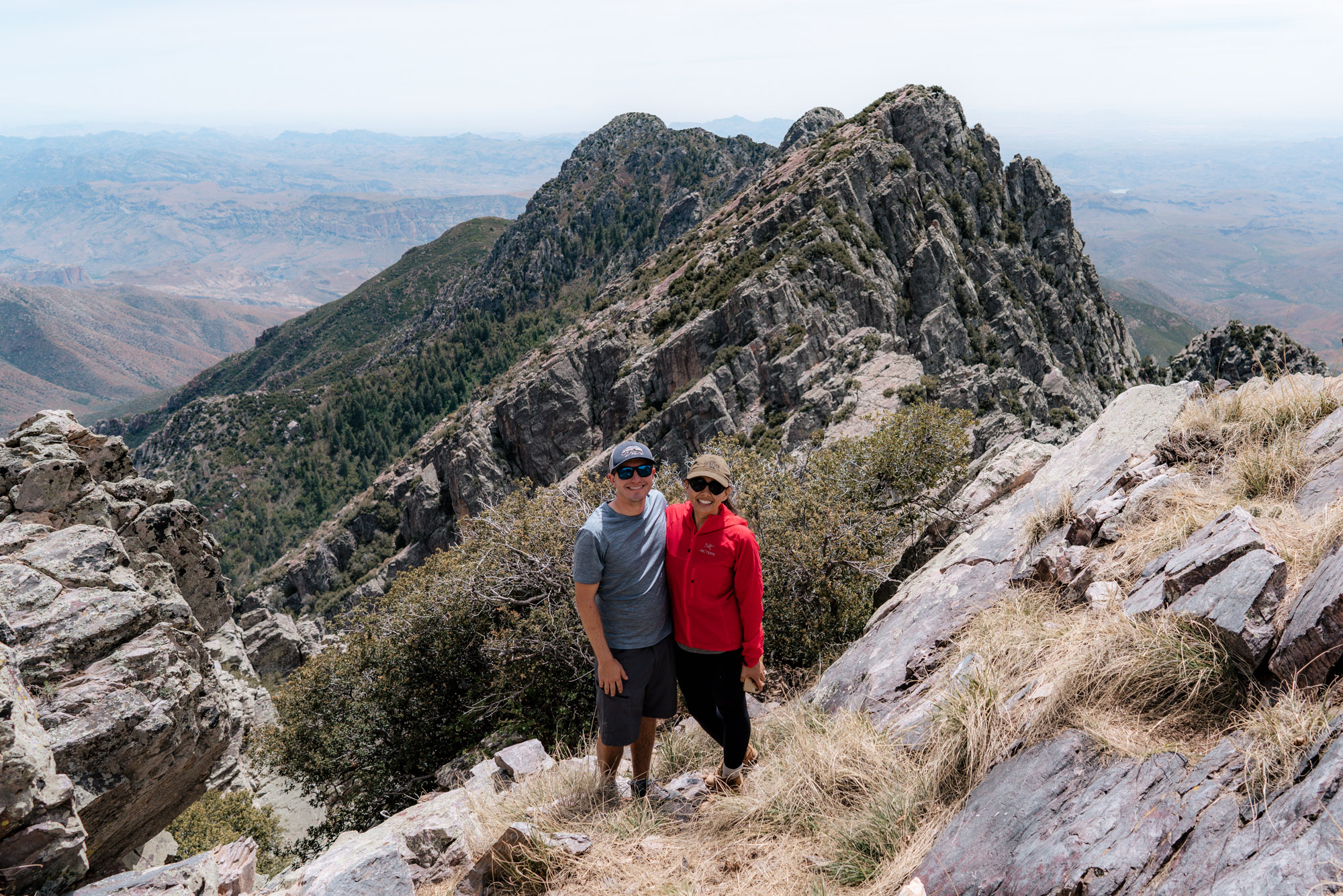
Once at the top of the chute, the trail goes up and to the east to the summit. It’s a quick scramble from there to the highest point in Maricopa County: Browns Peak.
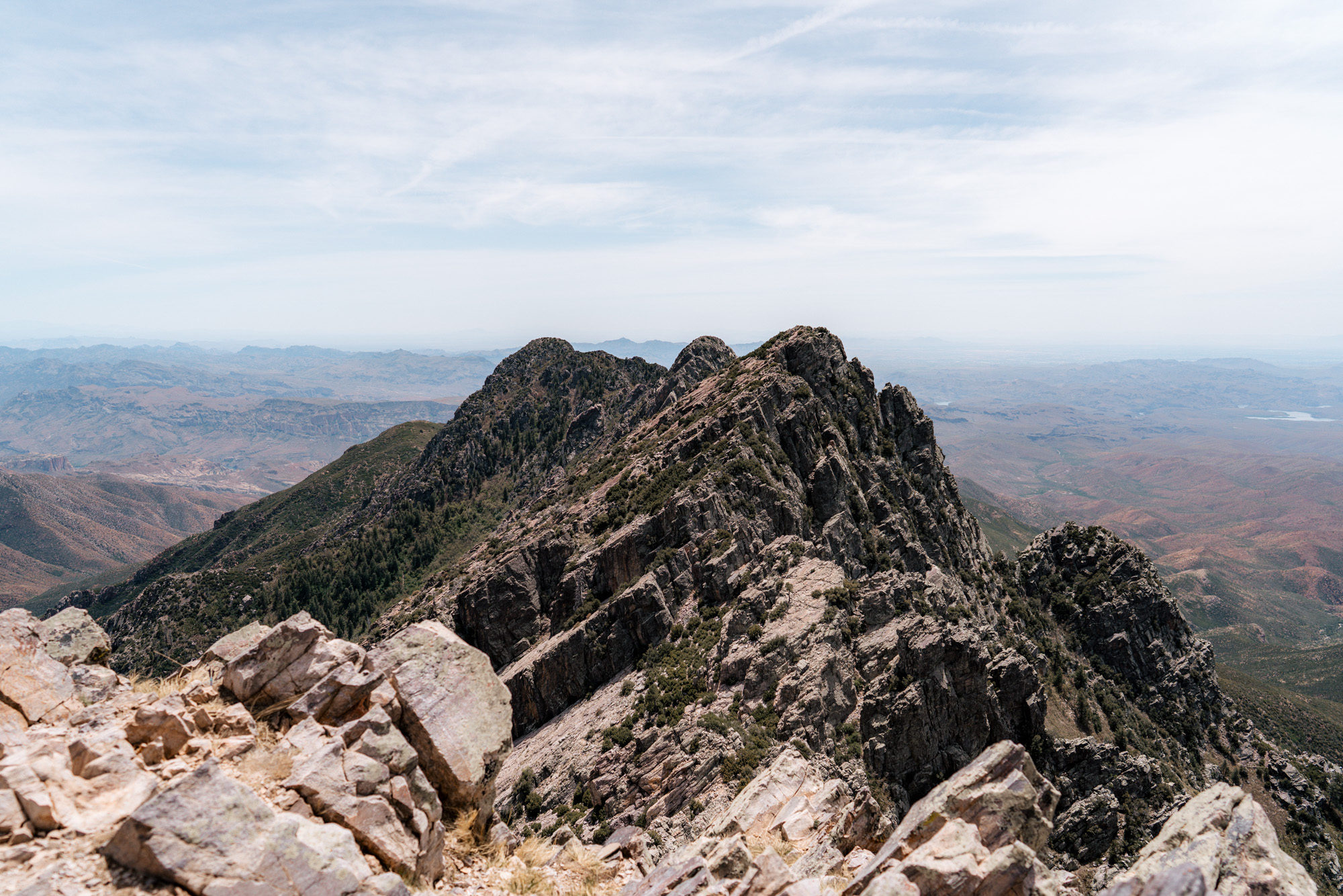
Every time we’ve been to the top (granted it’s always been in the springtime), it’s been extremely windy, and there’s always swarms and swarms of lady bugs!
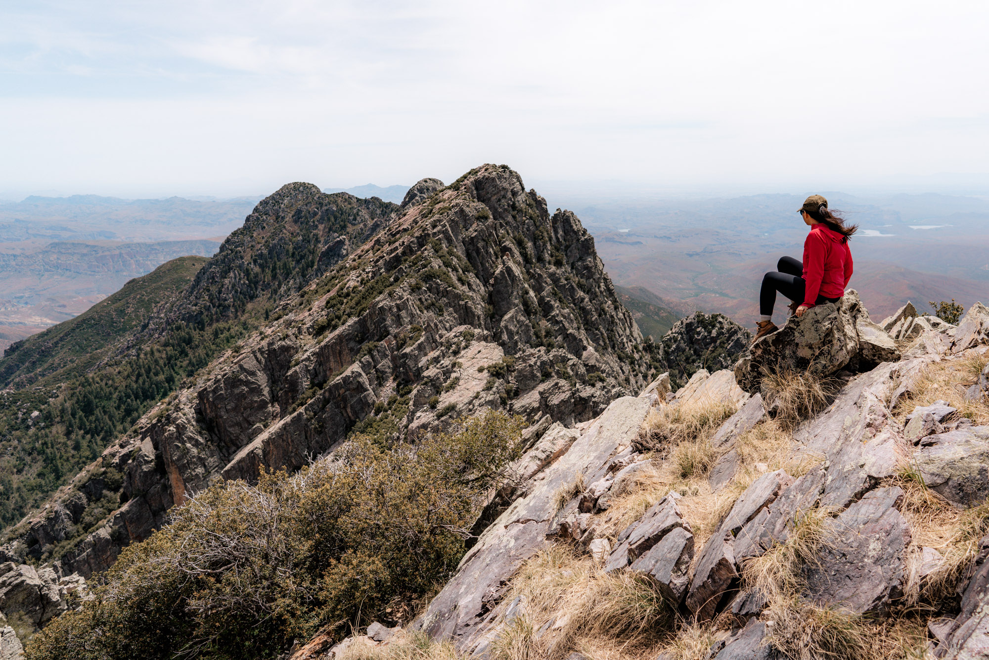
Getting to the summit is always rewarding with 360 degree views after conquering the scree chute, but getting to the top is only half the hike. Down-climbing the chute is arguably more technical than going up – it tends to be a butt slide to the bottom.
Overall, Four Peaks is a quintessential Arizona hike that’s exhausting, rewarding, and unforgettable (not many “hikes” make your arms sore). It’s a long drive, a diverse hike with both pleasant hiking and intense climbing, followed by 360 degree views of the Sonoran desert.
At the end of the day, it’s pretty cool to be able to tell people you’ve been to the top of Four Peaks!