On Sunday of Memorial Day weekend we drove over Santiam Pass from Bend and down into the McKenzie River Valley. The McKenzie River begins officially at the outlet of Clear Lake and is almost entirely supplied by the Great Spring which produces the intensely cold water (35-43 F) found in Clear Lake. The Great Spring is fed by snow melt from Mt Washington that filters through enormous lava fields for 20 years and then erupts ice cold into the lake.
We stopped by Clear Lake after the waterfall loop and were shocked to see scuba divers climbing out of the lake left and right. Apparently it’s one of the best fresh water diving spots in Oregon because the water is so clear and 100 ft down is a forest of upright trees that were killed thousands of years ago in a volcanic event that created the lake. The cold spring water has preserved the trees – pretty cool!
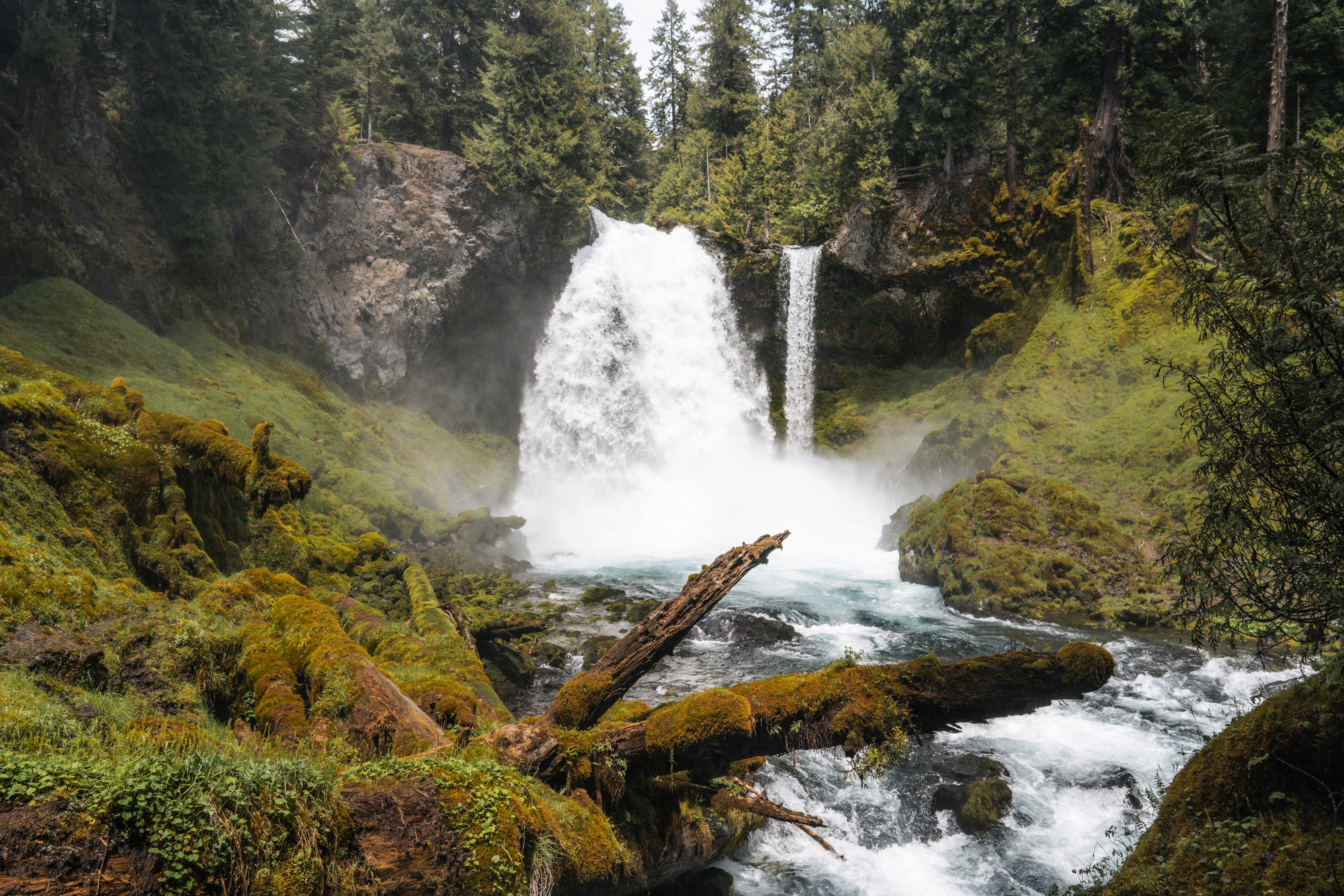
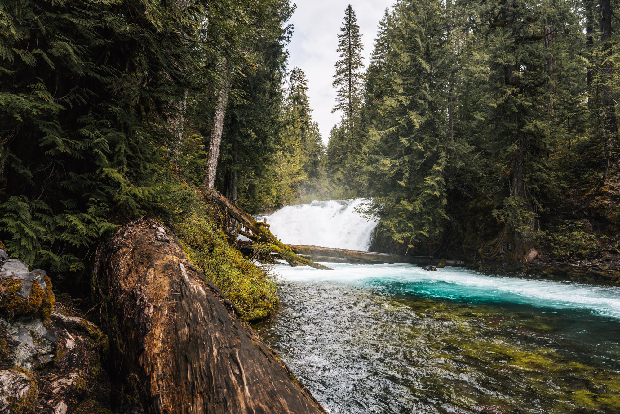
After it leaves Clear Lake, the McKenzie River flows over Sahalie and Koosah falls before emptying into Carmen or Trail Bridge Reservoir.
For this particular hike we parked in the day use area near the Sahalie Falls View Point. A 2 second walk put us right in front of the raging Sahalie Falls. A lot of people congregate here because it’s so close to the parking area, so we didn’t stay long and instead turned left and headed down stream toward Koosah Falls.
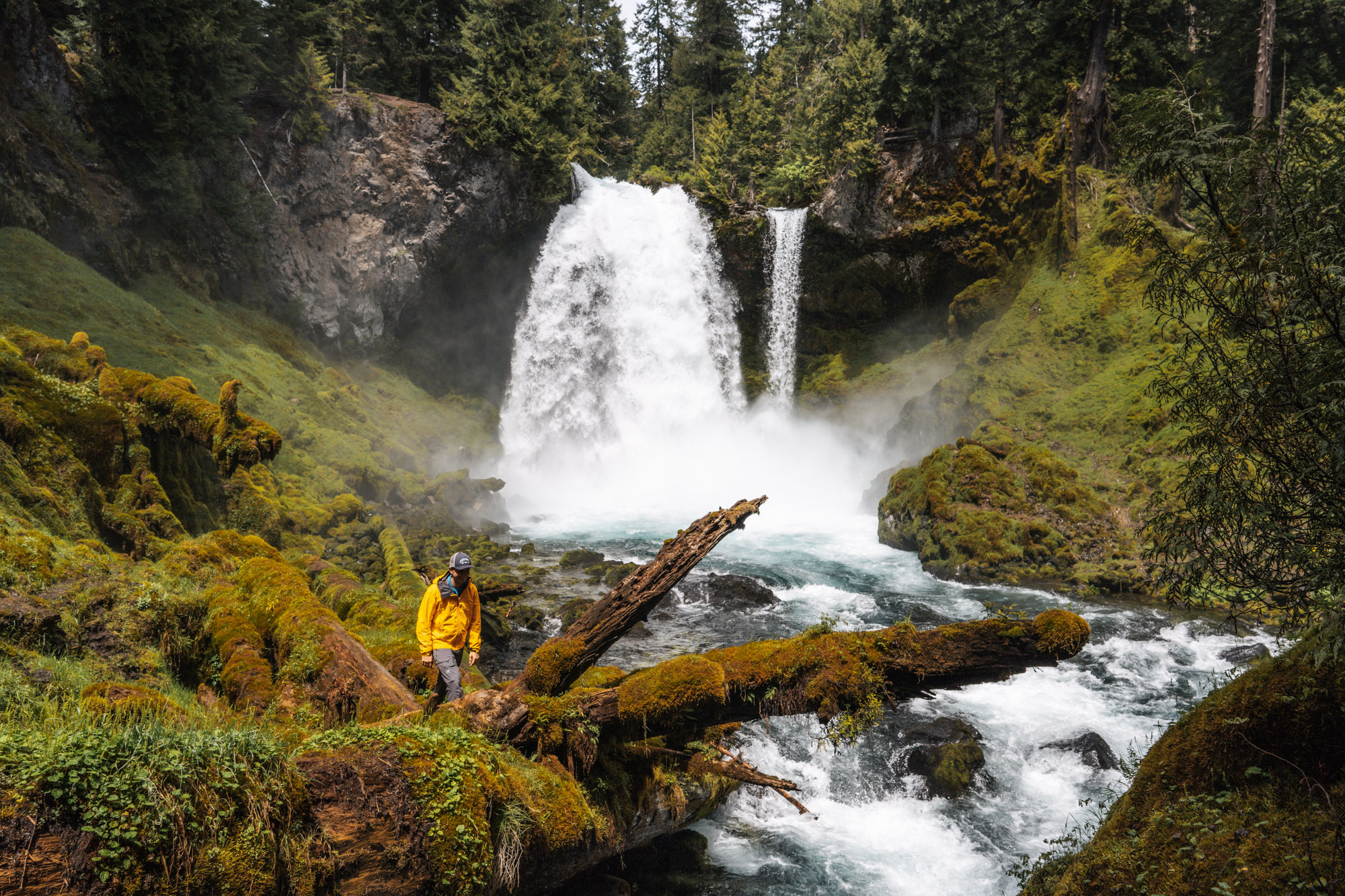
The trail followed the river very closely as it plunged over cascades in a fury of white water. We stopped and walked down to the water to get a better angle and were amazed at the temperature drop. It was a warm early summer day and just moving 10 yards closer to the water changed the temperature by at least 10 degrees. The jaw dropping clear, blue and white water reminded us fondly of Iceland.
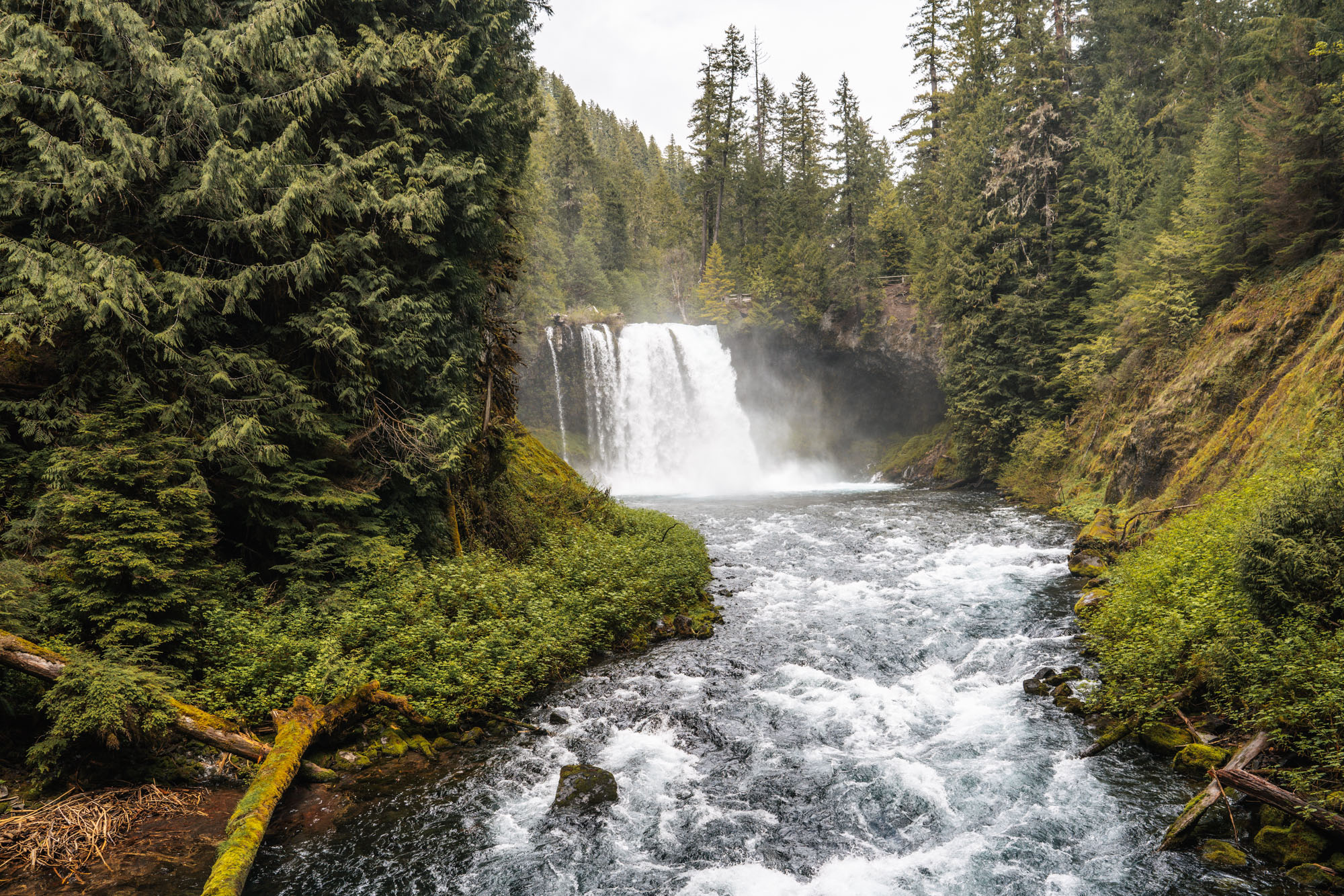
Koosah Falls is only 0.5 miles below Sahalie and there are several view points along the trail, high above the river, on top of the steep canyon walls.
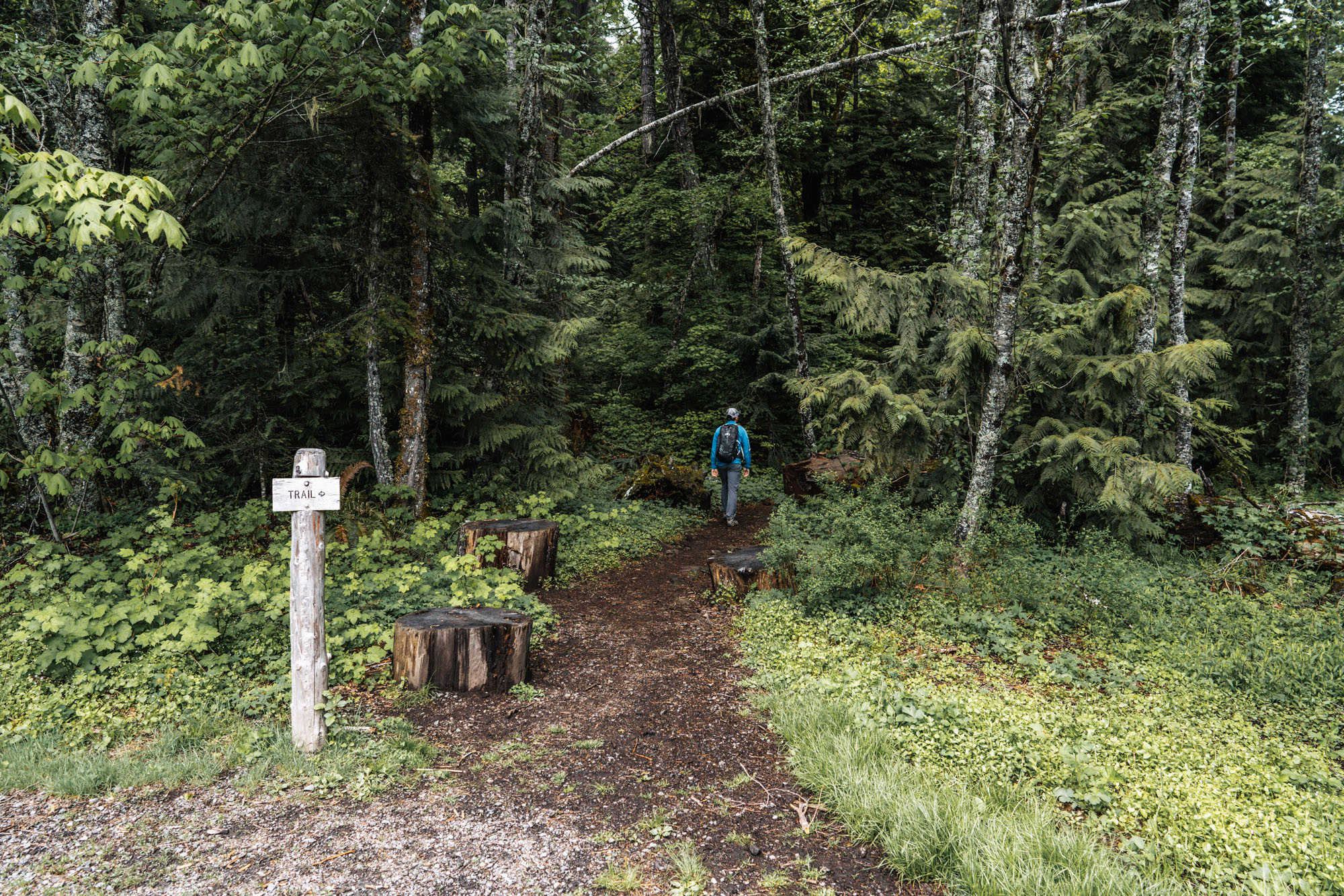
This is the point where most people stop and turn around, but we decided to make it a loop and walk downstream to the bridge over the river at the inlet of Carmen Reservoir. From there, follow the dirt road until we saw a “trail this way” sign pointing towards the McKenzie River Trail. This small spur trail ran into the main trail, where we turned right and continued going upstream.
The McKenzie River trail is actually 25 miles long and goes from Clear Lake all the way down to the McKenzie River Ranger Station. We had walked on the trail further downstream when we explored Tamolitch Pool, so it was kind of cool to walk on it again in a different spot.
The nice part about doing the loop is that we got to see the river and the waterfalls from the other side as well. Different perspectives are always welcome.
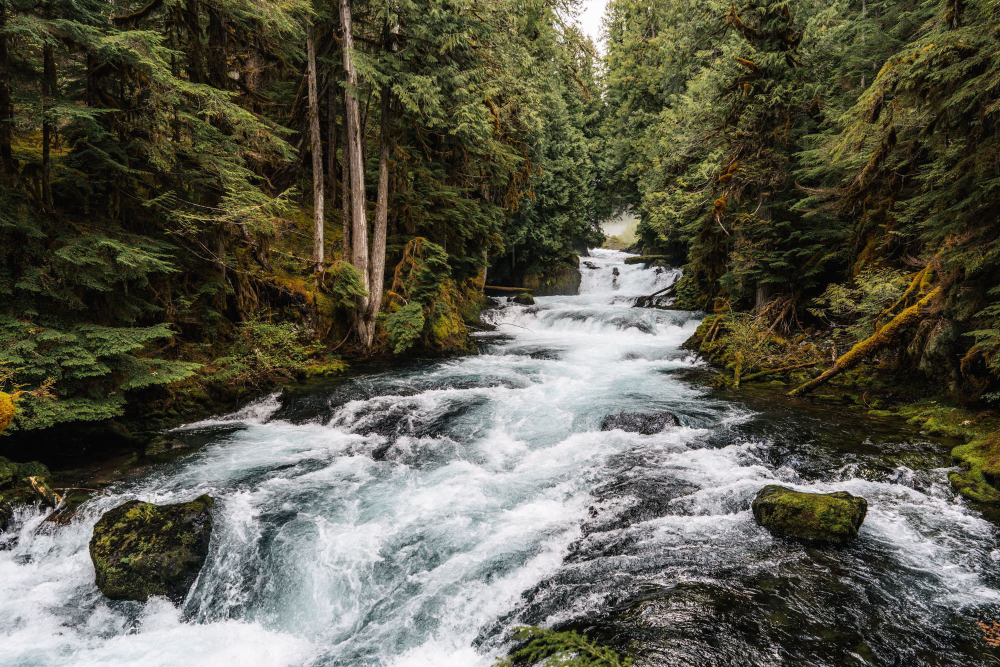
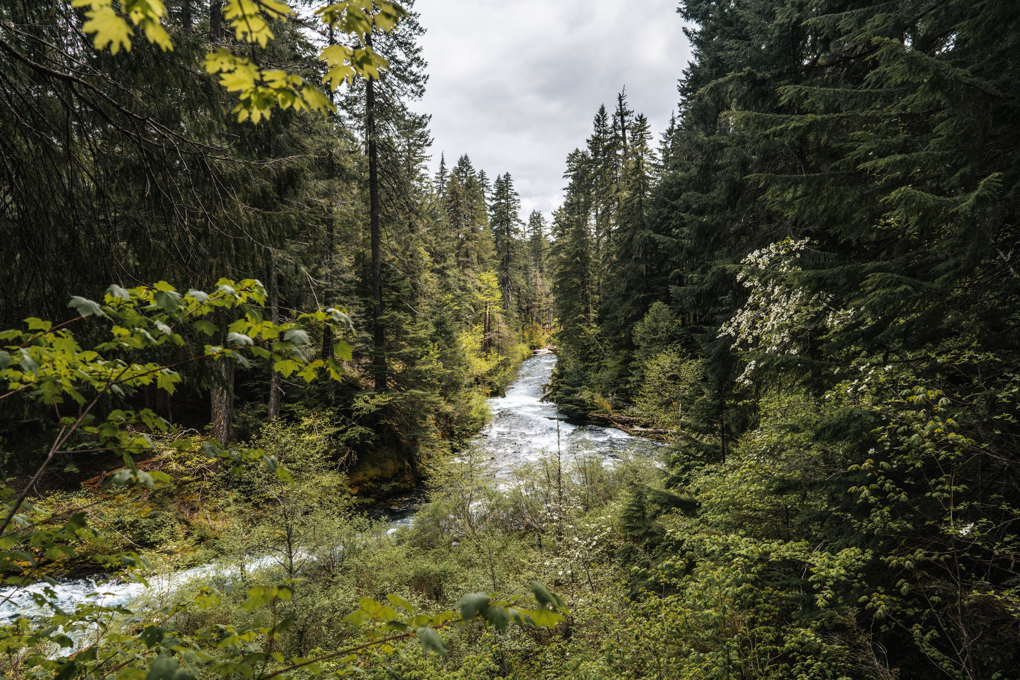
The river is also dotted with a few other unnamed waterfalls and cascades with no official viewpoints.
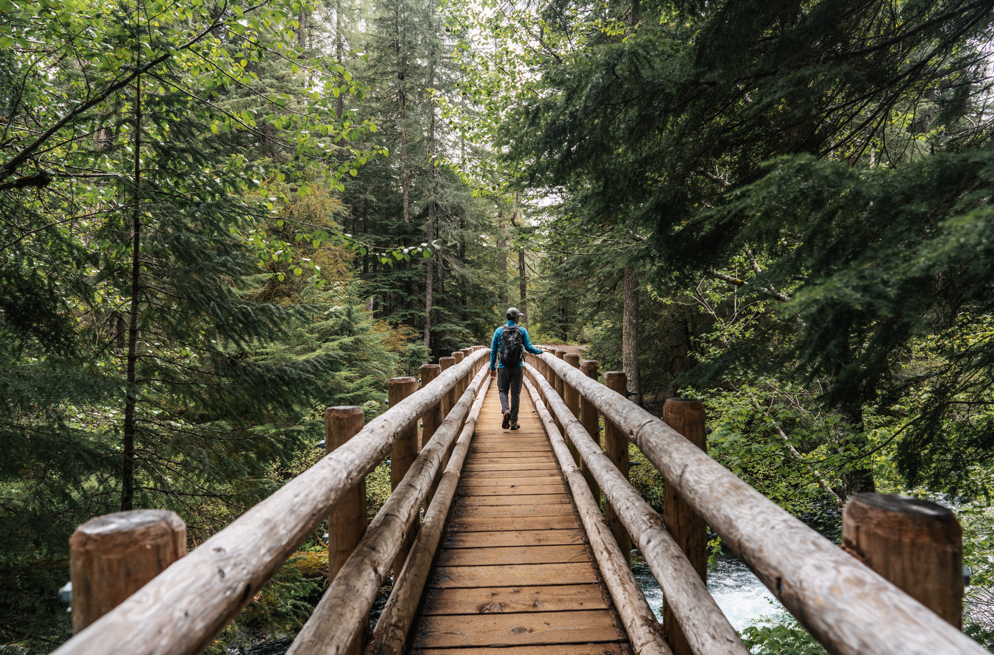
It was about 1 mile from Carmen Reservoir to where the McKenzie River Trail crossed back over the river above Sahalie Falls. From the bridge, we turned right and took a connector trail back to the parking lot.
This is an easy hike with some superb Pacific Northwest scenery. Definitely a lot of bang for your buck, especially when the river is flowing high from snow melt.