The Icefields Parkway is a world-famous drive through some of the most scenic mountains in the world. It’s the perfect introduction to the Canadian Rockies and we could not haver been more excited to see the glacial blue lakes and endless towering peaks.
Clearly we can’t get enough the of the Rocky Mountains, because even after visiting the Rockies in Colorado and Montana earlier this year, we were still stoked to explore the Canadian Rockies over an extended Labor Day weekend. Our to-do list was ambitious, but we couldn’t skip the world-renown drive on the Icefields Parkway. Knowing we only had one day to make the drive and that we wanted to spend a decent amount of time at each stop to take in the views and snap photos, we planned for our turnaround point to be the Saskatchewan River Crossing. We got up early to beat the crowds and drove straight to our most highly anticipated stop.
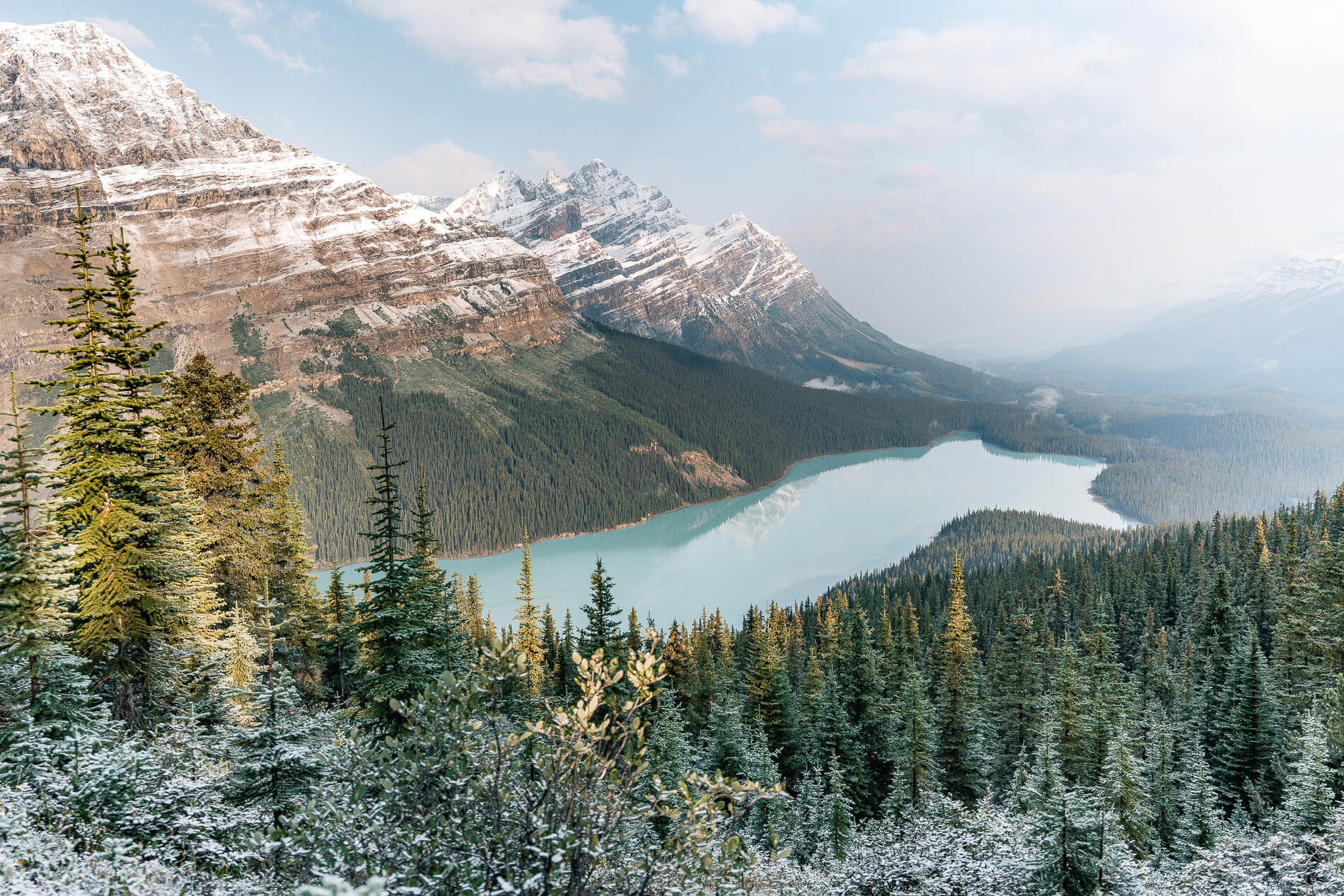
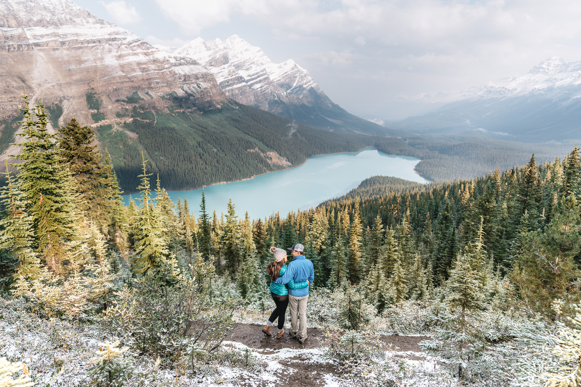
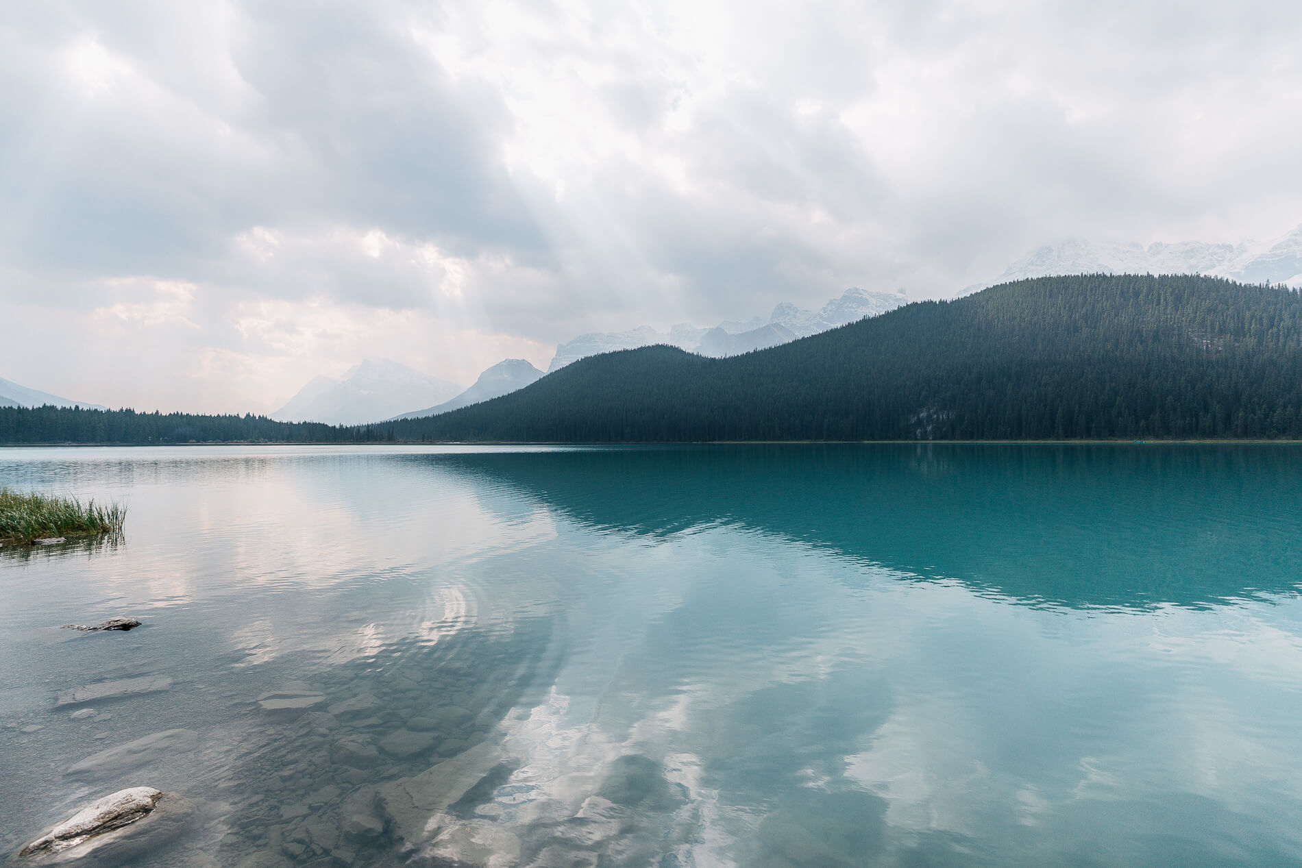
Peyto Lake
We could have made several other stops along the way to Peyto Lake (the plan was to hit them on the way back), but this little fox-shaped lake was at the top of Icefields Parkway to-see list, and we wanted to get there closer to sunrise before the tour buses started rolling in.
As we approached Bow Summit, the highest point on the parkway, the ground on the side of the road started to disappear under a blanket of snow. The snow was still fresh from the storm the night before; the peaks and greenery around us were sprinkled in white. Swinter at its finest! The Peyto Lake (we learned it’s pronounced “pea-toe”) parking lot sits basically at the top of Bow Summit. After parking, we immediately layered up for the short brisk hike to the view point. It’s just over a half a mile, only slightly uphill, and paved. Once at the viewpoint, we were greeted with a view of the most uniquely shaped and also possibly the bluest lake we’ve ever seen.
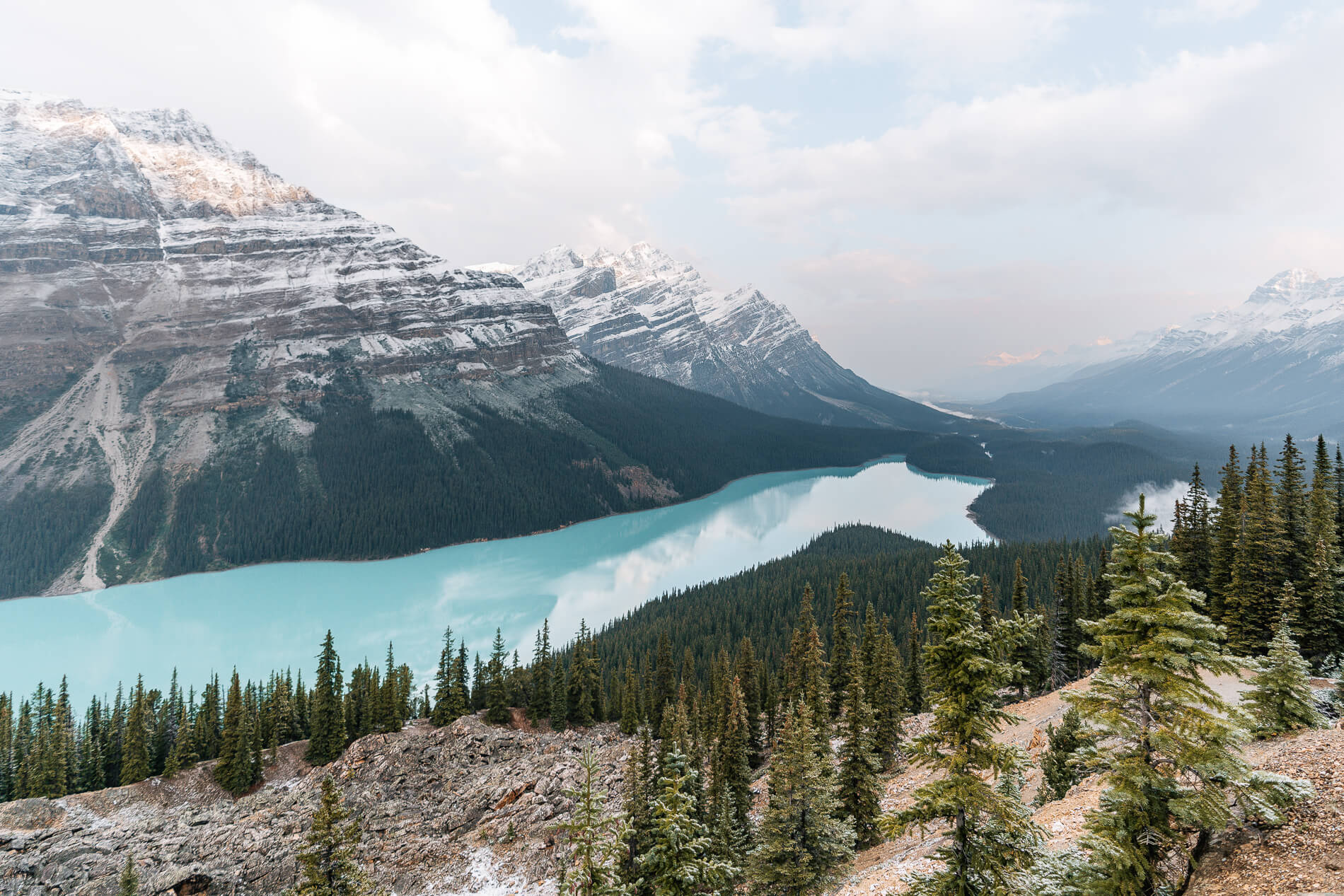
The boardwalk was pretty busy with fellow photo-takers. And while it’s probably impossible to take a bad photo of this epic lake, we wanted a little more privacy so we hiked a little further up the trail (not quite up to the summit) to find a better photo spot. The conditions on this day were a little odd. It was pretty hazy, as you can see in the photos, and at first we thought it was residue from fires in the area, but there was smoke smell. For a while the sun was obscured by the clouds, but just before we left the sun broke through the clouds and gave us some awesome lighting. Although we could’ve stared at Peyto Lake for hours, we decided to head back down to the car and make our way to our next stop. When we come back some day, we’d like to hike down to the shore of the lake and try our hand at the cutties who supposedly make this blue fox-shaped lake their home.
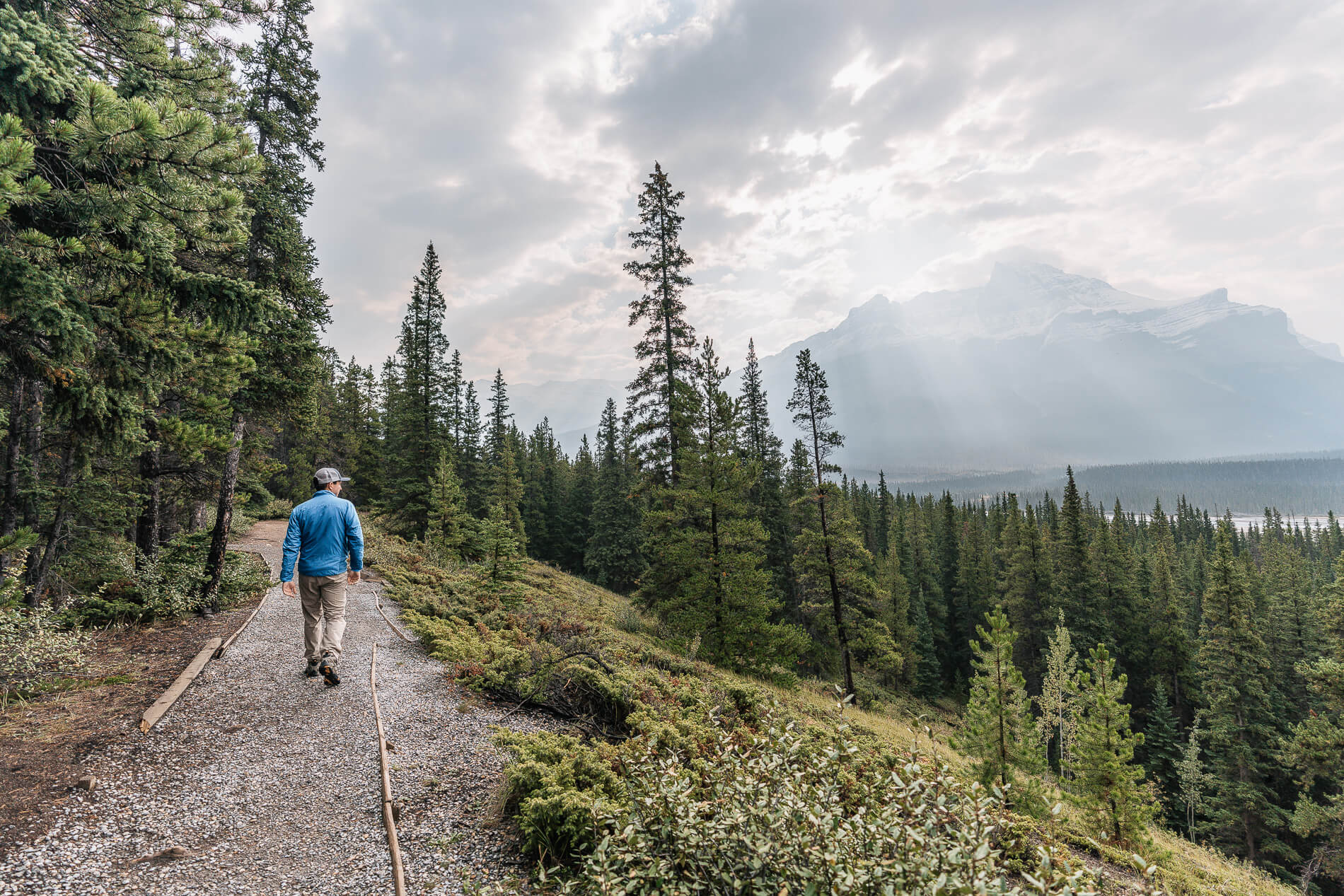
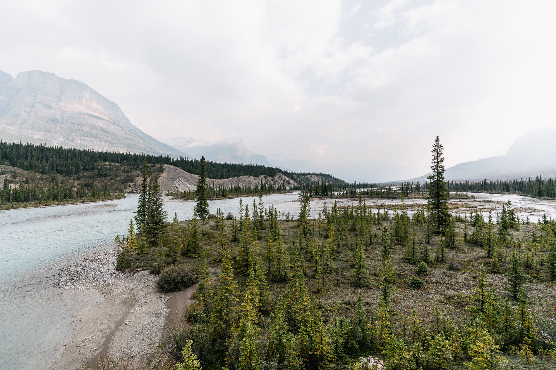
Saskatchewan River Crossing
From Peyto Lake, we headed north to the Saskatchewan River Crossing. “The Crossing” as it’s also called, is the only place that has basic services between Banff and Jasper National Park. It’s also the confluence of three rivers: North Saskatchewan River, Howse River, and Mistaya River. We parked in a dirt lot on the north side of the bridge and wandered around the area for a bit, walking along the river and staring at the seemingly endless mountains surrounding us. Eventually we hopped back in the car and headed back south to hit some of the sites we skipped on the way up. As you can see, we didn’t do the Icefields Parkway drive in any logically order – we kinda just winged it.
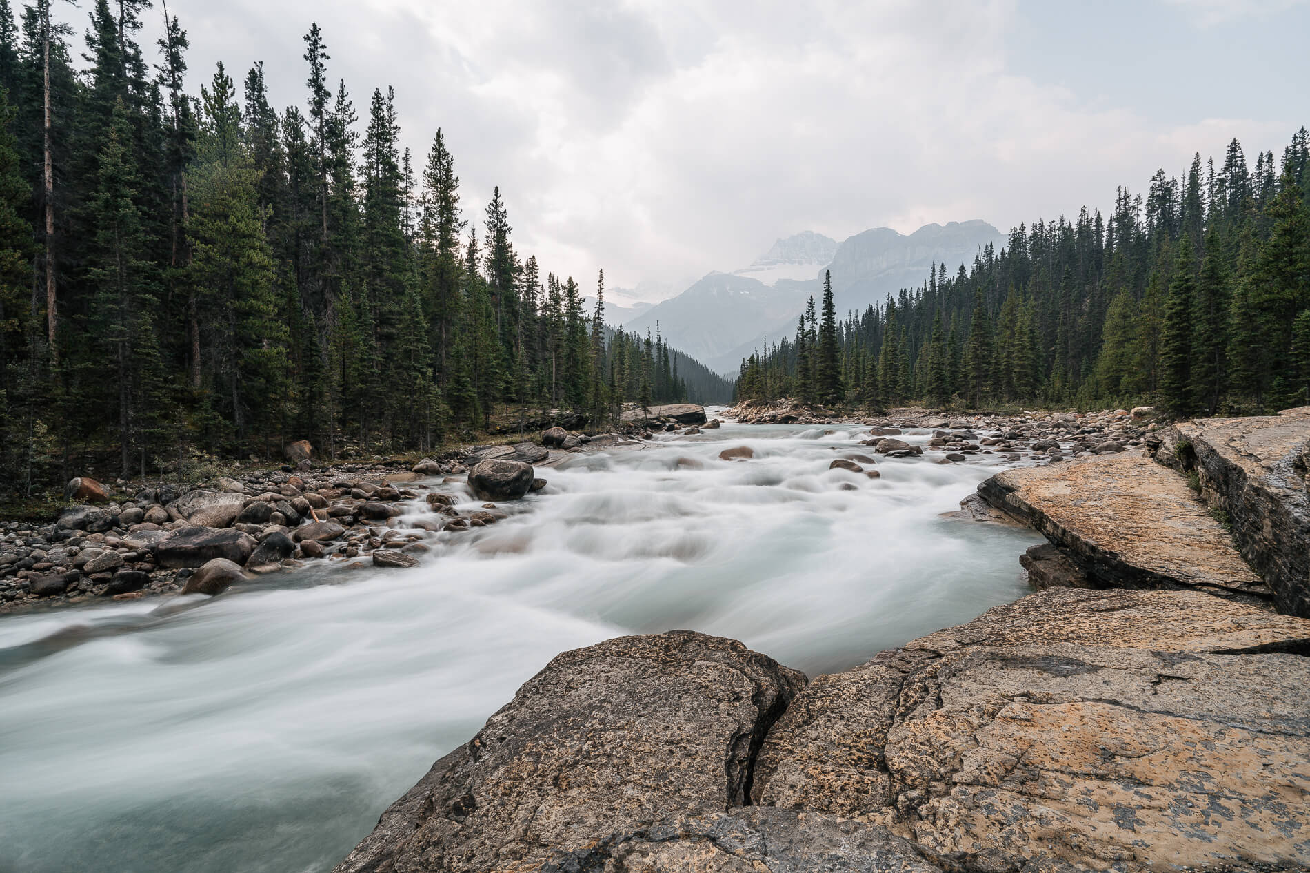
Mistaya Canyon
We actually wanted to stop at Mistaya Canyon after Peyto Lake, but the first time we drive by we noticed that the parking lot area was blocked off by construction, so we kept on driving. On our way back from The Crossing, we noticed a car parked in a dirt pullout across the road and that the trail itself wasn’t blocked, just the parking area!
The walk down to the canyon is super short, even shorter than the walk to the Peyto Lake viewpoint, probably around a 1/4 of a mile. The rocky dirt trail is downhill to the Mistaya River. Once at the river, there’s a bridge that crosses the steep, narrow canyon below. The sides of the bridge are actually pretty tall, so the best, unobstructed view of the canyon is on some of the ledges on the west side of the canyon.
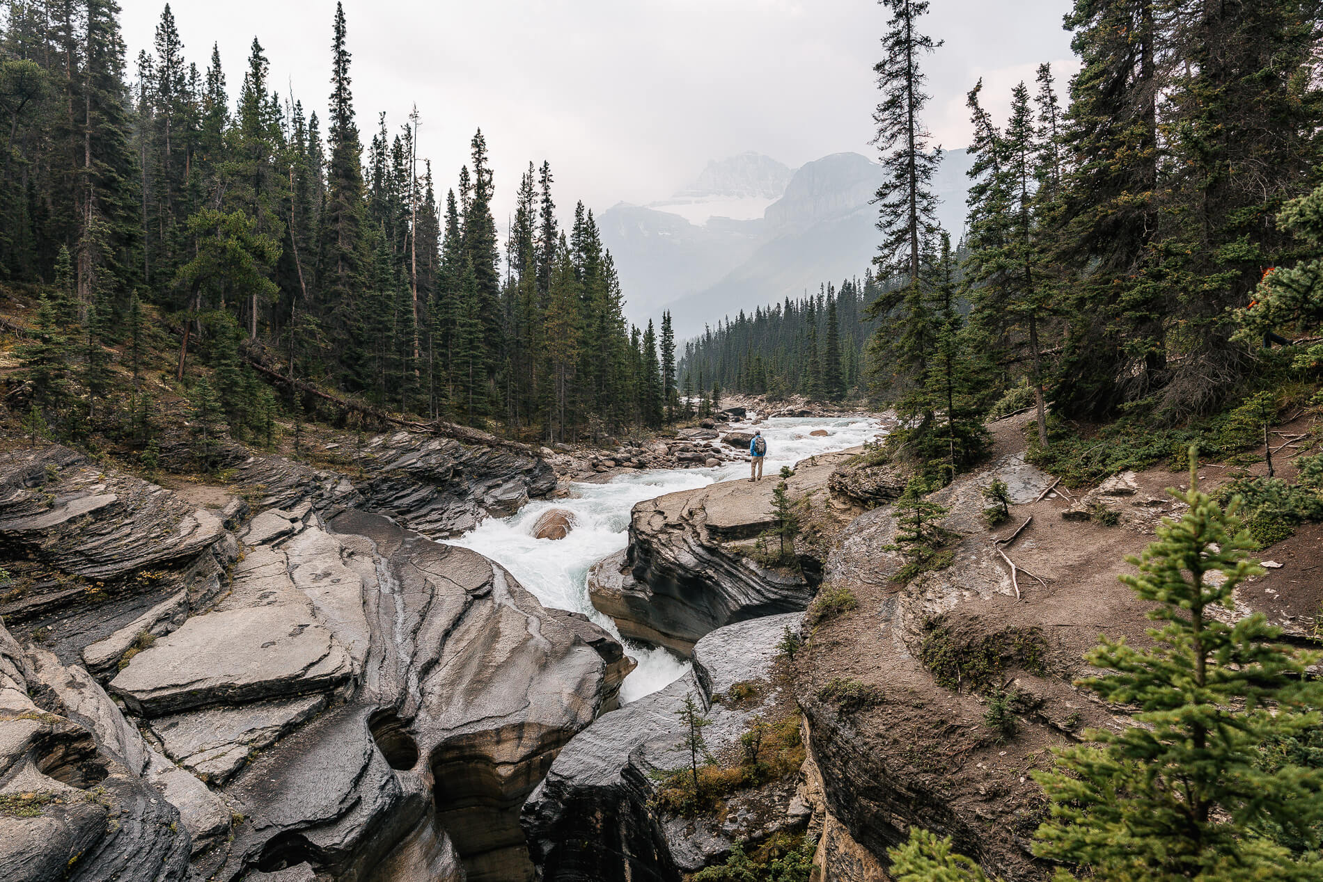
Mistaya Canyon is a very distinctive, narrow canyon with curvy walls carved by the raging, blue Mistaya River (whose headwaters are actually Peyto Lake). Fun fact: Mistaya means “grizzly bear” in the language of the Cree Indians. Another fun fact: we didn’t run into any mistaya in its namesake canyon, or anywhere on this particular trip! Not sure how we feel about that…
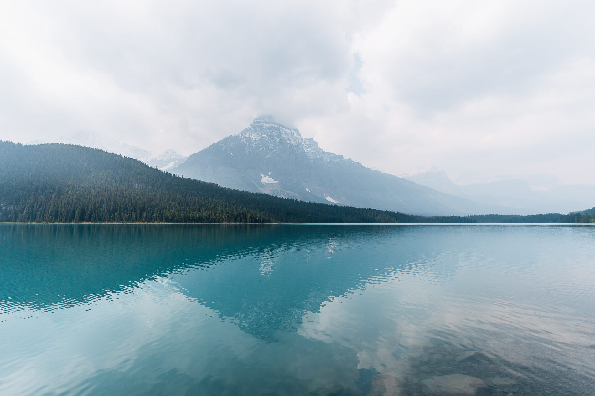
Waterfowl Lakes
We kept on driving south and decided to stop at bright blue Waterfowl Lakes to eat our lunch. We parked at the lower of the two lakes and enjoyed the beautiful view. Although the conditions were partly cloudy and hazy this day, the sun rays bursting through the clouds were insane. We noticed them in particular at this lake. It was pretty hard sight to capture in photos, but definitely not a hard one to forget.
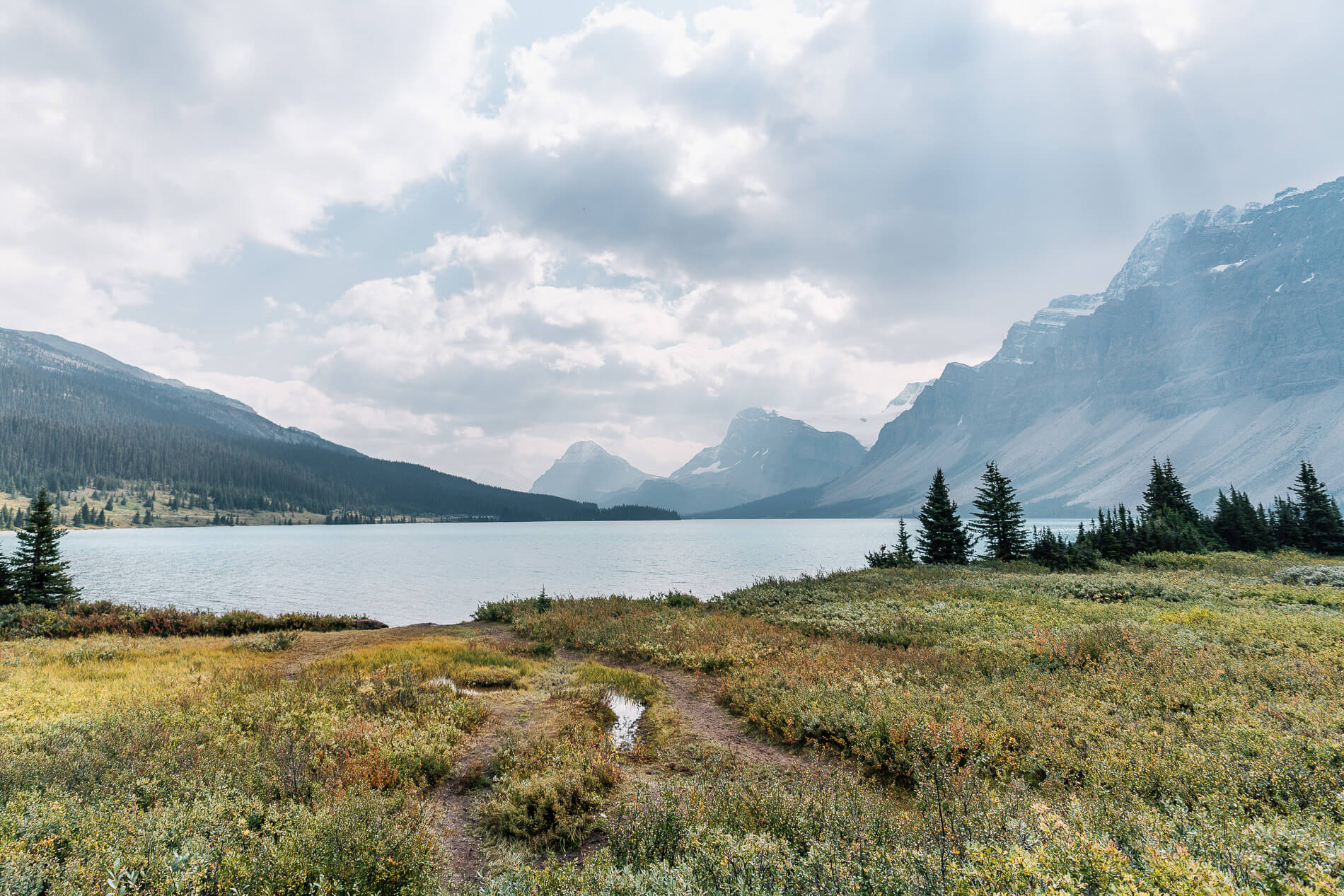
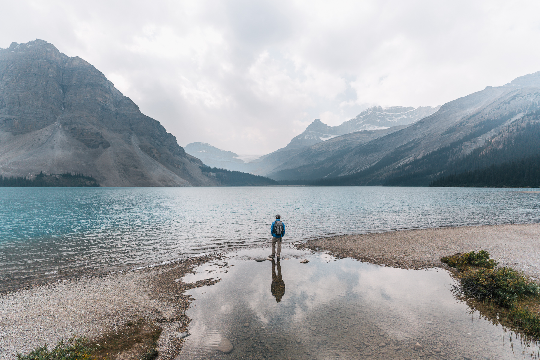
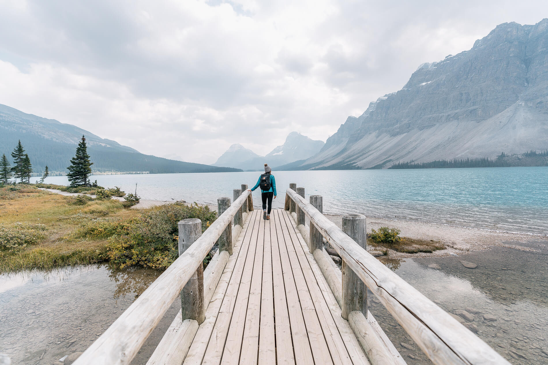
Bow Lake
By the time we got to Bow Lake, it was pretty busy with tourists. It was tough to get a parking spot and we almost bailed, but we managed to snag a spot on the dirt road leading to the parking area. Bow Lake was probably the busiest spot we visited on the Icefields Parkway. While there were tons of people walking around, it actually wasn’t too hard to find a more private spot to enjoy the view. We walked out to the lake and decided to walk the shore a bit. To the south we saw Crowfoot Glacier, surrounded by Bow Peak, BowCrow Peak, and Crowfoot Mountain (wow they must really like crows and bows). To the southwest, we could see Bow Glacier, Portal Peak, and Mount Thompson.
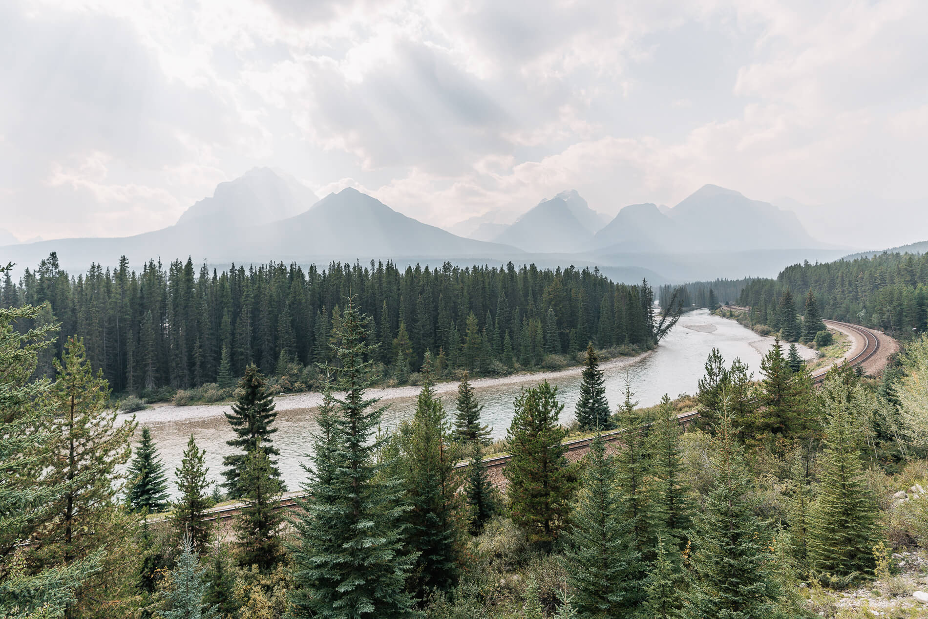
Morant’s Curve
This spot isn’t on the Icefields Parkway, but we decided to include it anyway since we made a stop on our way back to Canmore. Morants Curve is an iconic photo spot where the railway hugs a bend in the Bow River. Many photographers wait all day here to snap a photo of a train passing by. We were one one of those photographers. Our hunger outweighed our patience this day.
The Icefields Parkway was our first taste of the Canadian Rockies and by far, it exceeded our expectations. There are so many hikes we missed out on since we decided to make it more of a photo tour this time around, but we already have hikes and fishing spots in mind for next time. At the end of the day, we talked about we hadn’t seen so many different picturesque scenes in such a condensed area since we were in Iceland. Not only that, but to think we only drove half of the Icefields Parkway – next time we’ll need to make it all the way to Jasper!